Our summer odyssey began May 10 after our Mother’s Day calls to our moms. We planned on a short 260 mile trip to the Grand Canyon as our first stop and believe it or not, was one of the parks we never got to last year during our National Parks Tour (for some reason!), even though it is so close. Before we left, I did receive the new windshield just in time to see how it functioned and I am pretty happy. I ordered the tall GT screen for the GTL and found the wind protection, particularly the additional deflection of air over my head, to be very good. The downside is I think the side wind has increased though not objectionably so. Aeroflow told me they are beta testing a GT screen that is slightly wider and I think that would provide a bigger still air pocket for the pilot of GTL’s. Cynthia says she likes the passenger protection the one we have now provides.
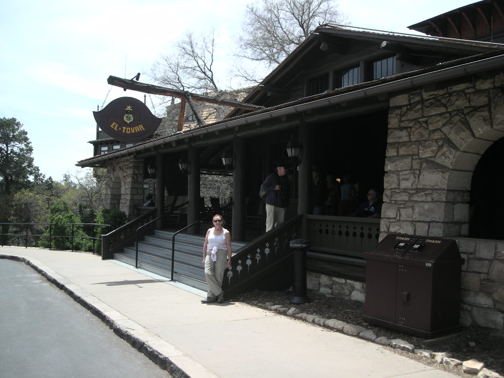
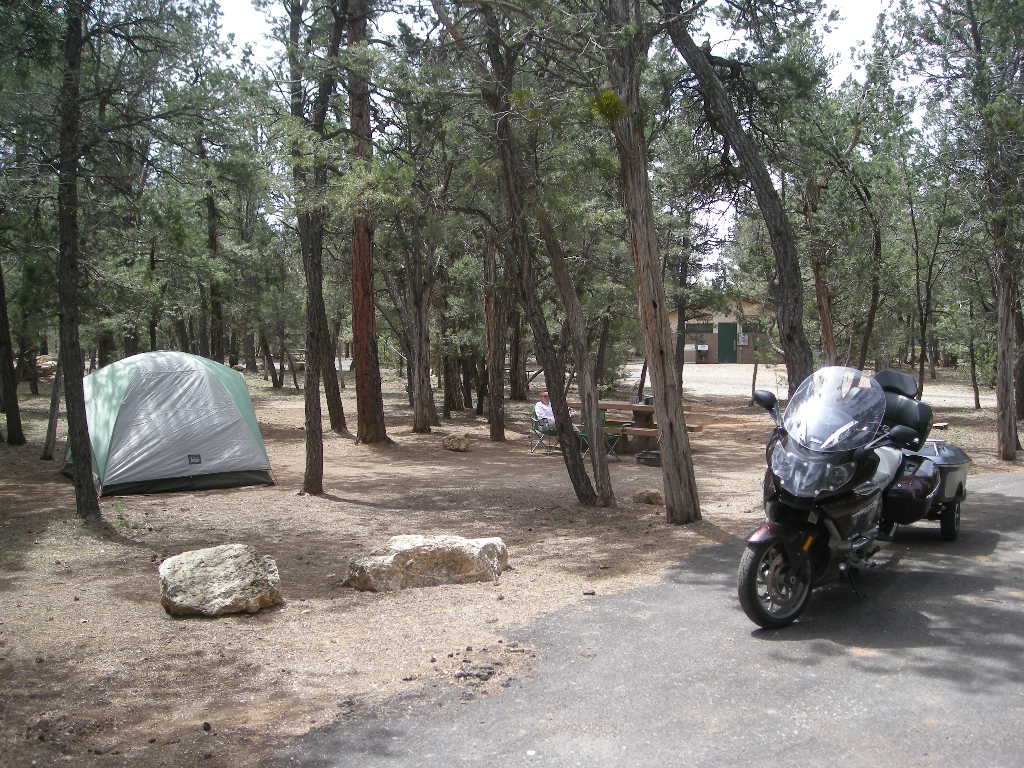
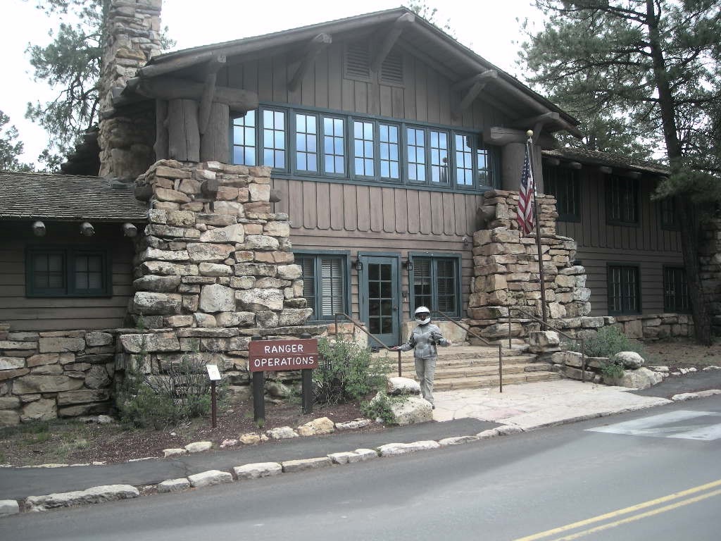
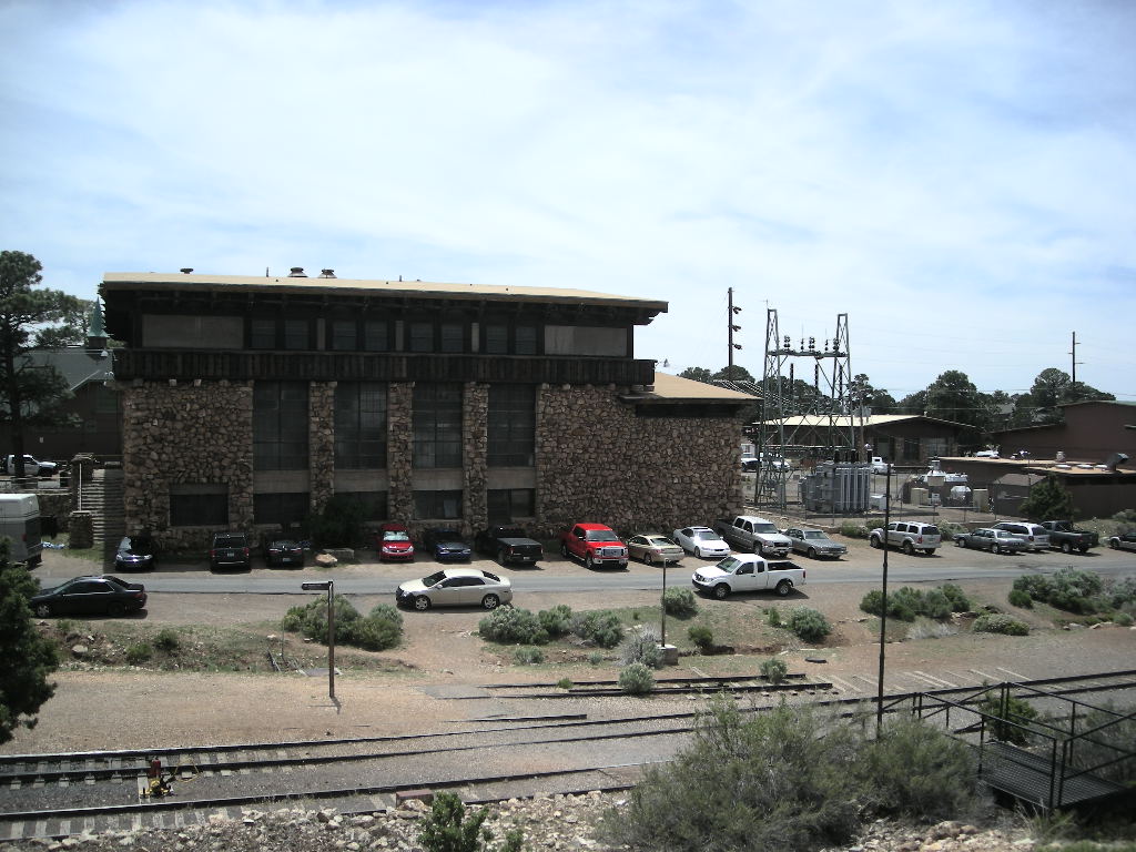
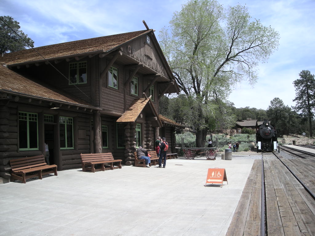
We had reservations at Mather Campground so there was no need to rush and we took our time even though it was highway practically the whole way. We had great weather for camping albeit cold at night (low 30’s). Besides the park itself, there are seven national historical landmarks (six on the south rim) at the Grand Canyon. One was really hard to find and the other no one heard of! The six are the railway depot, the El Tovar (hotel), the park operations building (that was a hard one to find), the power house, the Grand Canyon Village as a whole and a place called the 1956 Grand Canyon TWA-United Airlines Aviation Accident Site. That one we could not locate. Pictures will have to suffice for the rest.
We stayed two nights with plans to visit our friends in Tucson on Tuesday for a few days. On the way, I scoped out Tonto National Monument as a possible stop with AZ 87, 188 and AZ 77 thrown in as a ride attraction. Both AZ 87 and 188 are roads that have the telltale dots along them in the Rand-McNally book and they did not disappoint. All were low traffic-high fun rides in the high desert of east-central Arizona. Besides Payson and Globe, there are few towns. Places like Strawberry and Pine looked particularly interesting though we did not have time to stop and explore.
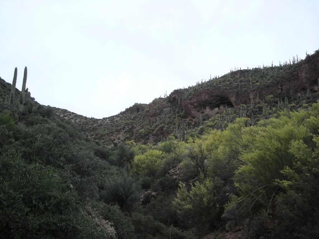
Good thing we didn’t! Our day ended up being 387 miles, a bit more than I really wanted to ride AND have time to explore places. Our visit to Tonto NM was pretty nice, no one there and we had the place to ourselves. They have a great film that tells you just about all you need to know about the cliff dwelling and the Tonto Basin, Salt River in general. The only thing the film did not tell us about but the Ranger did was the giant bee hive that has closed access to the dwelling. You can’t get any closer than 50 yards. Not wanting to tempt fate, we enjoyed the wonderful view from the observation deck above the visitor’s center. By about 5:30, we were in Tucson for our multi-day visit and stock up on a few things that we overlooked.
Sunday, May 17 we left early with a short trip to Gila Cliff Dwelling NM in New Mexico. We were going to stop by Fort Bowie along the way (just south of I-10) but with 16 miles of dirt road, we opted not to. We got to Gila just in time before the visitor’s center closed. The drive up NM 15 from Silver City is grueling when you are in a hurry! Very curvy road and not one that is conducive to carving the curves when pulling a trailer! Nonetheless, we were happy not to have to drive back down NM 25 (it is one way in about 44 miles) to find camping because they did have free camping in the monument. The evening was cold and VERY clear. The skies were alive with stars!
We packed early hoping to make a few stops along our way to the Texas border just past Clovis, NM but our plans got changed by the day’s circumstances. We spent a fair amount of time trying to find the Prehistoric Trackways National Monument just outside Las Cruces and never did have success. My GPS had us going down dirt roads, on private property and backtracking all over the place! Since the website did not have an address (other than Las Cruces, NM) we had to use the coordinates. Hence the problem. We decided to just move on with a quick stop at McGinn’s pistachio ranch to load up on green chili pistachios in Alamogordo. Since we were so far form Clovis, it being pretty hot and so late in the day, we decided to camp at Valley of Fires National Recreational Area just outside of Carrizozo, NM. With a storm front moving in as we were setting up the tent, it was tough to hold the tent (and everything else) while setting up. Everything wanted to blow out onto the malpias (lava field bad lands). The wind blew pretty strong all night with ample lightning but hardly any rain.
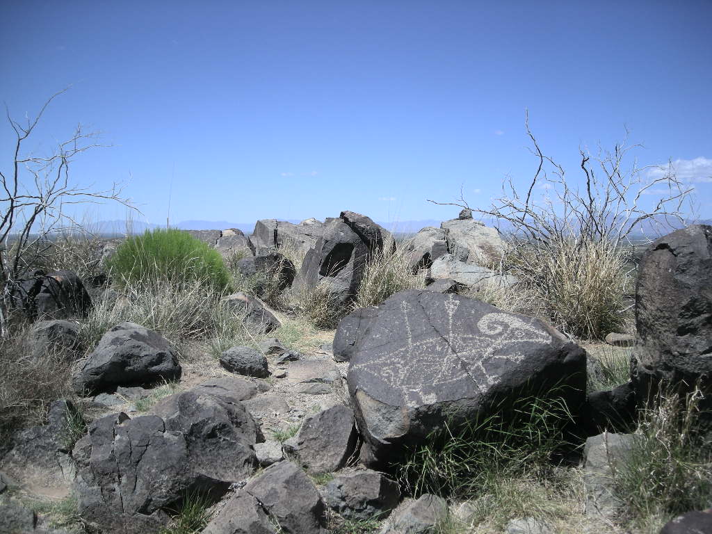
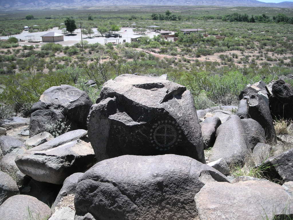
Tuesday, May 19 brought a really fine day and we decided to stay another day since we weren’t in a hurry and it would be nice to just relax after the more than 360 miles from Gila. Besides, we had a great site (at $7.00 a night!) and the campground had showers too (a real plus….). Since we had a whole day, we back-tracked to Three Rivers Petroglyph NM just a little south of our camp. Three Rivers Petroglyph NM is about two miles off US 54. It has a self-guided trail that takes you to hundreds of petroglyphs mostly done about 700 years ago. An easy place to get to, we recommend a visit. We spent the rest of the day journaling and organizing the trailer.
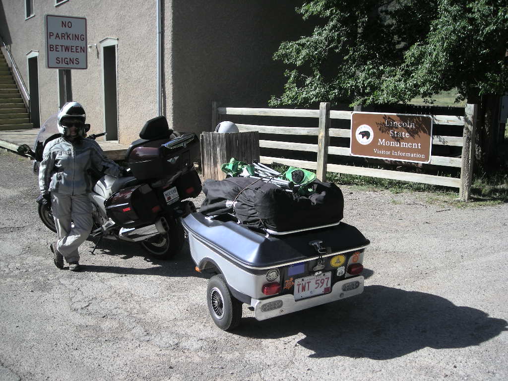
Our plan for Wednesday was to get to Lake Meredith NRA just north of Amarillo, TX with a stop at Alibates Flint Quarries NM. However, our plans got fooled up again. Little did we know a pretty big weather bomb was setting up for the whole southwest. Headed out US 380, we did get to stop at Lincoln, NM which is a national historic landmark on our way to Roswell. Turning northeast, we started to hit cool (felt cold really) weather as we traveled towards Clovis on a pretty lonely road, US 70. By the time we got to Clovis, it was clear we weren’t going to make Lake Meredith AND camp out in the damp cold. I think I saw more cows on this leg of our trip than I have ever seen in my entire life! It should have come as no surprise when we saw that Hereford, TX is the cattle capital of the world! I never saw so many feed lots ever! However, it was a good sign for dinner later that night! It was an astonishing 49 degrees by the time we checked in at the Holiday Inn in Amarillo. A few minutes on the Weather Channel made it all clear. We had to change our plans.
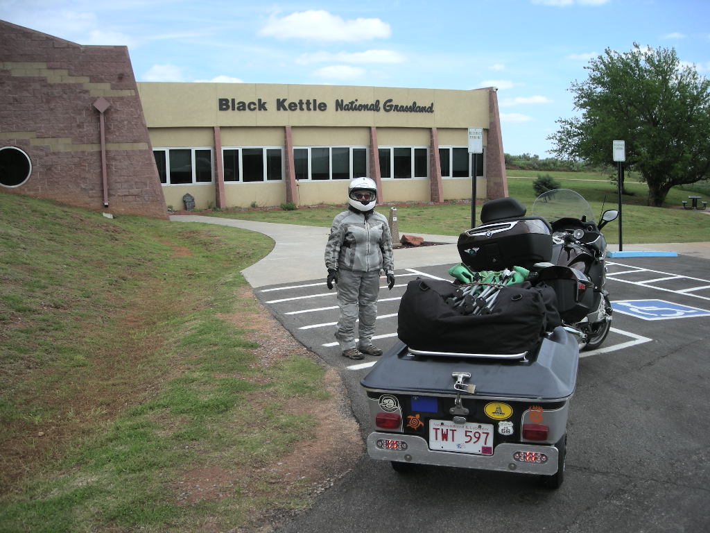
We decided to make a run for Russellville, AR where we had planned to visit one of Cynthia’s cousins, but later than it was working out to be. We hit the road early trying to get out ahead of the front. By the time we got to Oklahoma, the skies were much clearer (albeit not completely without clouds) so we decided to side track about 25 miles and visit Washita Battlefield NHS and Black Kettle National Grassland. Washita was the site of an Indian massacre perpetrated by none other than, you guess it, General Custer in 1868. After traveling out that way, I got a new appreciation for the Oklahoma countryside that stayed with me all day as we passed farm after farm. The Washita River is a beautiful area although cloaked in tragedy. We got back on I-40 headed east, set the cruise control for 75 and ground away the 552 miles to Russellville, eventually out-running the weather, at least for Thursday! Our gas mileage suffered quite a bit at 75 mph while fighting a head wind though. No matter, beats riding in the rain! We arrived safe and sound at Cynthia’s cousins and we had a grand time catching up. We plan a few days here visiting and waiting till the weather passes and then we’ll back track a bit and explore northeast Arkansas before continuing east into Mississippi.
Stay tuned!