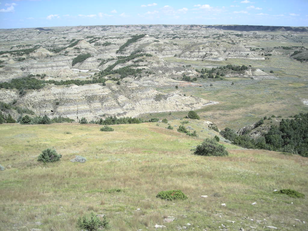
We started out fairly early Monday, August 10 from Deadwood since the weather was so nice and we wanted to enjoy the ride BEFORE it got hot! By the time we loaded up, most all of the Sturgis folks had left (and we didn’t even hear them!). We didn’t have all that far to go. Our plan was to get to Theodore Roosevelt National Park in good time so that we could get a camping spot and check out the park. Since getting back out west, camping spots have become rare in some parts! The drive up US 85 was really nice. The road was excellent and the views go on and on and on! It was sad to think that as recently as 150 or so years ago, these same views would have been nothing but herds of tens of thousands of bison. Really hard to imagine since you can see just about forever! The road was pretty straight most of the way with lots of elevation changes to make it somewhat interesting. Oh, and did I mention the views? We had a pretty stiff tail wind most of the way (while pointed north) but it also kept us on our toes when we shifted either east or west for short periods. It was about 225 miles by the time we found ourselves cruising through Medora, ND where the entrance to the south unit of the park is. The park is comprised of two units, a southern unit right off I-94 and a northern unit about 50 miles further up US 85. We were really surprised how beautiful the area is. Similar to the badlands of South Dakota, Theodore Roosevelt National Park is however, much prettier. We took the 36 mile scenic drive after setting up our camp. Along the route you’ll see three or four extensive prairie dog towns, great overlooks of the badlands and lots of bison. Be careful though, they aren’t as friendly as they might appear and buffalo chips are really slippery when on the road! The park also boasts a great collection of petrified wood but that requires a 16 mile hike or horseback ride from within the park or a 3 mile round trip hike from a point on the western boundary of the south unit.
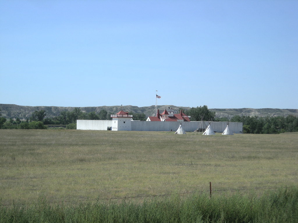
Our night included really good temps with the low in the upper 50’s. Perfect sleeping weather! Tuesday August 11, we packed and were on the road early again with plans for about 200 miles since (once again) campsites are hard to come by in far eastern Montana. Our only stop included Fort Union Trading Post National Historical Site right on the Missouri River. You have to want to come here because it is WAY out of the way. Less than 75 miles from the Canadian border, Fort Union is partly in Montana and partly in North Dakota. THE principle trading post on the Missouri River, the fort wasn’t a military fort but like Bent’s Old Fort in southeastern Colorado, it was all about economics. We watched the film first, (as we always do since it clues us in to what we want to explore further) then headed out to tour the grounds. The fort that exists today is a complete reconstruction from plans made in its early years. The original fort was dismantled after the US Government bought it at the beginning of the Civil War and used the materials for Fort Buford at the confluence of the Yellowstone and Missouri Rivers (which can also be visited not far away). Fort Union was a fascinating place. Its life spanned the longest of any other frontier fort lasting 39 years from 1828 – 1867. In its heyday, Indians would camp all around the fort and after a lengthy trading ritual lasting sometimes 8 or more hours (before any talk of prices etc) the prices were set between the chief of the tribe and the traders and all the members of that tribe traded at the set price(s). It all worked! Too bad it went south later as the white man infringed upon the Indian territories (among other things). Fort Union has also had its share of notable visitors including Prince Maximillian, John James Audubon, Jim Bridger and others famous in western history. Once leaving Fort Union, we picked up on US 2 west into eastern Montana. Here the views go on even further than forever (if that were possible)! Beautiful farms were folks measure their driveways in miles, not feet. On many of the farms the winter wheat was still not cut and the golden fields stretched for miles. Setting the cruise control at 5 below the posted 70 mph, it was quite a relaxing ride as we soaked in the scenery as the GTL purred along as it always does. With no cars to pass and only slightly rising temps, we had a wonderful day. It’s on rides such as these that you can get really lost in your head. When we finally got to the Fort Peck cutoff, it really felt like we had been in a trance the whole time. How great it was! Other than the constant clash of grasshoppers on the bike and our lower legs (they sit on the road and hop to their demise just as you get to them), it really was a memorable trip. Our camp was at the Downstream Campground of the Army Corps of Engineers Fort Peck dam on the Missouri River. We were early so we got a nice shady spot and relaxed the afternoon away. By evening, the mosquitoes were out and we turned in. Being only about a half mile from the dam, when the horn that could be heard 20 miles away went off at about 2:00 in the morning for what seemed like 5 minutes, we were instantly awake. We have NO idea why it happened except that either the dam was getting ready to fail or (and most likely) it was a warning to get off the water due to lightning in the area. Either way, we were awake then! By morning it was damp and cool with the weather expected to be in the triple digits later. We packed and hit the road for the 300 mile run to Great Falls. MT.
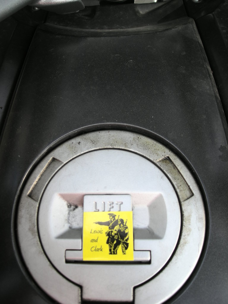
Since it was to be weather brutal later (high’s in the lower 100’s AND bright sunshine to bake you to a crisp), we decided to hotel it in Great Falls. Our ride out US 2 was again a wonderful ride (since it was so early). It is really pretty in eastern Montana albeit long and the scenery unchanging. Every now and then you get a glimpse of the Missouri River and I often drifted off to thinking about how Lewis and Clark must have felt as they traveled the same countryside in 1804. It probably looks very much like they saw it with the exception of the farms and fences. Other than that, it is fairly pristine. I spotted a National Park sign just as we were getting into Chinook, MT. that read Bear Paw National Battlefield. I don’t know when it happened but I have been tuned into only spotting (reading) brown signs for some time now! We took a quick left and found ourselves at the Blaine County museum that also serves as the visitor center for the park. This museum is a must stop! We were amazed at the number and quality of the displays! The film chronicling the plight of the Nez Perce Indians was really well done. We picked up the brochure on the Nez Perce National Historic Trail since we’ll be visiting a number of the battle sites throughout Montana and into Idaho (where it all began in September 1877). Bear Paw was where Chief Joseph finally surrendered while another band of Nez Perce escaped to Canada (only 40 miles away). The whole story of the Nez Perce is worth investigating! We’ll be experiencing the story in reverse. As we made our way off US 2 and onto US 87 towards Great Falls, the skies started to darken and I was sure we were going to get a storm! I set the cruise a little faster at the posted 70 mph (it seems ALL roads in Montana are 70 mph, even these two lane ones) hoping to beat it out. We got lucky because by the time we arrived in Great Falls, it was only a sprinkle to us. We didn’t get to see too much of Great Falls Wednesday but what we did see we really liked. It is a very nice city set right on the Missouri River. There used to be falls here but they are now quasi-falls with power stations at each of the five. Lewis and Clark only expected to see the Great Falls as the Indians had told him but they encountered five, hence the difficult (most difficult of the whole trip) 18 mile portage.
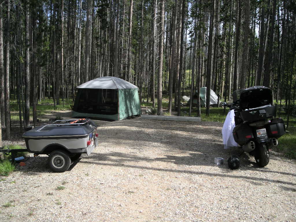
Thursday August 13 arrived and we were off to the Lewis and Clark National Historic Trail Interpretive Center in Great Falls. Our plan was visit there and get more information on Lewis and Clark and to make Walmart in Butte for some additional supplies. After a short planned 200 miles, we hoped to be around Anaconda, MT by the early afternoon. What a center it turned out to be! The Lewis and Clark NHT Interpretive Center is an excellent museum set right on the cliffs of the Missouri River just downstream from Great Falls (the town) and Eagle Falls (the last falls traveling upstream). It boasts an excellent theatre, a walking museum that chronicles the trip of Lewis and Clark from start to finish with artifacts and information galore! If you visit any Lewis and Clark site, make it this one! It was SO inspiring that we hope to make plans to complete the entire Lewis and Clark NHT next year with all the significant stops even though we have seen many already. We had a great run down I-15 to Butte. The weather cooperated as the temps never peaked 90 and a lot of the way it was in the high 70’s. We made our Walmart pit stop and were soon on MT 1 headed towards Anaconda. If you recall from our journal last year, this is where I spent a week in the hospital around 1987 after missing a turn on my then 1981 CB900C. We wanted to get our same campsite from last year at Lodgepole Campground just at Georgetown Lake but it wasn’t to be. We ended up at an even better place a few miles east on MT 1 called Spring Hill. Maybe not near the water but it came with LOTS of real estate (take a look at the picture)! We set up all out gear and plan to stay a few days. There is so much in SW Montana to explore!
Stay tuned, much more to come in SW Montana and as we head into the northern Rockies and explore Idaho and! Lots more to see! Greg & Cynthia.