We had a pretty good thunder storm the night of the 21st. The storm was so close that the lightning was followed immediately by very loud thunder. Once the thunder booms quieted down, all that was left was babies crying and dogs barking. It was a little tough getting to sleep! However, the morning of Thursday, August 22 was a really nice one at first. Soon into our travels though, we had to put on the rain gear. We originally planned to go to somewhere close to the Grand Coulee Dam on the Columbia River and camp but our plans got changed for us. We first started out continuing south on US 95 and slipped into Spokane, WA to pick up our new tent. All went well and after a short run on I-90,we hooked up with US 2 and headed west towards the Columbia River. We skirted a few big storms but since we had our rain gear on since the start of our travels, we didn’t really mind thee occasional sprinkle or short hard rain. We got to the Grand Coulee Dam and Roosevelt National Recreational Area pretty early with plans to camp nearby. Cynthia however, heard a person at the visitor’s center mention that US 20 into the North Cascades was closed. I asked the guy for some clarification and sure enough, both US 20 and WA 153 were closed due to slides as a result of the combination of the forest fires and heavy rain. No other way exists to get into that area from the east. The only thing we could do was wait or drive around. Since neither was a good option and since there was no expected opening time, we headed south on WA 153 to hook up again with US 2 and drive to Everett, WA and stay.
Our visit to the dam was short but the area is long on scenery! The Grand Coulee Dam was completed in 1950 and created the Roosevelt Lake National Recreational Area. The lake is 129 miles long and has 26 campgrounds within its boundary. This NRA is ideal for boaters but as someplace to view the lake from roads, not so much. The visitor’s center has some pretty nice displays of what it was like in the area before the white man showed up (Lewis and Clark) and traces the history through the dam construction to present day. We even saw that the government paid Woody Guthrie $266 to write a song about the Grand Coulee Dam to help promote it! You can hear him singing it in the center also. In addition, the visitor’s center is situated such that you get a great view of the entire dam (a second generating station was added years later) and is worth the stop if you are in the area.
After our visit to the dam visitor’s center, we found the drive down WA 153 to be really nice! It follows Banks Lake (a Bureau of Reclamation project) for about 25 miles and a great drive albeit short! Washington 153 ends at US 2 and finally after passing through many miles of wheat fields along US 2, we banked down into the Wenatchee River Valley, a beautiful area with loads of apple and peach orchards. From the top to the river bottom, the temperature rose by 155 degrees and we couldn’t WAIT too get the rain gear off! Turning west again at the town of Wenatchee, we passed through Leavenworth, WA that turned out to be just like a true German Alpine village. All the buildings are built in the Bavarian style and combined with the surrounding scenery after a few beers, you could imagine yourself being in Bavaria! After leaving Leavenworth, our ride along US 2 turned not as nice as it could have been since the rain started there and continued just about the whole way to Everett, WA. Clouds routinely obscured the peaks but traffic was light. Once out of the mountains, it was a long 35 mph slog to Interstate 5. Since we had no reservations, it took us about 30 miles to find a hotel that had a room for us. Fortunately though, it put us a lot closer to WA 20, the road into the North Cascades National Park from the west. We looked back on the day and realized that we started in Idaho and drove just about the width of Washington! We ended the day in Marysville, 370 miles from Round Lake State Park.
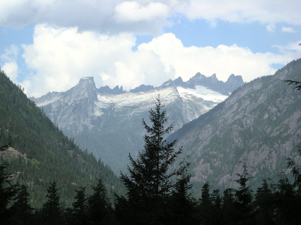
Friday, August 23 started out GREAT! We watched the weather report and it seems the whole state is going to be dominated by a high pressure system for at least a week! How great is that?! It isn’t very often that the northwest area of Washington State gets clear weather and that will be good for us. We took a brief jump up I-5 to exit 208 and WA 530 to cut off a bit of WA 20 that comes from I-5 only further north. The drive on WA 530 is a great road too. Sweeping turns, great scenery and a good road surface really makes a difference! We got to WA 20 and gassed up on some pretty expensive premium just is case we drove around the park more than the half tank would take us. Soon after heading east on WA 20, we were at the Newhalem Visitor’s Center, the first from the west side of the park. We arrived around 11:00 and thought it best to secure a campsite first, which is what we did. Instead of heading out to explore the park, we took a leisurely day and did some reading and relaxing in the warm sunshine.
The North Cascades National Park is huge! Most of the park is accessible via WA 20 and that is the principle route through the park. Also in the area is Ross Lake National Recreational Area, though this one is accessible only from Canada on an unimproved road. Also, there is Lake Chelan National Recreational Area and that is accessible only by boat or float plane. Both Lake Ross and Chelan offer the real backcountry experience where not too many people will be your neighbors! Also close by is the Mount Baker Wilderness and National Recreational Area. LOTS to do up there!
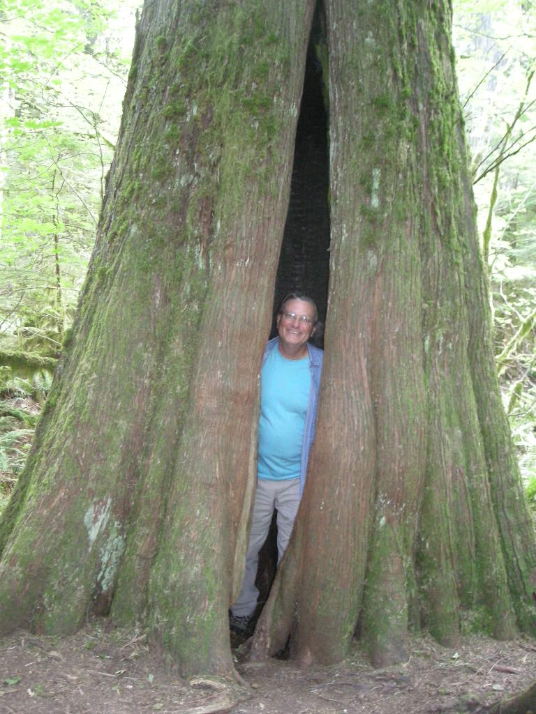
On Saturday, August 24 we took our time getting going because we had the whole day to explore. We decided to do two hikes- the Rainy Lake and Happy Creek Forest trails. In addition, we would be driving on some pretty nice road and seeing lots of other sights. After being a little disappointed at the first part of the trip east on WA 20 due to the power plants and associated wires etc that really ruined the views, we got to Rainy Pass about 10:30 for the one mile hike. It was nice to see that this trail was also paved so that disabled folks can get out into the wild too. Rainy Lake is a glacial lake and was worth the hour round trip hike. On our way backtracking, we hit some showers and temps dropped fast into the high 50’s. It is amazing how fast they warmed up though after the rain stopped. By the time we got to Happy Creek, it was in the upper 70’s. Happy Creek is a nice easy hike that goes through some old growth forest. The trees are pretty impressive. It is said one of these trees could build an entire house. Considering this whole area was logged near the turn of the century (the one before the last one that is), it was great to see those towering trees that would have been the whole forest at that time. We stopped at a few overlooks and enjoyed the ride on WA 20, a smooth winding road perfect for speeds in excess of the limit…. We arrived back at our campsite to relax the afternoon away and hike a few of the trails out of the campground, and send off some postcards.
It was a fine start to Monday, August 25. We took our time knowing we had only about 100 miles to drive and a stop at Walmart along the way. Washington 20 loses its appeal after passing out of the North Cascades but is still a pretty nice road. We got to I-5 and took it south two exits to Exit 227 for the Walmart. Since the trailer tires were getting a bit smooth, I opted to buy a pair. When I thought about it, I put those tires on in Rapid City, SD. When I checked, that was over 6,000 miles ago. I guess that’s not too bad considering they were Walmart tires too! These should get us home because we don’t think there is another 6,000 miles till we get there. Another thought about that- we decided that since we don’t really need to be in Las Vegas till October, we are going to stretch this summer all the way out! Don’t look for us till September 30! After Walmart, we went back up to WA 20 and followed that onto Whidbey Island and to our camp at Fort Ebey State Park. The site was pretty nice and since we got in early, we had a chance to put away all the Walmart stuff and change out the trailer tires. I am sure the trailer will handle much better now especially in the rain. Fort Ebey State Park is just north of Coupeville, WA and is very convenient for the ferry from there to Port Townsend on the Olympic Peninsula. I made the ferry reservations and our plan is a short run after the ferry ride of about 50 miles to Olympic National Park. Fort Ebey was WWII era fort that protected the approaches to Seattle, Tacoma and the Puget Sound in general. The only things left at the fort are the concrete gun emplacements and ammunition bunkers. However, that area affords great views of the water and passing ships. We had a pleasant afternoon at the park walking along the cliffs that overlook the strait and had a good evening.
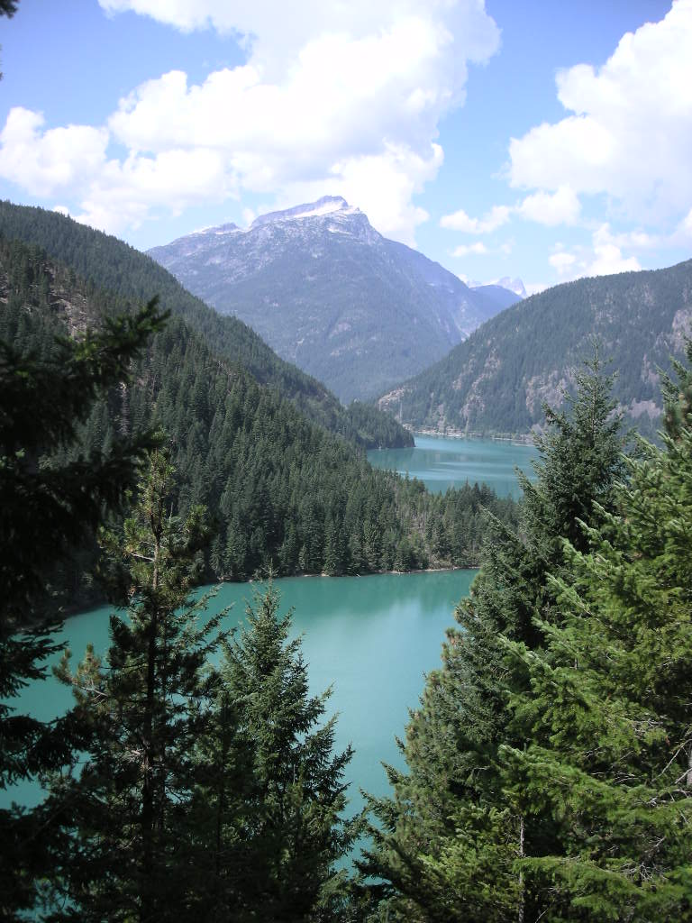
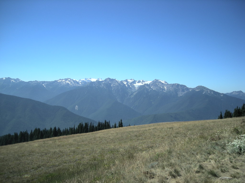
Another fine day greeted us on Tuesday, August 26. We took our time heading to the ferry that proved to be a 20 minute drive. Since we were so early for our ferry, they got us on the 8:45 to Port Townsend. Sixteen dollars and ninety five cents later and we boarded behind some pretty load motorcycles. After about 45 minutes of some pretty smooth sailing, we docked and headed off on the continuation of WA 20 to the intersection of US 101. We took a right and headed towards Port Angeles on the Olympic Peninsula. It really was a short hop to the Olympic National Park. We only travelled 90 miles. We decided to camp at the Heart ‘O the Hills campground just inside the park along the road to Hurricane Ridge. There was hardly anyone in the park and we really had the pick of sites. Sometimes you can have TOO many choices! Anyway, we set up fast so we could get to Hurricane Ridge while the sun was high for the best pictures. The road up to Hurricane Ridge is only about 17 miles and it’s a nice smooth and twisty road, perfect for motorcycles as long as Ma & Pa Kettle aren’t in front of you…there are no legal passing zones. We got lucky going up and really lucky coming back in that we followed a fellow BMWMOA member on his R1200RT and ALL the cars obliged by pulling over so we could pass! The views from on top of 5,242 foot Hurricane Ridge are VERY nice. On one side you see the Olympic Mountains and to the other you can see Port Angeles, the Strait of Juan de Fuca, Vancouver Island and Victoria, BC in the not too distant. With the weather SO clear, you could see miles. We went into Port Angeles for a quick stop and to hit a bank and buy some smoked salmon. Cynthia and I are both big fans of smoked salmon. Around here is a great place to buy it!
Olympic National Park is also HUGE! Crowned by Mount Olympus, it protects the largest old-growth forest in Pacific Northwest. Some of the trees here took root 200-1,000 years ago! In addition to those, temperate rain forests grow along the coast that receive upwards of 12 FEET of rain per year (now you Newfoundland readers can stop complaining!)! An amazing amount. There are three visitor centers and many, many miles of backcountry trails for hiking and backcountry backpacking. This park is definitely on our ‘come back to’ list and we recommend a visit.
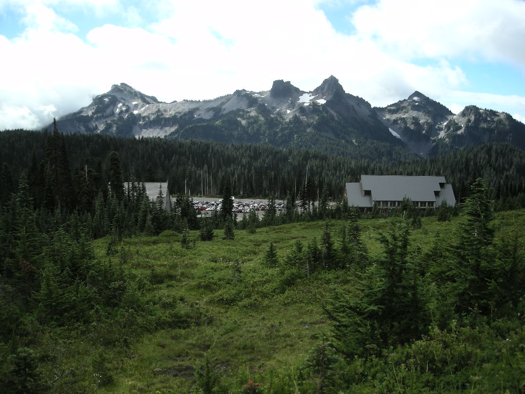
Wednesday, August 27 was, yes, another fine day! I mentioned that we were in for 7 or more high pressure days! We still have a few to go. We got back on US 101 and headed south towards WA 104 then onto WA 3. We were skirting the west side of the Puget Sound. Once on WA 16, we crossed at the Tacoma Narrows (the place of the infamous Tacoma Narrows Bridge that collapsed during a wind storm). Fortunately, the engineers got it right with the bridge that is there now. It was a pretty easy run down WA 7 to Elbe and then east towards Mount Rainier National Park. We got to our camp at cougar rock around 2:00 and set up fairly quickly then headed to Paradise.
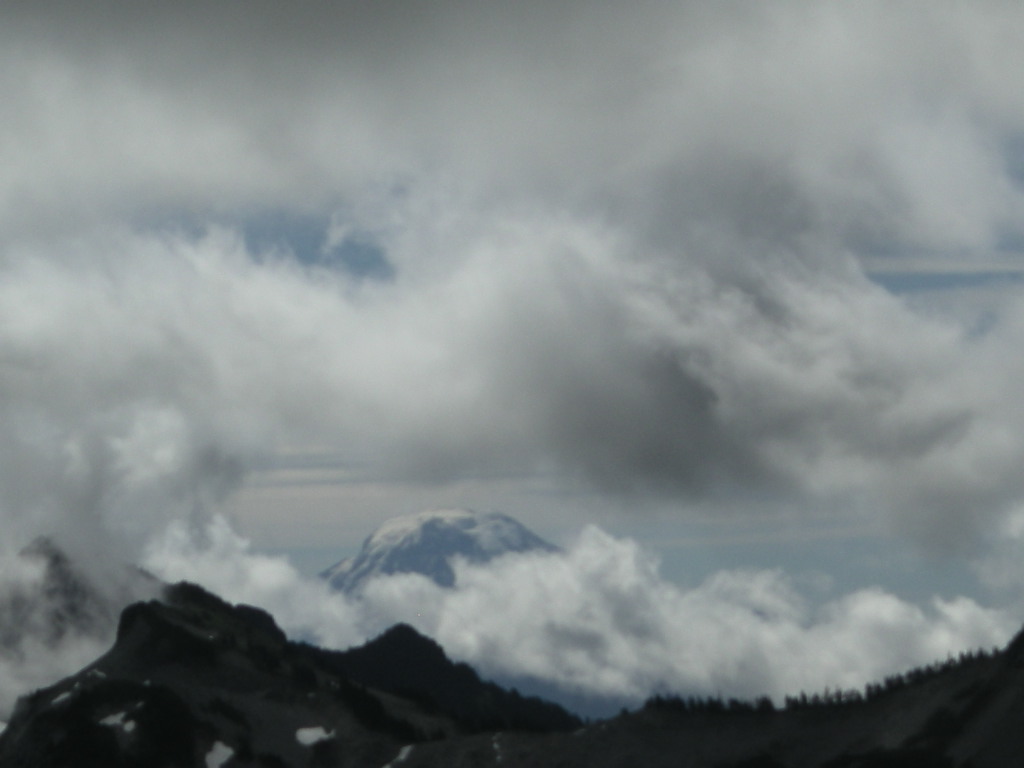
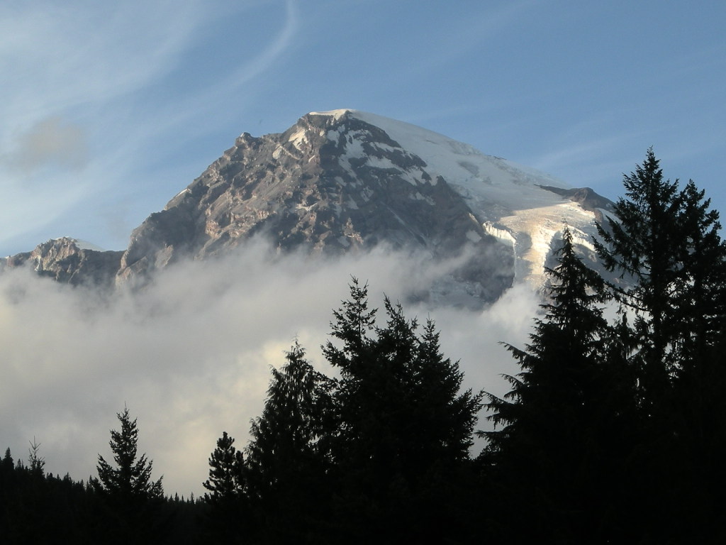
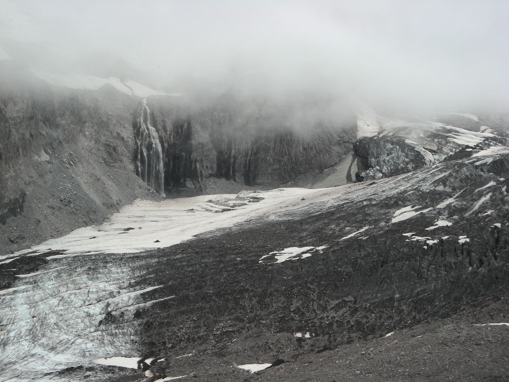
We planned to do a pretty decent amount of hiking on Thursday, August 28 and the weather did not disappoint! We left to go back to Paradise around 9:30 and got there about 10:00. We got ourselves ready and headed out on the Skyline Trail. Since this IS Mount Rainier, all the trails go UP from the visitor center at Paradise. We made it to the Glacier Viewpoint at 6,300 ft but the top of Rainier wasn’t visible due to the low hanging clouds. We stayed there a bit hoping the clouds would lift but that wasn’t to be. We did get to see a pretty nice waterfall and the Nisqually Glacier. We decide to give up and headed back down the trail the 1.5 miles to the visitor’s center and counted 8 Marmots along the way. They were busy eating, getting ready for winter. Since the 3 miles r/t wasn’t enough, we took the 1 mile r/t to Myrtle Falls before we called it a day.
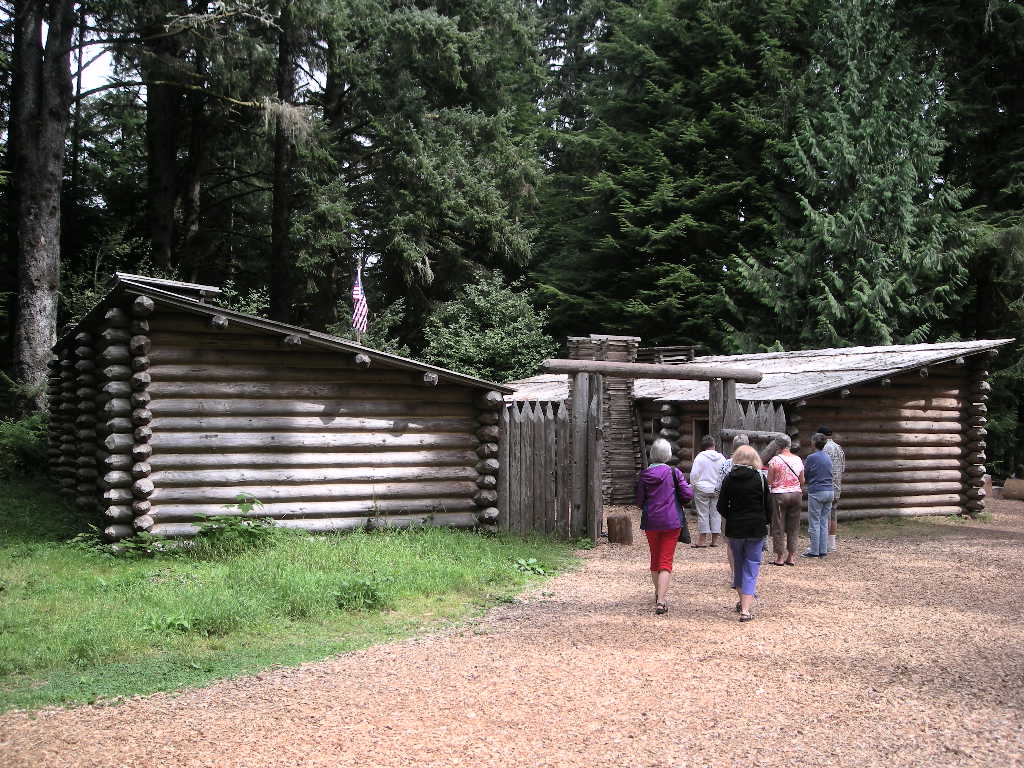
Another great day greeted us as we packed to leave Mount Rainier on Friday, August 29. We went back out the way we came in past Longmire but at Elbe, we went south to US 12 and out to I-5. A few miles later, we stopped at the Mount St Helen’s visitor center not far from the highway. This center was run by the State of Washington but we stopped for our stamp anyway since it is part of the Mount St Helen’s National Volcanic Park. It was a really nice center and worth the visit. Soon after, we continued south on I-5 to WA 4 along the Columbia River, tracing the steps of Lewis & Clark on there journey westward in 1804. Washington route 4 is a really nice road. It follows the river most of the way and is in good shape. Lots of turns and changes to elevation make it an interesting ride out to WA 401 where we headed a little south to cross the Columbia opposite Astoria, OR. This is almost at the mouth of the Columbia where it meets the Pacific Ocean. Not far from our crossing we stopped in to visit Fort Clatsop, the wintering home of the Corps of Discovery. Though not the actual fort, it is a great recreation of the original because Lewis and Clark kept such detailed records. Over the past few weeks, I have been reading the abridged version of their journals and in some places, it feels like we are right there with them. Fort Clatsop is one of those places. Their adventure must surely have been a great one just as ours has been in its own right.
We left Fort Clatsop and proceeded down US 101 and since it was the beginning of the Labor Day weekend, traffic was terrible! Fortunately, we didn’t have to go far and just beyond Seaside, OR, we took US 26 east towards Portland. This is another pretty good motorcycle road as long as the traffic isn’t too bad. Good for us that they were all headed west as we proceeded east! We got to our hotel about 4:00 and that gave us time to do wash and catch up on a few things. It had been six days since we’d been out camping. We have been blessed with some pretty fine weather these past 7 days and the report is for warmer and sunnier days ahead. I guess we’ll just have to stay out longer!
We got up fairly early on Saturday, August 30 to a fairly disagreeable day. It started raining and did not let up till we got to The Dalles along the Columbia River. Even though the clouds hung low, the drive out I-84 is pretty nice, following the Columbia River. Next rip, we plan to do the Washington side on WA 14. Despite that, we stopped at The Dalles to visit the Columbia River Gorge National Scenic Area visitor’s center, run by the State of Oregon. It seemed to be getting nice but just to be sure, as we headed out of there and south on US 197, just as we cleared the gorge, the clouds looked VERY menacing! Good thing wee left our gear on, the whole way down US 197 and further after linking up with US 97, it rained off and on. Heavy at times, not so much other times. We passed Redmond (the site of the BMWMOA meet a few years ago and passed Bend, OR on our way to Newberry National Volcanic Monument. We only made a quick stop here because we’ve seen a few lava flows already. After inquiring about camping, we drove a few more miles south and camped at the Lava Lands campgrounds in the National Forest. We got a pretty good site, since no one was there and a chat with the camp host got us all the free wood we wanted! That was really nice of him! We had a great fire that night and we needed it! Temps dipped into the high 40’s.
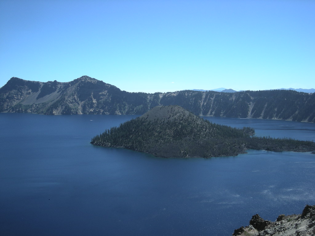
What a glorious day Sunday, August 31 was! All the rain exited and left clear skies albeit a lot cooler. We pack fairly fast because to move is the only way to stay warm. Back onto US 97 south, we didn’t have far to go to OR 138 and in a short 30 or so miles, we were at the north entrance to Crater Lake National Park. It is AMAZING just how blue the lake water is! We passed up stopping on our way around the west side so we could get a campsite. Since we were there around noon, we had little trouble securing one. Once we dropped the trailer, we were back off again but took the east rim drive and counter-clockwised the park road. Even though the vistas are spectacular, the traffic took all the fun out of the drive. I forgot it was Labor Day Weekend! Seemed like everyone was there! We took some photos but were happy to be back at our campsite, out of the traffic. The evening was good and with plenty of free wood- that’s right, FREE wood, we had a wonderful campfire (and we needed it here too at +6,000 feet)! Our night was ruined however when our air mattress gave up the ghost and went flat. Not only is it uncomfortable but it is also colder since there’s no air to insulate you! We thought ahead though and saved some lumber and had a nice toasty fire in the morning.
Crater Lake is max about 6 miles across and a minimum of about 4.5 miles. It is 1,943 feet deep, the deepest lake in the United States. Formed when Mount Mazama erupted, Crater Lake isn’t really a lake but a crater that has filled with 4.9 TRILLION gallons of (did I mention?) the BLUEST water you’ll ever see! Though there isn’t a boatload of things to do there, the focus being on the lake, it is definitely worth putting on your bucket list even if just for a short visit.
That wrapped up August so by the numbers it was: We traveled 5,518 miles in the 31 days of August. That’s averaging 178 miles a day. Much slower pace than July. Since January 1 at the onset of our National Parks Tour, we have clocked 31,639 miles, though only 25,325 since we left Las Vegas April 4. We visited 28 new national sites in August for a total of 234 sites in our quest. We also logged 4 new states and since January 1, we have logged a total of 42 states (including the District of Columbia).
Our gas mileage remains pretty impressive. Even with pulling the trailer 99% of the time, we are still averaging over 40 mpg (41.7 to be exact) for the whole trip according to the onboard computer. We consistently get over 40 pulling the trailer (I guess the GTL is broke in now at over 43,000 miles!). As for gas cost, in August we spent $464 in gas.
The end of August is marking the winding down period of our trip. Looks like sometime in September we’ll be calling it quits (unfortunately!). So, just a few more chapters to close it all out. There are still more great parks in store so stay tuned, we’ll be back soon with our next installment of our National Parks Tour! Greg & Cynthia.