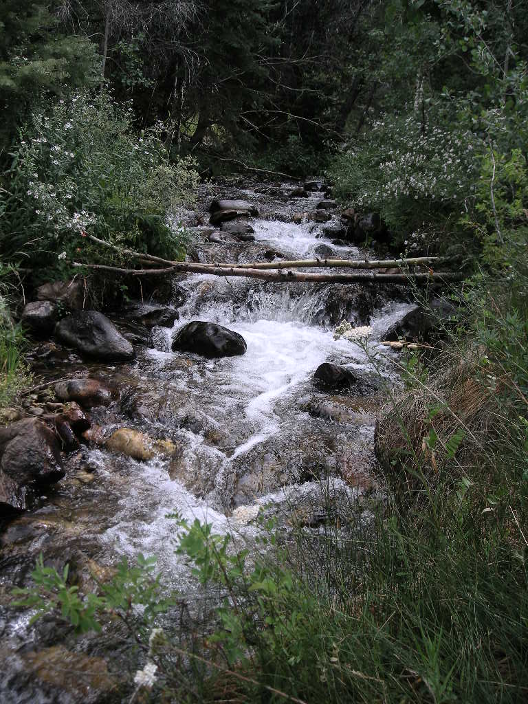
Our start to Monday, July 28 was good with temps low but a good distance to cover (about 250 miles I thought). We hoped to make Great Basin National Park in Nevada before it got too late so we wasted no time packing and continuing on UT 24 west towards I-15. The rest of UT 24 is pretty nice too but not as spectacular as when it winds through the park. Nonetheless, we had a great ride out to connect to US 50. After a short run down I-15 to reconnect to US 50, we were headed out into the desert of western Utah. This part of US 50 reminded us of the stretch in Nevada that is the “Loneliest Road”. If you have travelled that, then you know it is pretty much just scrub and dirt for as far as you can see! Once we got closer to Great Basin, the mountains began to show the green of trees and the promise of cooler temps. We stopped at the visitor’s center as we normally do and inquired about the weather since we saw the rain up in the mountains as we approached from the east. The forecast wasn’t good. We threw caution to the wind and went up into the park to see what kind of spots the Lower Lehman Creek campground had to offer. Once there, we got hit by a quick rain storm! Cynthia was tucked under some pines and I was stuck at an outhouse. The rain went as quick as it came and it was where Cynthia was that we camped. Surrounded by five tall pines that provided a nice flat pine needle bed and protection from wind (and rain it turned out), we set up the tent fast. Turned out, the clouds were having a difficult time rising past Wheeler Peak, the highest point in Nevada so the rain stayed away till after we had dinner. That’s always good. At about 7:00 pm the rain came back and as we were tucked in our tent under the pines, we could see the heavy rain out the window but we never heard much hitting the tent. That spot (which will remain a secret) is on our list to stay at again!
The morning of July 29 was good with the same cloud action as the night before- all of them trying desperately to clear the peaks. We got on the road towards Ely, NV on US 50 but stopped soon after to put the raingear on. Good thing we did. We got intermittent rain to Ely (about 60 miles) but once we turned north on US 93 (The Great Basin Highway) we ran right into a storm. Temps dropped into the low 60’s and stayed there. It is funny to us when we think about riding in the rain this trip. Really it has only been in Mississippi and along the northern part of Michigan, Wisconsin and Minnesota. And now here we are in the desert and getting a good soaking! Welcome to summer in Nevada! The upside is that it was in the 60’s and not the 100’s. That’s ALWAYS a good thing! By the time we hit the US 93A route that goes a little east to Wendover, we were pretty much out of it. The further we went, the warmer it got. By the time we reached Twin Falls, ID, it was back in the 90’s! Since we had been out camping for four nights, we stopped at the Holiday Inn and regrouped, did some planning and the general stuff like wash etc. It was one of our longer days at 320 miles but that’s the way it goes sometimes. Besides, if you’ve ridden the Great Basin Highway, you know you pretty much just keep driving! It is a nice drive but, it is too much of a good thing too! One other thing I noticed about US 93, there is a LOT of truck traffic (mostly headed south) from I-84 in Idaho all the way down to I-80 and beyond. It may be the same northbound but I never passed one. I am sure they have the best route figured out when heading south from the western states like Washington and Oregon.
We had a good night in Twin Falls, ID and weren’t in too much of a hurry to get going since I had it figured we wouldn’t be doing too many miles. I was wrong about that! Wednesday, July 30 started out great! We took I-84 east to visit a place called City of Rocks National Preserve. We had no idea what this place was about. I plugged it into the GPS and got a reading back that it was 54 miles. No big deal even though we’d have to back-track to get to our second destination. Well, 96 miles later (don’t ask me how that happened), we were at City of Rocks. And that’s exactly what it is too. Turns out, this preserve is a world-class rock climbing area. Combined with the neighboring Castle Rock State Park, rock climbers could have a ball! For us, not so much…. We did tour a little of the park but the road was dirt with lots of loose stones that made the driving more than challenging. After a visit to the visitor’s center, we found out that City of Rocks is internationally renowned for the rock climbing! Who knew? The granite spires range from 30 to 600 feet. There are about 700 routes that have been developed. So, if you are into rock climbing like the couple we met who were from British Columbia, this is your place!
Our next stop was back on the western side of Twin Falls at Hagerman Fossil Beds National Monument. Found there was the “Hagerman Horse”, Idaho’s State Fossil among many other fossils that were exposed after Lake Bonneville flooded the Snake River plain thousands of years ago. According to the park folks,” no other fossil beds preserve such varied land and aquatic species from the Pliocene epoch”. Pretty impressive. Though you can travel the dirt road to the overlooks, you won’t see any fossils sticking out of the ground. There is a good view of the Oregon Trail though were the ruts are still visible.
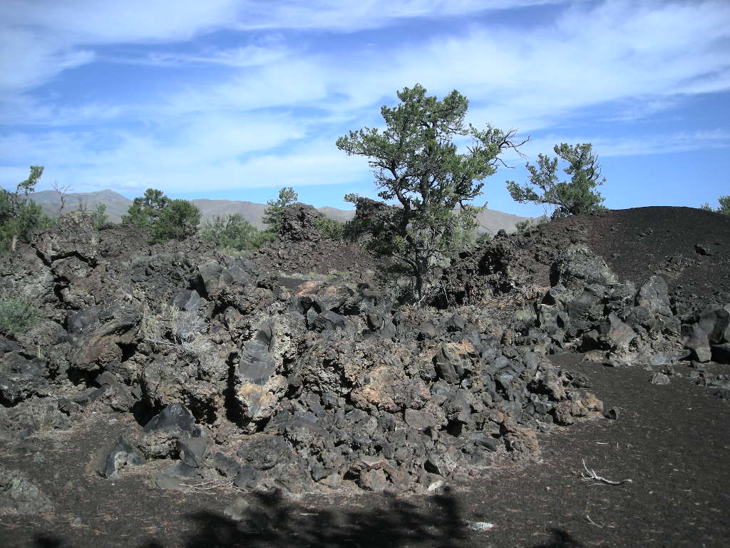
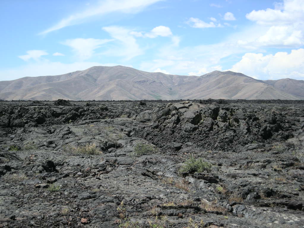
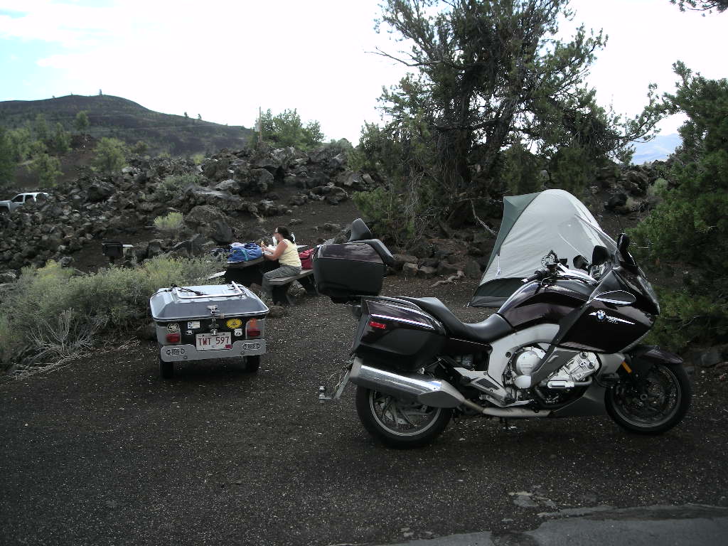
We left Hagerman and headed to our final destination for the day at Craters of the Moon National Monument. Turns out, it was a full 334 mile day, not what I had planned. We wanted to make it a short day but somehow the calculations didn’t prove it out. We arrived at Craters of the Moon via US 26 from I-84 west. Another nice campground and at $10.00, we decided to take an extra day there and do some hiking. We rounded out the day at the visitor’s center. They have a great movie about the park and it explains a lot about the geology. One thing we didn’t know was that the whole Snake River Plain is one big long continental hotspot ending at Yellowstone. It is the only active continental hotspot in the world. Pretty cool! All other hotspots are along coasts where plate tectonics is the driving force. The whole Snake River Plain is dotted with volcanoes and cider cones from times past. It is interesting to note however, that Craters of the Moon was active only 2,000 years ago and is currently being monitored for seismic activity which can signal an eruption.
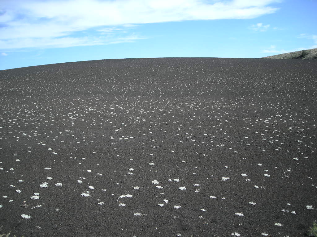
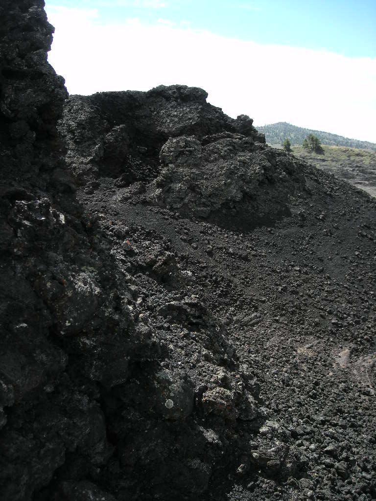
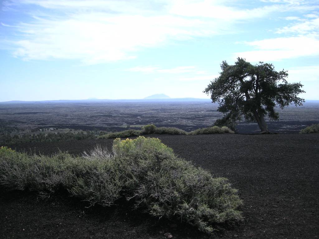
July 31 brought a pretty blue sky and we headed out to the loop drive around 10:30. Our first stop was the Devil’s Orchard, a .25 mile easy trail that winds through small spatter cones. It was our first taste of the ‘moon’. Next along the way was a .5 mile hike to the top of Inferno Cone. It gives you a GREAT view of the Snake River Plain and the numerous cinder cones and volcanoes that appear in the distance. A lone tree on top offered up some needed shade! After that we stopped at the Splatter Cones to hike up to two of them and gaze in. Splatter cones are formed by blobs of lava being ‘spat’ out of a vent and they land in no particular order. They are pretty interesting to watch in action too. We took the drive out to Tree Molds but decided to head back to the camp for lunch. The whole loop drive isn’t really that far, probably 25 miles. After our break, it was off to do the hike to the Tree Molds, those places where the lava surrounds a tree and after it burns out, leaves the tree impression in the lava. We weren’t too impressed with these examples since we had seen much more distinct ones in Hawaii. Our day ended as easy as it began and after a visit from a fellow across from us (who happened to be a retired geologist!) we turned in for the day. It was a good idea to stay at Craters of the Moon a second night. If you are in the area, make plans to visit. It is the ONLY place to see young lava from a continental hotspot!
Here’s the wrap-up of July: We traveled a phenomenal 6,945 miles in the 31 days of July. That’s averaging 224 miles a day. Quite a bit, and a lot more than I would have guessed. When I look back on the month, we were in Prince Edward Island the first of July. That seems so long ago. A TON of stuff has happened since then! Since January 1 at the onset of our National Parks Tour, we have clocked 26,121 miles, though only 19,807 since we left Las Vegas April 4. We visited 46 new national sites (including 2 Canadian ones) in July for a total of 206 sites in our quest. We also logged 10 new states (including 2 Canadian Provinces) and since January 1, we have logged a total of 39 states.
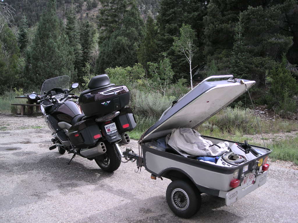
Our gas mileage remains pretty impressive. Even with pulling the trailer 98% of the time, we are still averaging over 40 mpg (41.1 to be exact) for the whole trip according to the onboard computer. I have found that keeping the RPM’s at or near 3,000 produces the best mileage. That’s about 65 mph, a nice speed for non-interstate travel. As for gas cost, in July we spent $674 in gas.
So, that’s about it for July. As we write this, we are realizing that at best, we have two more moths of travel left. That means we are over half way through. We’ll try not to think about that anymore! There are more great parks and adventure in store so stay tuned, we’ll be back soon with our next installment of our National Parks Tour! Greg & Cynthia.