EMO's Diary

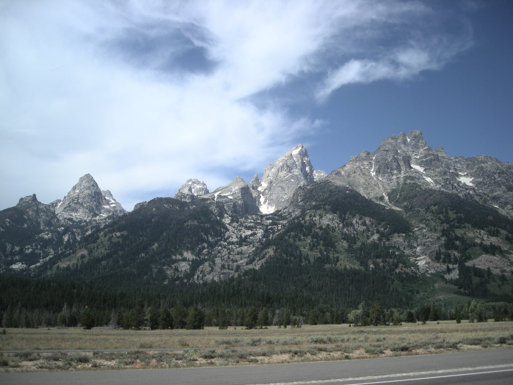
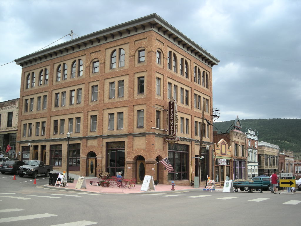
National Parks Tour chapter 26 September 1 - 7

nl7501's picture

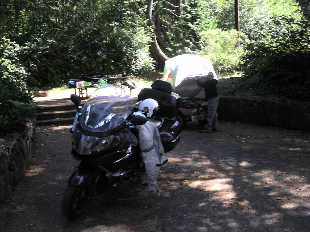
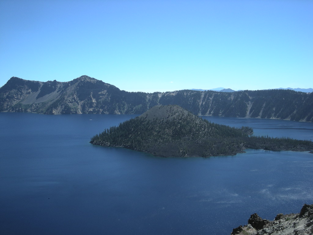
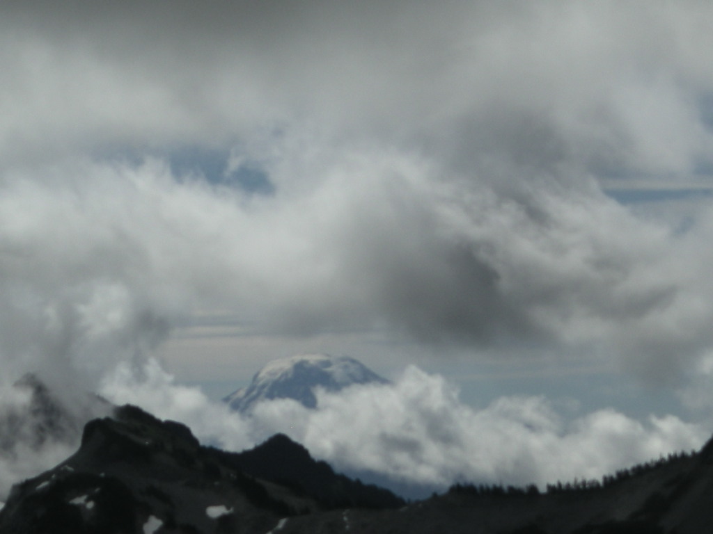
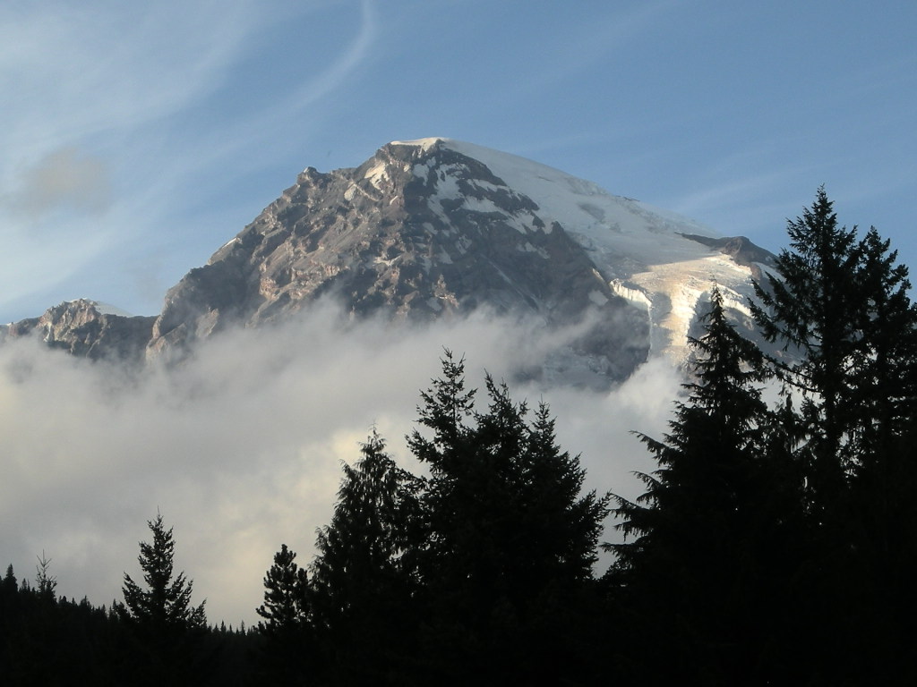
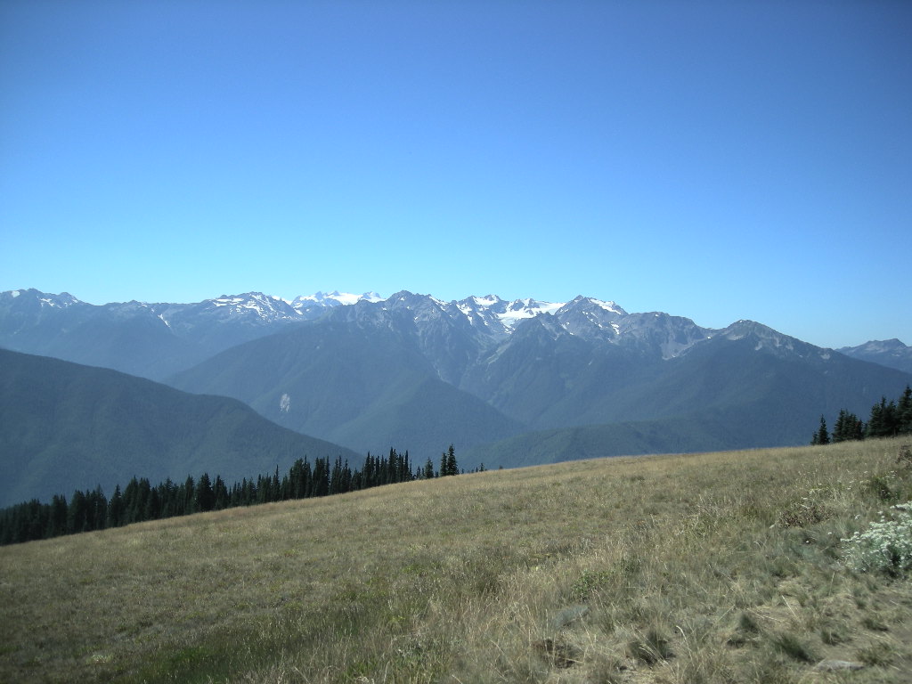
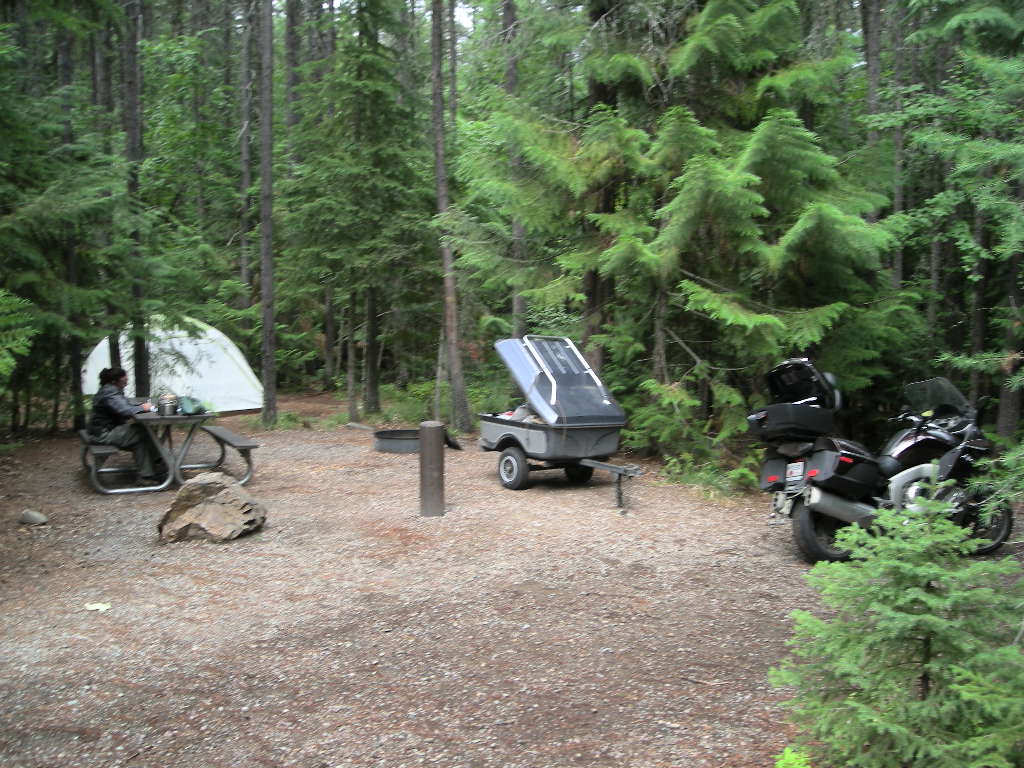
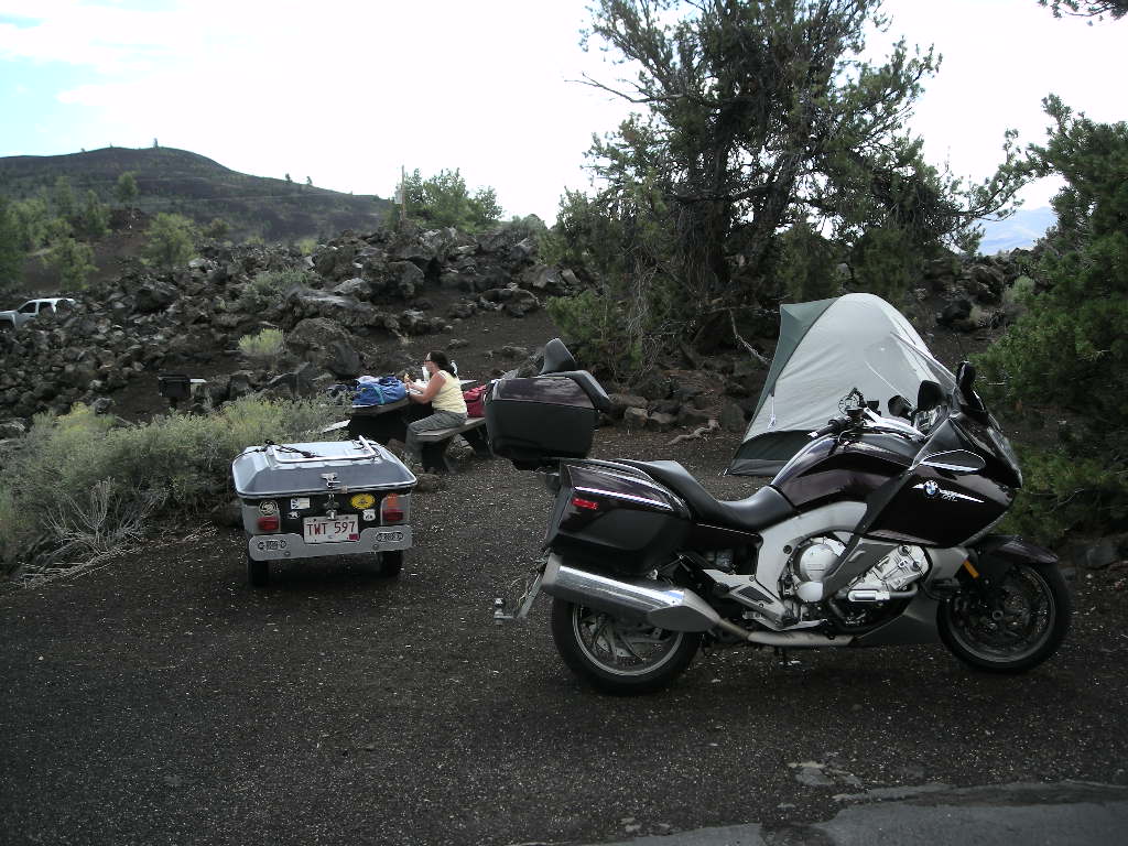
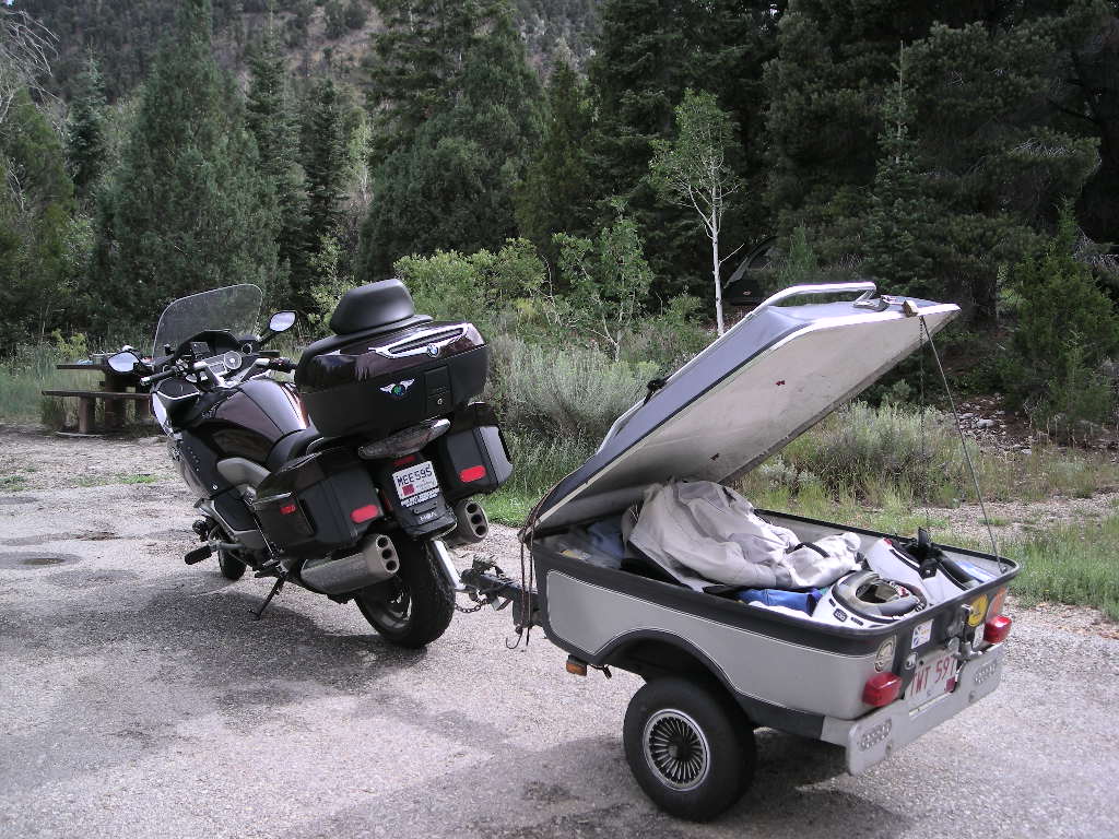
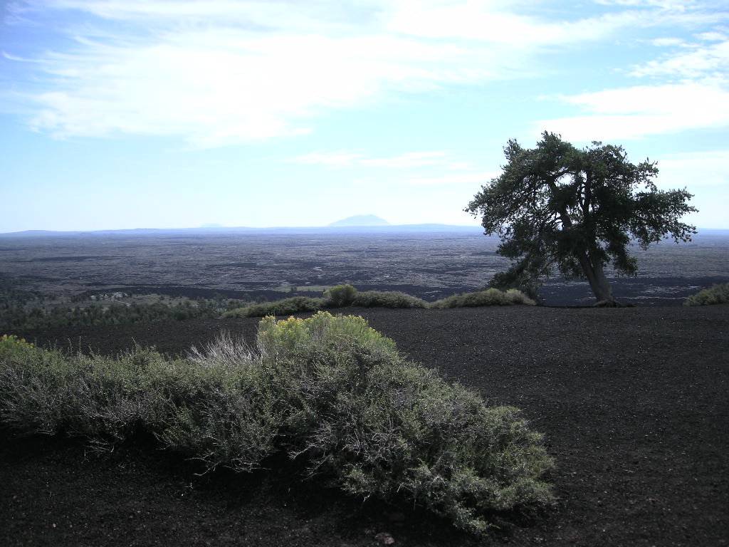
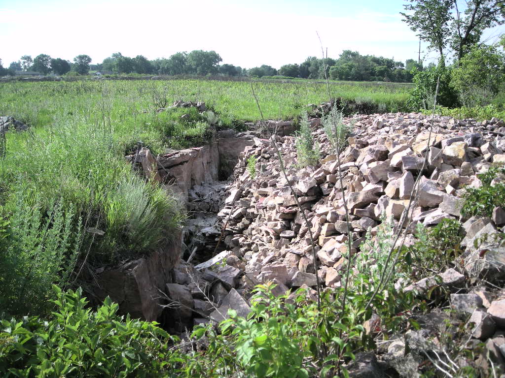
It was another fine morning on Labor Day. We started out cold (it was 45 when we left and surely much less when we rolled out of the tent!) and decided to stop in Klamath Falls, OR at the Walmart to get ANOTHER air mattress. Good thing they exchange them and don’t charge us! They should though because Coleman guarantees them for a year. After a brief stop there, we continued down OR 39 and into California to visit Lava Beds National Monument. If you are a caver or like caves at all, Lava Beds is your park! There are over 700 lava tubes (caves) within the park. Many (20) are easy access but require a helmet and light with good, sturdy shoes. Also, they screen you for prior visits to caves so as to not let the White Nose disease spread to their bats from others in the country. Cynthia and I aren’t really ‘cave’ folks so we elected to view the lava flows and pass on the caving. We took a short cut and drove up Hill Road to CA 161 and headed west to US 97 north. Soon after, we swung further west and north on a county road and once in Keno, OR we took a left on OR 66 (an historic route of the Applegate portion of the California Trail). Oregon 66 is a must ride. The road winds sharply and there are plenty of elevation changes to keep it interesting. Also, traffic wasn’t an issue. After hooking up with I-5, at Grants Pass we headed west on US 199 to our next visit at Oregon Caves National Monument just about 50 miles on. It was a big day at 300 miles. Since it was late and we’ve been in a number of caves, we decided to pass on the last tour of the day and went back down the road to the Grayback Campground. This BLM campground was just right! Only two other campers! Nice big sites and very tall trees made this a good place to overnight. Unfortunately, we had to drive about a half mile to get water since they had already turned off the taps in the campground. It was a warm night and THAT was welcomed after the night we had at Crater Lake!

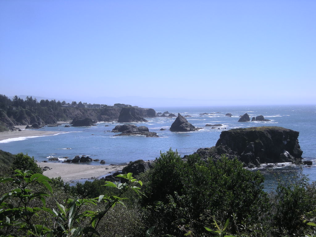
A very fine day greeted us on Tuesday, September 2. We really took our time since we were only going to travel the 80 or so miles to our next camp at Harris Beach State Park, just inside Oregon from California. The drive there was very nice. The Redwood Highway or US 199, travels from I-5 all the way to the coast. It is made for motorcycles! It was lovely. Harris Beach is a GREAT state park and we thought the best we’ve ever stayed in. The only thing missing is WiFi and a quarry not too far away works nights…that is, ALL night and that wasn’t too pleasant. Good thing for our ear plugs! The showers are as nice as many I have seen in homes and the campsites are laid out really well that gives everyone good privacy, especially tent folks like us. A short walk takes you to the beach and as most of Oregon’s coast is, it is spectacular! Once we got settled in, we drove back out to a store that I spied on the way in that sold smoked salmon. I just can’t pass that up. We got a good amount of that and once back at the camp, we went down to the ocean for a walk about and take some pictures. Our plan was to stay at Harris Beach two nights and take in Redwood National Park on Wednesday. We met a lot of great folks at this park and lots wanted to know about our adventure once they knew we had been at it almost 6 months. The experience reminded us once again how lucky we were (are).

September 3 was just as nice as any of the previous days for the past 2 or so weeks! We laid back all day and didn’t do very much except a run to the Fred Meyer (grocery store). We caught up on reading and doing a bit of writing.

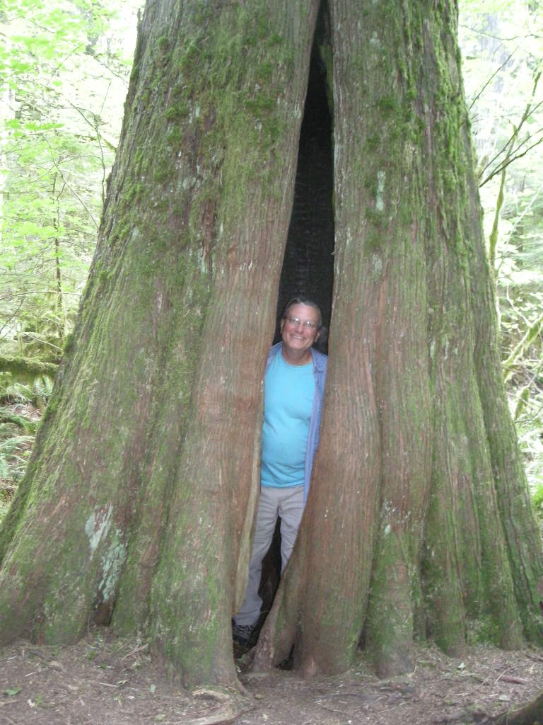
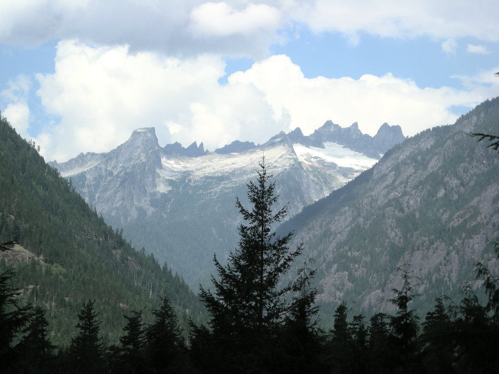
Thursday, September 4 was our get a way day with plans to get to Lassen Volcanic National Park by day’s end. It was yet another fine day and we took off south on US 101 and back into California. We took our time since a lot of this road travels through either the state parks or the national park dedicated to the Redwoods. Except for the smoke (from some fire, not sure which), the coast drive is great. If you are up that way and travelling south, just beyond the Klamath River, take the Newton B. Drury Scenic Parkway. It parallels US 101 but is WAY better! The coast redwoods are just spectacular! Along this route, there are groves devoted to individuals who have made a contribution to their preservation. That’s a pretty nice thing! We found the drive to be very relaxing albeit a bit cold. We hit lows in the mid to lower 50’s. We stopped at the south end visitor’s center, the Kuchel Visitor Center and took in the museum and got our stamp for the Iron Butt National Parks Tour. There we found out that the Coast Redwoods are in fact taller than the Giant Sequoia but not nearly as big around. The Redwoods can reach heights of 370 feet while Giant Sequoias are about 311 feet. The story about the saving of the Coast Redwoods is worth the visit alone but to experience such grandeur yourself, is beyond words.

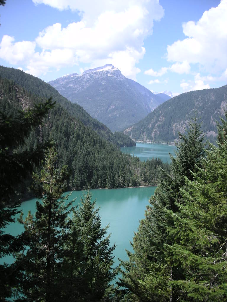
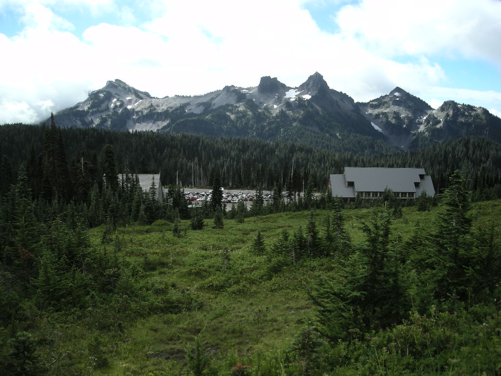
After a stroll along the beach, we mounted back up and continued south on US 101 to the US 299 cut off. One of the premier roads in California has to be US 299. Though we only did the coast to Redding portion, it was a blast (but looking at the map, the portion from Redding onward east looked just as exciting)! I FINALLY got a chance to wear some rubber off the SIDES of my Michelin Pilot Road 4’s. THE most scenic portion is the travel along the Trinity River, known for its Steelhead, Trout and Salmon fishing. The road, for us motorcyclists, HAS to be just as good as or better than the fishing! The limit is 55 but at 65 or so, the road stays a bit of a challenge when you combine the driving with sightseeing. Once we got up into the mountains from the coast, the heat broke out! By the time we got to Redding, it was 105 degrees. We couldn’t WAIT to speed out CA 44 and gain that cooling rise in altitude. By the time we reached Lassen Volcanic National Park at about 5,500 feet, it was a quite pleasant 78 degrees. We decided to camp at the first campground, Manzanita Lake since it had showers and was recommended by the park entrance officer. We easily found a good spot and took the opportunity to shower, making us feel SO much better after that long two plus hour slog in the heat.

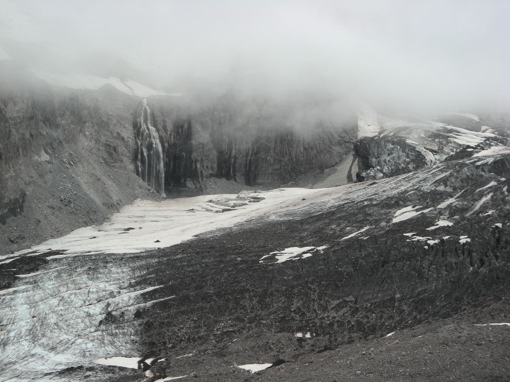
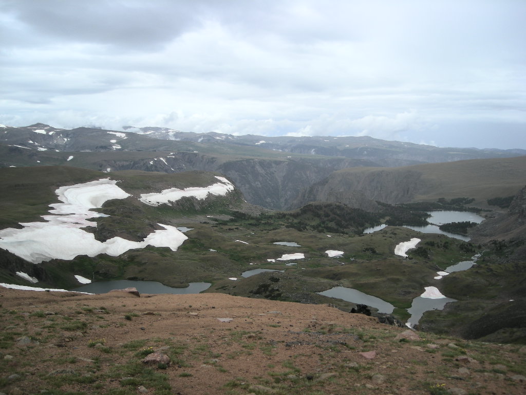
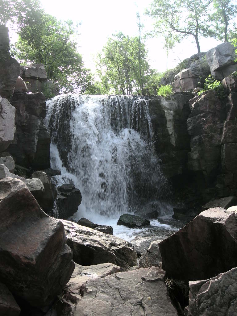
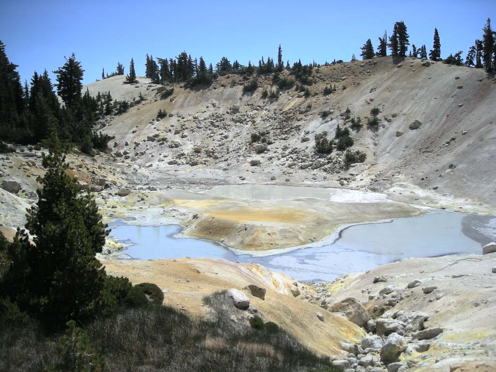
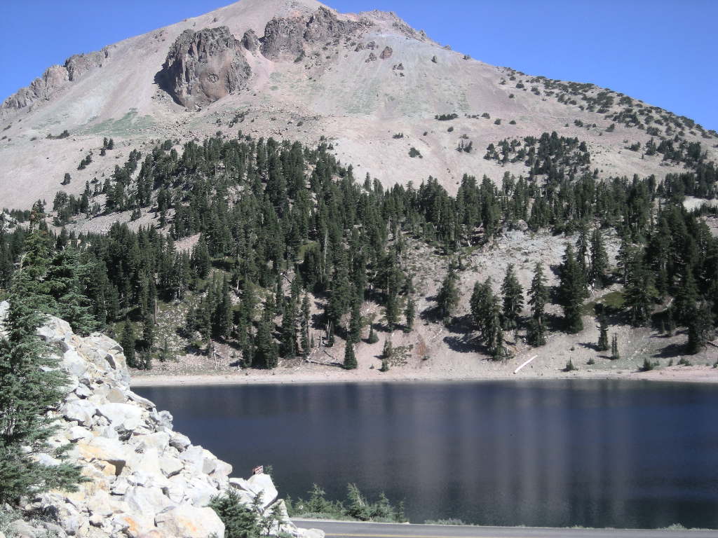
We thought Friday, September 5 was going to be a cold morning since we camped at about 6,000 feet but that didn’t prove out. The morning was fine (just like the previous ones…!) and we took our time getting to the visitor’s center for the film and such before heading out on our hike to Bumpass Hell. Though it has a funny name, Bumpass was the name of the fellow in 1863 that discovered the thermal area that bears his name. Unfortunately for him, while giving a tour to some friends, he fell through a weak spot in the crust and fell into boiling mud. The outcome we know not of but I bet it was hell! The hike was bout 1.7 miles in and was well worth the effort though not a difficult trail by any means. There you will find boiling mud pots, steam vents and sulphur deposits galore! Though it stinks a bit, the colors are great! A board walkway takes you around the features and keeps you safer than Bumpass.

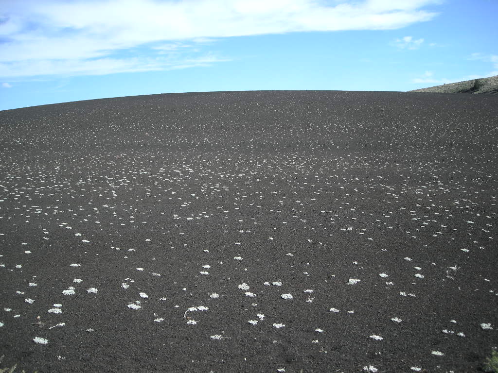
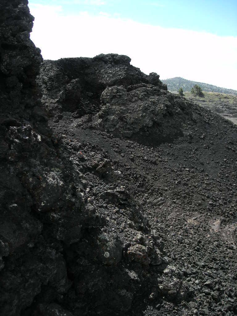
Lassen Volcanic National Park is very unique in that it is one of only a few places in the world where you can see all four types of volcanoes in one spot- the shield volcano, cinder cone, plug dome or lava dome and, the composite volcano. Very cool stuff! The beginnings of the volcanic activity at Lassen started 400,000 to 600,000 years ago with the build-up of Brokeoff Mountain portions of which portions are still visible today. Then rising to 11,000 feet and over 8 miles wide at the base, Brokeoff Mountain exists today only as a series of peaks that are the remnants of the mountain’s flanks. Lassen Peak formed about 27,000 years ago and has erupted as recently as 1916 with the largest being on May 22, 1915 that was caught on (movie) film. Lassen Peak is also the southern-most volcanic peak in the North Cascade range.

Saturday, September 6 started out a little colder than Friday but it warmed fast. We got away around 9:30 and headed back through the park to the southern entrance. There, we turned south on CA 36 and hooked up with CA 89 for the 120 or so miles to Truckee, CA. If you are up that way, be sure to travel CA 89. Great road with beautiful scenery. Once in Truckee, we needed to catch up on our electronic messages and there were plenty! We stayed at a hotel in Truckee-Tahoe, CA and enjoyed one night inside. But before we could settle in, we had to do our laundry, write our journals and get cleaned up!

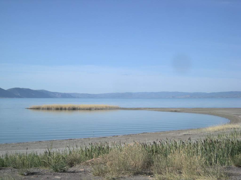
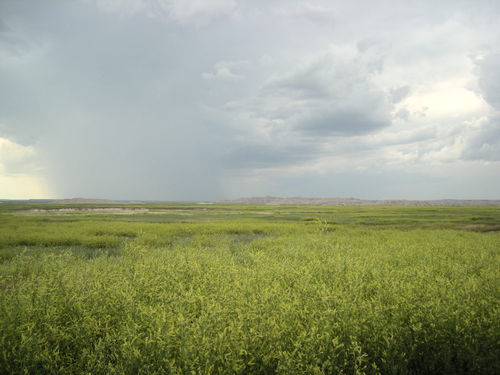
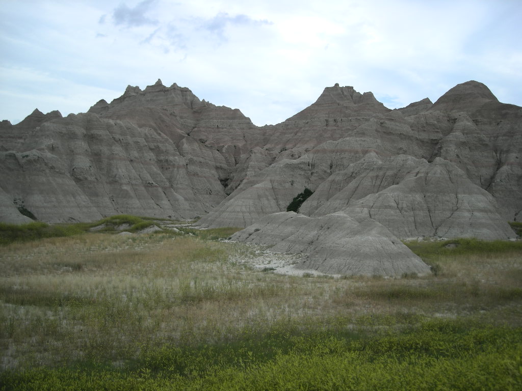
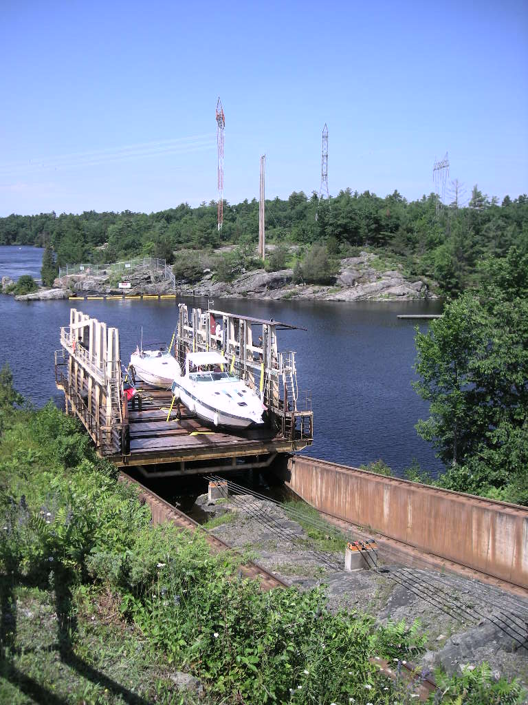
Sunday, September 7 was a fine albeit COLD morning! Good thing we were inside a hotel! The morning temp was in the high 30’s and I am sure we would have been pretty cold if we were outside camping. We waited till about 8:30 when it warmed a bit and headed off down CA 89 and the west side of Lake Tahoe. The traffic was terrible and the road all torn up. Add to that the sightseers traveling and the mind-numbing speed of 25 miles an hour and it added up to an unpleasant ride. Once we got into Nevada, I wanted to take the NV 207 back out to CA 89 and onto US 395, cutting off a fair amount of driving but the road was closed at the summit. We had to stay on US 50 over to Carson City and pick up US 395 south there. It wasn’t too bad of a detour. Once on US 395 it was smooth sailing all the way to Mammoth Lakes, CA. We passed the Mono Lake area which is quite unique with the greenish color to the lake water. Once at Mammoth Lakes, we stopped straight away at the first campground, New Shady Rest Campground, part of the BLM system. The site we got was pretty good and we set up and unhooked the trailer for the ride to Devils Postpile National Monument. Considering it is a trek down a single lane road for about 10 miles, Devils Postpile isn’t the kind of national monument you just stubble upon. You have to want to go there! Considered to be one of the world’s finest examples of exposed basaltic columns, why wouldn’t go the distance to see it!? Though there isn’t a whole lot other than that, we think just the opportunity to see a world-class geological feature is reason enough to climb over about 9,000 feet in elevation and down into a pretty valley. After our visit there, we headed back to camp and enjoyed a quiet evening after having met a really nice couple who shared some of their travel experiences with us.

It looks like we have about a week left in our summer trip. We’re off to Yosemite and Kings Canyon with Sequoia thrown in for some more fun! Stay tuned! Greg & Cynthia.

National Parks Tour Chapter 25 August 22 - 31

nl7501's picture

We had a pretty good thunder storm the night of the 21st. The storm was so close that the lightning was followed immediately by very loud thunder. Once the thunder booms quieted down, all that was left was babies crying and dogs barking. It was a little tough getting to sleep! However, the morning of Thursday, August 22 was a really nice one at first. Soon into our travels though, we had to put on the rain gear. We originally planned to go to somewhere close to the Grand Coulee Dam on the Columbia River and camp but our plans got changed for us. We first started out continuing south on US 95 and slipped into Spokane, WA to pick up our new tent. All went well and after a short run on I-90,we hooked up with US 2 and headed west towards the Columbia River. We skirted a few big storms but since we had our rain gear on since the start of our travels, we didn’t really mind thee occasional sprinkle or short hard rain. We got to the Grand Coulee Dam and Roosevelt National Recreational Area pretty early with plans to camp nearby. Cynthia however, heard a person at the visitor’s center mention that US 20 into the North Cascades was closed. I asked the guy for some clarification and sure enough, both US 20 and WA 153 were closed due to slides as a result of the combination of the forest fires and heavy rain. No other way exists to get into that area from the east. The only thing we could do was wait or drive around. Since neither was a good option and since there was no expected opening time, we headed south on WA 153 to hook up again with US 2 and drive to Everett, WA and stay.

Our visit to the dam was short but the area is long on scenery! The Grand Coulee Dam was completed in 1950 and created the Roosevelt Lake National Recreational Area. The lake is 129 miles long and has 26 campgrounds within its boundary. This NRA is ideal for boaters but as someplace to view the lake from roads, not so much. The visitor’s center has some pretty nice displays of what it was like in the area before the white man showed up (Lewis and Clark) and traces the history through the dam construction to present day. We even saw that the government paid Woody Guthrie $266 to write a song about the Grand Coulee Dam to help promote it! You can hear him singing it in the center also. In addition, the visitor’s center is situated such that you get a great view of the entire dam (a second generating station was added years later) and is worth the stop if you are in the area.

After our visit to the dam visitor’s center, we found the drive down WA 153 to be really nice! It follows Banks Lake (a Bureau of Reclamation project) for about 25 miles and a great drive albeit short! Washington 153 ends at US 2 and finally after passing through many miles of wheat fields along US 2, we banked down into the Wenatchee River Valley, a beautiful area with loads of apple and peach orchards. From the top to the river bottom, the temperature rose by 155 degrees and we couldn’t WAIT too get the rain gear off! Turning west again at the town of Wenatchee, we passed through Leavenworth, WA that turned out to be just like a true German Alpine village. All the buildings are built in the Bavarian style and combined with the surrounding scenery after a few beers, you could imagine yourself being in Bavaria! After leaving Leavenworth, our ride along US 2 turned not as nice as it could have been since the rain started there and continued just about the whole way to Everett, WA. Clouds routinely obscured the peaks but traffic was light. Once out of the mountains, it was a long 35 mph slog to Interstate 5. Since we had no reservations, it took us about 30 miles to find a hotel that had a room for us. Fortunately though, it put us a lot closer to WA 20, the road into the North Cascades National Park from the west. We looked back on the day and realized that we started in Idaho and drove just about the width of Washington! We ended the day in Marysville, 370 miles from Round Lake State Park.

Friday, August 23 started out GREAT! We watched the weather report and it seems the whole state is going to be dominated by a high pressure system for at least a week! How great is that?! It isn’t very often that the northwest area of Washington State gets clear weather and that will be good for us. We took a brief jump up I-5 to exit 208 and WA 530 to cut off a bit of WA 20 that comes from I-5 only further north. The drive on WA 530 is a great road too. Sweeping turns, great scenery and a good road surface really makes a difference! We got to WA 20 and gassed up on some pretty expensive premium just is case we drove around the park more than the half tank would take us. Soon after heading east on WA 20, we were at the Newhalem Visitor’s Center, the first from the west side of the park. We arrived around 11:00 and thought it best to secure a campsite first, which is what we did. Instead of heading out to explore the park, we took a leisurely day and did some reading and relaxing in the warm sunshine.

The North Cascades National Park is huge! Most of the park is accessible via WA 20 and that is the principle route through the park. Also in the area is Ross Lake National Recreational Area, though this one is accessible only from Canada on an unimproved road. Also, there is Lake Chelan National Recreational Area and that is accessible only by boat or float plane. Both Lake Ross and Chelan offer the real backcountry experience where not too many people will be your neighbors! Also close by is the Mount Baker Wilderness and National Recreational Area. LOTS to do up there!

On Saturday, August 24 we took our time getting going because we had the whole day to explore. We decided to do two hikes- the Rainy Lake and Happy Creek Forest trails. In addition, we would be driving on some pretty nice road and seeing lots of other sights. After being a little disappointed at the first part of the trip east on WA 20 due to the power plants and associated wires etc that really ruined the views, we got to Rainy Pass about 10:30 for the one mile hike. It was nice to see that this trail was also paved so that disabled folks can get out into the wild too. Rainy Lake is a glacial lake and was worth the hour round trip hike. On our way backtracking, we hit some showers and temps dropped fast into the high 50’s. It is amazing how fast they warmed up though after the rain stopped. By the time we got to Happy Creek, it was in the upper 70’s. Happy Creek is a nice easy hike that goes through some old growth forest. The trees are pretty impressive. It is said one of these trees could build an entire house. Considering this whole area was logged near the turn of the century (the one before the last one that is), it was great to see those towering trees that would have been the whole forest at that time. We stopped at a few overlooks and enjoyed the ride on WA 20, a smooth winding road perfect for speeds in excess of the limit…. We arrived back at our campsite to relax the afternoon away and hike a few of the trails out of the campground, and send off some postcards.

It was a fine start to Monday, August 25. We took our time knowing we had only about 100 miles to drive and a stop at Walmart along the way. Washington 20 loses its appeal after passing out of the North Cascades but is still a pretty nice road. We got to I-5 and took it south two exits to Exit 227 for the Walmart. Since the trailer tires were getting a bit smooth, I opted to buy a pair. When I thought about it, I put those tires on in Rapid City, SD. When I checked, that was over 6,000 miles ago. I guess that’s not too bad considering they were Walmart tires too! These should get us home because we don’t think there is another 6,000 miles till we get there. Another thought about that- we decided that since we don’t really need to be in Las Vegas till October, we are going to stretch this summer all the way out! Don’t look for us till September 30! After Walmart, we went back up to WA 20 and followed that onto Whidbey Island and to our camp at Fort Ebey State Park. The site was pretty nice and since we got in early, we had a chance to put away all the Walmart stuff and change out the trailer tires. I am sure the trailer will handle much better now especially in the rain. Fort Ebey State Park is just north of Coupeville, WA and is very convenient for the ferry from there to Port Townsend on the Olympic Peninsula. I made the ferry reservations and our plan is a short run after the ferry ride of about 50 miles to Olympic National Park. Fort Ebey was WWII era fort that protected the approaches to Seattle, Tacoma and the Puget Sound in general. The only things left at the fort are the concrete gun emplacements and ammunition bunkers. However, that area affords great views of the water and passing ships. We had a pleasant afternoon at the park walking along the cliffs that overlook the strait and had a good evening.

Another fine day greeted us on Tuesday, August 26. We took our time heading to the ferry that proved to be a 20 minute drive. Since we were so early for our ferry, they got us on the 8:45 to Port Townsend. Sixteen dollars and ninety five cents later and we boarded behind some pretty load motorcycles. After about 45 minutes of some pretty smooth sailing, we docked and headed off on the continuation of WA 20 to the intersection of US 101. We took a right and headed towards Port Angeles on the Olympic Peninsula. It really was a short hop to the Olympic National Park. We only travelled 90 miles. We decided to camp at the Heart ‘O the Hills campground just inside the park along the road to Hurricane Ridge. There was hardly anyone in the park and we really had the pick of sites. Sometimes you can have TOO many choices! Anyway, we set up fast so we could get to Hurricane Ridge while the sun was high for the best pictures. The road up to Hurricane Ridge is only about 17 miles and it’s a nice smooth and twisty road, perfect for motorcycles as long as Ma & Pa Kettle aren’t in front of you…there are no legal passing zones. We got lucky going up and really lucky coming back in that we followed a fellow BMWMOA member on his R1200RT and ALL the cars obliged by pulling over so we could pass! The views from on top of 5,242 foot Hurricane Ridge are VERY nice. On one side you see the Olympic Mountains and to the other you can see Port Angeles, the Strait of Juan de Fuca, Vancouver Island and Victoria, BC in the not too distant. With the weather SO clear, you could see miles. We went into Port Angeles for a quick stop and to hit a bank and buy some smoked salmon. Cynthia and I are both big fans of smoked salmon. Around here is a great place to buy it!

Olympic National Park is also HUGE! Crowned by Mount Olympus, it protects the largest old-growth forest in Pacific Northwest. Some of the trees here took root 200-1,000 years ago! In addition to those, temperate rain forests grow along the coast that receive upwards of 12 FEET of rain per year (now you Newfoundland readers can stop complaining!)! An amazing amount. There are three visitor centers and many, many miles of backcountry trails for hiking and backcountry backpacking. This park is definitely on our ‘come back to’ list and we recommend a visit.

Wednesday, August 27 was, yes, another fine day! I mentioned that we were in for 7 or more high pressure days! We still have a few to go. We got back on US 101 and headed south towards WA 104 then onto WA 3. We were skirting the west side of the Puget Sound. Once on WA 16, we crossed at the Tacoma Narrows (the place of the infamous Tacoma Narrows Bridge that collapsed during a wind storm). Fortunately, the engineers got it right with the bridge that is there now. It was a pretty easy run down WA 7 to Elbe and then east towards Mount Rainier National Park. We got to our camp at cougar rock around 2:00 and set up fairly quickly then headed to Paradise.

We planned to do a pretty decent amount of hiking on Thursday, August 28 and the weather did not disappoint! We left to go back to Paradise around 9:30 and got there about 10:00. We got ourselves ready and headed out on the Skyline Trail. Since this IS Mount Rainier, all the trails go UP from the visitor center at Paradise. We made it to the Glacier Viewpoint at 6,300 ft but the top of Rainier wasn’t visible due to the low hanging clouds. We stayed there a bit hoping the clouds would lift but that wasn’t to be. We did get to see a pretty nice waterfall and the Nisqually Glacier. We decide to give up and headed back down the trail the 1.5 miles to the visitor’s center and counted 8 Marmots along the way. They were busy eating, getting ready for winter. Since the 3 miles r/t wasn’t enough, we took the 1 mile r/t to Myrtle Falls before we called it a day.

Another great day greeted us as we packed to leave Mount Rainier on Friday, August 29. We went back out the way we came in past Longmire but at Elbe, we went south to US 12 and out to I-5. A few miles later, we stopped at the Mount St Helen’s visitor center not far from the highway. This center was run by the State of Washington but we stopped for our stamp anyway since it is part of the Mount St Helen’s National Volcanic Park. It was a really nice center and worth the visit. Soon after, we continued south on I-5 to WA 4 along the Columbia River, tracing the steps of Lewis & Clark on there journey westward in 1804. Washington route 4 is a really nice road. It follows the river most of the way and is in good shape. Lots of turns and changes to elevation make it an interesting ride out to WA 401 where we headed a little south to cross the Columbia opposite Astoria, OR. This is almost at the mouth of the Columbia where it meets the Pacific Ocean. Not far from our crossing we stopped in to visit Fort Clatsop, the wintering home of the Corps of Discovery. Though not the actual fort, it is a great recreation of the original because Lewis and Clark kept such detailed records. Over the past few weeks, I have been reading the abridged version of their journals and in some places, it feels like we are right there with them. Fort Clatsop is one of those places. Their adventure must surely have been a great one just as ours has been in its own right.

We left Fort Clatsop and proceeded down US 101 and since it was the beginning of the Labor Day weekend, traffic was terrible! Fortunately, we didn’t have to go far and just beyond Seaside, OR, we took US 26 east towards Portland. This is another pretty good motorcycle road as long as the traffic isn’t too bad. Good for us that they were all headed west as we proceeded east! We got to our hotel about 4:00 and that gave us time to do wash and catch up on a few things. It had been six days since we’d been out camping. We have been blessed with some pretty fine weather these past 7 days and the report is for warmer and sunnier days ahead. I guess we’ll just have to stay out longer!

We got up fairly early on Saturday, August 30 to a fairly disagreeable day. It started raining and did not let up till we got to The Dalles along the Columbia River. Even though the clouds hung low, the drive out I-84 is pretty nice, following the Columbia River. Next rip, we plan to do the Washington side on WA 14. Despite that, we stopped at The Dalles to visit the Columbia River Gorge National Scenic Area visitor’s center, run by the State of Oregon. It seemed to be getting nice but just to be sure, as we headed out of there and south on US 197, just as we cleared the gorge, the clouds looked VERY menacing! Good thing wee left our gear on, the whole way down US 197 and further after linking up with US 97, it rained off and on. Heavy at times, not so much other times. We passed Redmond (the site of the BMWMOA meet a few years ago and passed Bend, OR on our way to Newberry National Volcanic Monument. We only made a quick stop here because we’ve seen a few lava flows already. After inquiring about camping, we drove a few more miles south and camped at the Lava Lands campgrounds in the National Forest. We got a pretty good site, since no one was there and a chat with the camp host got us all the free wood we wanted! That was really nice of him! We had a great fire that night and we needed it! Temps dipped into the high 40’s.

What a glorious day Sunday, August 31 was! All the rain exited and left clear skies albeit a lot cooler. We pack fairly fast because to move is the only way to stay warm. Back onto US 97 south, we didn’t have far to go to OR 138 and in a short 30 or so miles, we were at the north entrance to Crater Lake National Park. It is AMAZING just how blue the lake water is! We passed up stopping on our way around the west side so we could get a campsite. Since we were there around noon, we had little trouble securing one. Once we dropped the trailer, we were back off again but took the east rim drive and counter-clockwised the park road. Even though the vistas are spectacular, the traffic took all the fun out of the drive. I forgot it was Labor Day Weekend! Seemed like everyone was there! We took some photos but were happy to be back at our campsite, out of the traffic. The evening was good and with plenty of free wood- that’s right, FREE wood, we had a wonderful campfire (and we needed it here too at +6,000 feet)! Our night was ruined however when our air mattress gave up the ghost and went flat. Not only is it uncomfortable but it is also colder since there’s no air to insulate you! We thought ahead though and saved some lumber and had a nice toasty fire in the morning.

Crater Lake is max about 6 miles across and a minimum of about 4.5 miles. It is 1,943 feet deep, the deepest lake in the United States. Formed when Mount Mazama erupted, Crater Lake isn’t really a lake but a crater that has filled with 4.9 TRILLION gallons of (did I mention?) the BLUEST water you’ll ever see! Though there isn’t a boatload of things to do there, the focus being on the lake, it is definitely worth putting on your bucket list even if just for a short visit.

That wrapped up August so by the numbers it was: We traveled 5,518 miles in the 31 days of August. That’s averaging 178 miles a day. Much slower pace than July. Since January 1 at the onset of our National Parks Tour, we have clocked 31,639 miles, though only 25,325 since we left Las Vegas April 4. We visited 28 new national sites in August for a total of 234 sites in our quest. We also logged 4 new states and since January 1, we have logged a total of 42 states (including the District of Columbia).

Our gas mileage remains pretty impressive. Even with pulling the trailer 99% of the time, we are still averaging over 40 mpg (41.7 to be exact) for the whole trip according to the onboard computer. We consistently get over 40 pulling the trailer (I guess the GTL is broke in now at over 43,000 miles!). As for gas cost, in August we spent $464 in gas.

The end of August is marking the winding down period of our trip. Looks like sometime in September we’ll be calling it quits (unfortunately!). So, just a few more chapters to close it all out. There are still more great parks in store so stay tuned, we’ll be back soon with our next installment of our National Parks Tour! Greg & Cynthia.

National Parks Tour Chapter 24 August 14 - 21

nl7501's picture

We got a late start on Thursday, August 14 because we had to wait till 9:00 to call the service folks at Big Sky Motorsports in Missoula to schedule a service appointment. We got the appointment for Tuesday at 10:00 and once all that was wrapped up, we headed out to the Beartooth Highway once again. This gave us plenty of time to go the 300 miles or so and thinking through that, we decided to stay in Yellowstone three nights. Our plan to have some really nice pictures from the highway weren’t to happen though. As you can see from those pictures attached, the clouds and rain moved in on us. We got suited up at the hotel and it was a good thing. It rained all the way there. The upside was that it stopped after we crossed the Beartooth Pass at 10,927 feet. I was sure we’d be IN the clouds up there but as we approached, we could still see the peak. That was a good sign. On our way up the road, just out of Red Lodge, MT, I saw out of the corner of my eye a black bear run from the left side of the road right at us! By the time he got to the middle of the road, we were mostly past him but then I was sure he would run into the side of the trailer! It all happened so fast that it was over before it got started! He missed me and I missed him. I am sure glad nothing happened but we are going to count another bear in our wildlife tally!

We got back to the east entrance of the Yellowstone National Park early hoping the campgrounds would not be full (the first come, first serve ones) because all the reservation ones were booked. I saw a campground in the National Forest as we approached Cooke City, MT (could be Wyoming) called Crazy Creek that looked really appealing but it was 20 miles from the entrance and we really wanted something closer. Once we got to the entrance station, I saw that Pebble Creek, just 10 miles on had availability so we headed out right away. We pulled in just as they hung the “Campground Full” sign but I stopped anyway since the camp hosts had a sign on their trailer saying they were from Loch Haven, PA. That’s where all my father’s family is from! I had a grand ‘ole chat with them about Loch Haven and they even knew my great uncle George but not my grandfather Charles. It IS a small world! The ‘revelation’ didn’t get us a site though. They sold the last one 5 minutes before we arrived! They did give us good info on some of the other campgrounds and we started out fast headed for Mammoth Hot Springs first since we were informed they don’t usually fill till about 3:00 pm. It is hard to do the speed limit when you need to be somewhere fats but I managed to stay at, or just above 45 mph. It was tough…. A word of caution- if you find yourself in Yellowstone for a visit, be CAREFUL! Yellowstone IS the definition of distracted driving! The drivers aren’t all that good in the first place then add them being in a GREAT park and throw in some wildlife and you have the potential for some pretty dicey events! The most significant one for us (other than the bear) was when we rounded a curve to see as usual, cars stopped to view animals but this time two Harley Davidson riders (and two cars) decided to park right in the travel lane…in the center of the travel lane. Traffic was backed up in the other direction too but we were fortunate in that there was just enough room to slip through. We got to Mammoth Hot Springs and found ourselves a great spot in that campground overlooking a beautiful mountain albeit close to a road. The traffic died down early so noise wasn’t a problem till early morning when the trucks, trying to make the hill loaded with dirt for the road construction, grinded away in low gear and ¾ throttle. That wasn’t that nice.

Since we had three days, we decided to ride the west side one day, stopping at all the sights we hadn’t been to last September and do the same the following day on the east side. We got out late on Friday, August 15 since we only planned to drive the 100 or so miles to Old Faithful and return. That’s not much but considering traffic and a wildlife back-up, it could take three hours. It just wasn’t the traffic and wildlife though. The east side from Mammoth to the Norris Geyser Basin has a LOT of road construction and there is a 7 mile stretch that is one lane only. Count on a 30 minute wait in each direction (at best) just to get your turn to go through. We got through that fairly easy but hit rain just before we got to Old Faithful. It was one of those occasions that you try to decide to take a chance without rain gear since its ONLY 5 miles or so or do you don the gear and ride on. We opted to take the chance and we made out okay, only slightly getting wet. Our visit to the lodge was short because we really wanted to see the geysers. Naturally, Old Faithful was first! From there we were headed back towards Mammoth and took the Firehole Lake Drive through the Lower Geyser Basin. There we stopped and waited for the Great Fountain Geyser to do its thing but unlike Old Faithful, it is unpredictable even though the sign at the lodge indicated it would erupt while we were there. We decided not to wait any longer than the 45 minutes we did and went back to heading north. We had a longer wait at the construction this time but the break was nice. Remember, we’re stooped in traffic in Yellowstone National Park! What a great place for a traffic back-up! We arrived back at the campground with plans to go up the hill to Mammoth Hot Springs proper and get some ice cream after supper. This trip has caused a serious wanting for sweets after dinner but we’re never around a place that was that easy to reach. The Huckleberry ice cream is pretty good!

On Saturday, August 16 we headed out to the east side of Yellowstone, stopping first at Tower Falls. Tower Falls is a nice waterfall and there is a canteen there and gift shop. After the brief and easy walk out to the overlook, we continued on to Canyon Village and our second visit to the Grand Canyon of the Yellowstone and the Upper and Lower Yellowstone Falls. These falls are really spectacular! We hiked the North Rim Trail to take in all the overlooks and at the middle overlook, got a chance to see what appeared to be an osprey nest down in the canton (see attached picture). What a sight! Turning the other way, you get the best view of the falls and the canyon. What a visit! We definitely recommend an extended stop at these overlooks. We got back on the park road north and crossed some pretty high elevations on our way to Tower-Roosevelt. We stopped just past the falls (Tower) at the Calcite Springs overlook and we must say, the overlook up and down the Yellowstone River there is really nice too. We continued on and stopped at another water fall almost to Mammoth Hot Springs right along the road- Undine Falls. Not as spectacular as Tower or the falls on the Yellowstone, it was nonetheless a scenic spot worth a visit. By the time we got back to our campsite, it was still pretty early so we took the time to sit and admire the view and get some reading in. While we were at that, the folks camped next to us returned on their Harley Davidson from a ride through the park. We got to talking and hit it off right away. Later that evening after supper, we all got together around the campfire and had a grand chat about each other’s adventures and what lay ahead for us. Meeting them and having such a good time was such a contrast! They had a 40 foot motorhome with the Harley on a hydraulic platform that was attached to the trailer hitch (in two places). Behind that they were towing a Jeep. All told, Nick said the total length was just about 60 feet. Wow! I can’t imagine driving that around! Then here we were all of 17 feet total with our BMW and little trailer. They ride a Harley, we ride a BMW. They had a refrigerator full of food and a full bar while we had a few freeze dried meals and Vitamin Water. You never know how things will work out and we’ve met some really nice folks on the road. We’ll remember Nick and Anna a long time. They were great folks!

By Sunday August 17, Nick and Anna pulled out to head to Glacier and we pulled out to head towards Missoula. It was another fine day and we exited the park at West Yellowstone and followed US 287 north. I had big plans for that day but by the time we got out of the park, it was clear we wouldn’t do the plan since we would have been riding into the early evening. Since we had no camping reservation, we thought it better to take a shorter route. By the time we got to Ennis, MT it was clear we needed to make the ride shorter. We picked up MT 287 and continued on to Virginia City, Montana’s first capital. If you have the time, Virginia City is worth the stop. Part tourist trap and part REAL old west town, there is something for everyone. A little further on you pass through Nevada City, a little less touristy and more ghost townish. It was all about gold mining in these parts in the mid to late 1800’s. Both are pretty cool and we recommend seeing them both. After we passed through those two towns, it was hard at it straight up MT 41 to Interstate 90 where we headed west to exit MT 1 towards Anaconda. Anaconda, MT holds a special place in my heart because it is there that I spent 7 days in their hospital about 30 years ago after I missed a turn and lost control of my ’83 Honda CB900 Custom in a turn just south of town on MT 569. It brought back memories to say the least. Some of them quite nice actually. The staff at the hospital were pretty good to my wife and I. They brought us ice cream every night!

By the time we got to Georgetown Lake further along MT 1, it was time to pull in for the night. We stopped at a BLM campground called Lodgepole and found it to be almost empty. Three other campers in a campground with about 70 total sites. My kind of campground! Most of the sites were for trailers or camper rigs but we found a really nice spot for our tent. After visiting the camp host and buying a LOAD of wood for $5.00, we settled in and had a great evening sitting by the campfire that lasted past our usual bedtime! We don’t usually have a campfire but this one was a welcome event. Needless to say, it was VERY quiet that night with no one around. While it was still light, out of the corner of my eye I saw a big bird swoop into a tree about 20 yards away and up about 15 feet. With a closer look, we saw it was a grey owl! We’ve never seen one in the wild! It sat of the limb about 10 minutes looking around and then spread its wings and flew, with utmost silence to a tree 10 or so yards further and did the same thing. After about ten more minutes, it moved the same distance again. It was hunting. What a fabulous thing to see! All told, we saw him do that 4 times before he was out of sight.

We took our time getting on the road Monday, August 18 since we really only had about 100 miles to go. It was cold in the morning but after the sun poked over the trees, it warmed fast. We continued on MT 1 and hooked up with I-90 at Drummond, MT. Interstate 90 out in western Montana is really nice as far as interstate highways go. You pass through the Clark Fork River valley with long sweeping turns that beg something greater than the legal 75 mph and the road surface is perfect. We arrived in Missoula early and did some shopping at REI and Carbela’s to stock up on food and look at tents once again. Seems the one we have doesn’t function well when it rains and since REI allows returns up to one year after purchase, we decided to get a dome tent that would work better for us. There was only one catch- we had to pick it up at the Spokane, Washington store! No worries that will be in a few short days after our visit to Glacier National Park.

Our service appointment at Big Sky Motorsports wasn’t until 10:00 on August 19 and they were only 4 miles from our hotel (which by the way was the BEST Super 8 we have ever been in) so we had plenty of time to relax in the morning. We met a guy from British Columbia there with his 2013 GLT same as ours wanting a front tire and oil change. We had a great chat while we waited and since he had only 8,000 miles on his K1600, I was letting him know what we have experienced in the 42,000 we had on ours. Our bike was taking a little time so we walked the 7 blocks to the Staples to take care of some business. When we got back, it was ready. They delivered the bike to me but forgot to reset the clock. The service manager gave me a bit of a time about that, claiming I needed a major service but could not tell me what the major service at 42k miles was. Maybe he was new to BMW… Anyway, they reset the clock and after paying for the most expensive Michelin Pilot Road 4 GT EVER, we were on our way to Glacier. We took the back road, so to speak and headed east on MT 200 and then swung north on MT 83 on the eastside of Flathead Lake. This is a wonderful drive and much less traffic than if you go the US 93 route up through Kalispell. We hit a strong rain just outside Columbia Falls and got a little wet. We stayed damp all night because of it. Our site at Glacier National Park at the Fish Lake campground was really nice. Once again we met a fellow motorcyclist (he had an R1200RT) and had a grand chat with him. After a short sit out on our chairs enjoying the scenery, we packed it in.

Wednesday, August 20 started out not too good but got a lot better! It had rained over night and it was damp but the skies appeared to be breaking. We pondered whether we should just pack up since the weather report said 70% chance of showers for the day and night. We figured showers meant not too much rain so we elected to stay our second night. We put on the rain gear and off we went for the ride up the Going-To-The-Sun Road to Logan Pass at about 6,700 feet. If you haven’t driven this road, you are REALLY missing out! Completed in 1932, it is the premiere alpine road in the States. Shear drop-offs and spectacular vistas await all who travel it (when the weather’s good, that is) and we had ify weather. Even though we drove through the clouds part of the way, we were still able to see the hanging garden complete with its glacier and mountain stream run-off. Unfortunately, on Logan Pass, the clouds moved in and you couldn’t see a thing. It reminded us of Newfoundland! After a great ride up and back, we settled in for a nice afternoon at our camp writing, reading a bit and relaxing. It wasn’t until the evening did things get bad. It rained all night long. There really is nothing worse when traveling via motorcycle than to wake up camping and its raining. The rain gods shined (figuratively) on us and the rain quit long enough for us to get the rain gear on, pack and hit the road in 35 minutes. No breakfast at camp that morning!

We exited the park on US 2 heading towards Kalispell and by then, the rain had stopped. We continued on US 2 until we got a little past Libby, MT (right before Troy) and turned south on MT 56. There are GREAT roads all over the place up there in NW Montana and northern Idaho but US 2 is a must ride. We are definitely considering it for next year. After hooking up with MT 200 (another great road that runs a good distance in Montana) we headed west again into Idaho and took US 95 south to our campground at Round Lake State Park just south of Sandpoint, ID. It was nice to gain an hour going into Pacific Time because we had quite a bit of stuff to dry out! We hung the line and each article took a turn in thee shining sun (including us).

Our plan is to get our new tent (the one we have, we hate, especially after last night) in Spokane, WA on Friday and continue west through Washington, heading towards the Cascades National Park. There will be more great parks in store so stay tuned, we’ll be back soon with our next installment of our National Parks Tour! Greg & Cynthia.

National Parks Tour Chapter 23 August 5 - 13

nl7501's picture

We got to Cedar Breaks early and was it cold?! As we approached Brian Head along UT 143, it got colder and colder. By the time we got to Cedar Breaks, it was 52 degrees. Only a few miles before, in the valley, it was 80. We stopped at the visitor’s center for some information about the park. If you have not been there, it always appeared to me to be a miniature Bryce Canyon, only steeper. We left there pretty quickly and descended to Cedar city on UT 14, a really good motorcycle road. After stopping in St George to get our Vermillion Cliffs National Monument stamp, we took off down I-15 for the short 100 miles or so to Las Vegas. A quick stop at REI for a new tent and a re-stocking of freeze dried food, we made our way to our friends house and enjoyed a few days staying with them as we took care of our ‘Las Vegas’ business.

On Wednesday, August 6, I stopped at BMW Motorcycles of Las Vegas for the switch replacement only to find it wasn’t in. Robert (Miller) checked and ordered it for overnight and it was repaired on Thursday. That was good. All got completed on Thursday August 7 as promised and we continued to do all the other business we had to take care of. From the 7th to when we left Las Vegas on the 11th we were consumed with getting things done so we could get back out on the road. Aside from that, we had a great visit with our friends who put us ‘homeless folks’ up for the whole time we were there.

On Monday August 11, we took off early to beat the heat in the desert and were fortunate that it stayed cloudy till we got up I-15 to Cove Fort, UT about 250 miles from Las Vegas and close to halfway to our destination of Logan, UT. We wanted to get the majority of the trip up to Yellowstone National Park done by interstate highway, the fastest route. It took us 8 hours to do the 500 miles to Logan and we crashed in the Best Western right on Main Street providing easy access to US 89 north the following morning. I searched Yellowstone for a camping reservation and got lucky that we could stay at Canyon for the night. Yellowstone National Park is REALLY busy in the summer and I did not want to take a chance on arriving late for a ‘first come first serve’ campground.

We got underway about 9:00 am on Tuesday the 12th and headed straight north on US 89, the same road we went through going over to Fossil Butte from Golden Spike a little more than a week before. It was another great ride up the highway but this time there wasn’t any campers or motor homes to spool our party! We breezed through the Bear Lake region once again and just past Montpelier, ID we swung into Wyoming. US 89 up this way is a continuation of the smooth, albeit sweeping turn road that characterizes the stretch from Logan to Bear Lake. With the speed limit of 65, it is easy to push it to 75, even when pulling the trailer. The weather was great (cool with ample sunshine) and we pulled into Alpine Wyoming for the quick but very scenic stretch of US 89 that parallels the Snake River up to Jackson, WY. Jackson is an especially nice town that blends the old and the new quite nicely. Though traffic can be a little hectic since it is the gateway to the John D. Rockefeller, Jr. Memorial Parkway and the Grand Teton National Park, the scenery in and around Jackson is pretty nice!

We stopped at the visitor’s center for the Grand Teton National Park at about noon and it was a bustling place already. I knew Rockefeller made many contributions to our National Park System (like much of the property that makes up Acadia National Park in Maine). The John D. Rockefeller, Jr. Memorial Parkway commemorates those many contributions to conservation that Rockefeller made. Established in 1972, the parkway encompasses 24,000 acres of some pretty spectacular views of the Grand Teton Mountains. As for the Grand Teton National Park, there are three visitor centers along the Teton Park Road which basically parallels US 89 but is a MUCH nicer drive. The imposing Teton Mountains seem to be right up against you as you cruise up the park road at a pleasant 45 mph. We found some of the most impressive vistas were of Jackson Lake with the Tetons in the background. Another nice attribute of the park is the many bike (bicycle) trails that run along the park road as well as US 89. The terrain is relatively flat so it doesn’t take an Olympiad to have fun peddling the park.

We got back on US 89 just north of Moran Junction and continued north towards Yellowstone National Park. You know, every time we’ve been there, there is something new to be awed about. Whatever it is, it has always been there but it takes more than one visit to appreciate the vastness of Yellowstone National Park. I would have to say that if you only were to visit one national park, make it Yellowstone. Yellowstone is beautiful at times; spectacular at others and it seems to draw you in all the time. There is something there for everyone and the geological activity is hard to beat! Bubbling mud pots, geysers and hot pools round out the activity and the only thing missing is the lava flows (for now!).

We entered via the south entrance and found traffic to be light. We made it past Grant Village and West Thumb before the cars started to become a problem (slow drivers) and by the time we got around Yellowstone Lake and headed north towards Canyon Village, it really became a problem! We’ve been in a few Bison Back-ups before and I am NEVER really comfortable with buffalo walking within arms length of us while we are on the bike. There really isn’t much you can do about anything they decide to do! This time, while sitting in one of those back-ups, a full grown male started heading for us from the field. Before he made his way onto the road, my prayers were answered and he cut between the car in front of us and the one in front of them. It seemed to get real dicey when he all of a sudden stopped in front of that car, swung his head around facing them and gave them a pretty strong stare! I wonder if it was a challenge, after all it is getting on mating season! I guess that Honda Civic was more of a threat than our BMW K1600. He stayed there for what seemed like an eternity then walked up the other side of the road like he owned the place…I think he does!

It took us almost an hour to get clear of that Bison Back-up and we got to Canyon Village campground around 4:00. We got a really nice spot not too close to anyone and we dragged out the new tent with the hopes it would not be too confusing to put up. After all, we were pretty tired because it was a 300+ mile day on top of the 500 miles the day before. No worries though, all went smooth and we did our routine and turned in early only to be awakened by the rain in the middle of the night.

Wednesday morning August 13 was a cold damp one! It is tough when you come off a week’s worth of fine living at your friend’s house in the desert and then find yourself damp and cold in the woods! It didn’t take long for it to warm up and by the time we were on our way north towards Tower-Roosevelt, it was getting on time to peel the liner in our jackets. We have never been up the northeast part of Yellowstone National Park but we HIGHLY recommend it. It is home to the Lamar Valley, the highest concentration of wildlife in the park and home to the famous Yellowstone wolves. It is also home to more and larger Bison Back-ups since the bison in this part of the park seem to outnumber the visitors! We didn’t mind too much because we kept our eye on our prize for the day- a ride on the spectacular Beartooth Highway. And how spectacular it is! At some points it seems you could be in the Alps or someplace like that! About a third of the way through I decided to DRIVE the road and not stop to take pictures or anything like that. I made the plan in my head that we were going to ride the Beartooth again the next day because it WAS so inviting and spectacular! Once we headed back down the Montana side and through Red Lodge, MT, it was clear in my head we needed to plan the return trip.

We jumped on I-90 and headed east to book a room in Billings and started back out right away to head to Little Bighorn Battlefield National Monument since it was only 55 miles away. Little Bighorn is probably known to everyone reading this. This is the site of Custer’s last stand, June 26, 1876. It was pretty interesting and somewhat sad looking at ‘Last Stand Hill’ when you have heard so much about it. We felt a mix of emotions especially when you know the detail of the Native American’s issues with our government and Custer in particular. It was BLAZING hot there at 99 degrees with NO shade so we opted to leave with only the shortest of visits. I may have mentioned this before but I have travelled the prairies in summer and I have always found it much hotter there than in the desert in the summer. The temps can be just as great but you can also count on some humidity to notch it up even more! Our next stop was on out way back to Billing at Pompey’s Pillar. Ever heard of it? We didn’t either and THAT is what makes this trip so interesting!

Pompey’s Pillar is off I-94 just east of Billings. Standing right along the Yellowstone River, Pompey’s Pillar is a sandstone outcrop that Lewis and Clark mention in their journals. In addition to that, it is the only place where either Lewis or Clark left definitive evidence of their having been there. On the sandstone were William Clark’s name and the date of July 25, 1806. To see that was an inspiring sight. We could just imagine Clark ascending the ‘pillar’ to carve his name there. It caused me to be even more drawn to our thought that we might re-trace their expedition next year. So many things to do and so little (seemingly) time. If you are a history buff, this is a must stop!

We made it back to our hotel before we actually turned to toast and regrouped for our re-ascension of the Beartooth Highway. It was another long day at 345 miles but we got to see some pretty important places in American History. As for the Beartooth, you’ll have to wait till the next chapter to see those pics! So, there will sure to be more great parks in store so stay tuned, we’ll be back soon with our next installment of our National Parks Tour! Greg & Cynthia.

National Parks Tour Chapter 22 August 1 - 4

nl7501's picture

It was a great ending to July and we started off August just as good! We left Craters of the Moon early and headed along US 26 towards Pocatello. We planned on hitting a Walmart to do some shopping but first, we wanted to see the EBR-1 Museum. In case you don’t know (‘cause we didn’t!), EBR-1 stands for Experimental Breeder Reactor 1, America’s first nuclear reactor. You can find it about 40 miles west of Pocatello along US 26. Unfortunately for us, while we were waiting for them to open, a US Government security dude showed up and told us that the employees had a car accident and would be late. We thought about waiting but since we’ll be back that way after Vegas, we opted to keep going and visit then. After the customary trip in Walmart, I noticed that the right turn signal wasn’t working. I checked the bulbs and they were good so I assumed it was the switch. After heading down I-15 a little way to the US 30 exit, we continued on this great piece of road (which follows the Oregon Trail) to Montpelier, ID where we took US 89 south to Bear Lake. Before we got to Bear Lake though, I called my friends at BMW Motorcycles of Las Vegas and discussed my dilemma with Steve in service. He thought the same as I that it was the switch so he took my appointment for August 6 and before he ordered the part, verified his thoughts with the tech. If that is what it is, the part will be there by the time we arrive. If you get up this way in Idaho, make it a point to stop by and stay if you can at Bear Lake. What a great place! The water is a beautiful color from the calcium carbonate and it is really warm too, being fed by a hot spring. We were lucky again on a Friday night and got one of the two remaining sites. This place is definitely on our ‘come back to’ list. We struggled again with not enough shade but by 7:00 pm the sun went behind some clouds and did not return. That made our evening a lot cooler. We’ve decided that we definitely need two small chairs and a small table to be able to move around to find shade when necessary. Sitting in the sun at an immobile picnic table ain’t working!

Saturday, August 2 turned out to be a much longer day than planned. We originally thought that we’d take US 89 south to Logan, UT and jump across I-15 to visit Golden Spike National Historical Site again and then head straight back US 89 to US 30 and on to Kemmerer, WY where we planned a hotel night. I thought about 200 or so miles. We headed out about 8:30 am and had a great run down US 89, stopping at the overlook for Bear Lake. There we saw three humming bird feeders (taken care of by the rest area attendant) that had more humming birds then we ever saw. We counted 13 but there could have been more (since they are a little hard to count! They’re fast little buggers). While we were there a woman told us that there was a really bad accident along US 89. We went anyway and low and behold, it certainly was. The helicopter landed in the road while we were waiting and all kinds of emergency equipment was there. Finally, the officer told us that it would be at least an hour but probably 2 before they opened the road, there was one fatality but others were hurt quite badly. He suggested we take a detour that was pretty easy to remember but since we weren’t from around those parts, I was apprehensive. We ended up backtracking past Bear Lake State Park (where we started, about 75 miles by then) and up US 89 to ID 36. It was a really pretty ride through the Cache National Forest and ID 36 is a great motorcycle road.

We ended up getting to Golden Spike NHS about 2:00 pm, much later than I wanted to. The upside was that as we entered the visitor’s center, a rein-actor asked me if I wanted to play a part in the reenactment. Well sure! I got to be Territorial Governor Safford from Arizona. It was great fun! We think that everyone should take the time to visit the site of probably one of the most significant events in United States history by going there. The whole story of the building of the transcontinental railroad is fascinating. Here, you can see the (replica, but real!) steam engines (the CP Jupiter and the UP #119) come out and rein-act the whole event of coming together and driving the last spike to unite our country. One of the most interesting things we found out was that the Union Pacific laid 1,086 miles of track (from Omaha) and the central Pacific laid 690 miles of track (from San Francisco) to meet at Promontory, UT for a total of 1,776 miles to unite the country. Quite the number, huh? It must have been some occasion on May 10, 1869!

We left Golden Spike NHS and backtracked a lot of the way except most of US 89 out of Logan, UT because of the accident, we hadn’t seen that part. This road is HIGHLY recommended! It is a great motorcycle road as long as you don’t get stuck behind a party pooper (aka- a camper or motorhome). Very few places to pass. We got back to Fish Haven, ID which is in the southerly part of Bear Lake and stopped for some raspberries (it was Raspberry Days in town and everything was coming out raspberries, if you know what I mean!) and took US 30 east towards Kemmerer, WY. Nice road but straight and relatively boring. We passed Fossil Butte National Monument since we were tired and hungry and pulled into our hotel about 5:30 pm after 350 miles. We saved Fossil Butte for Sunday.

Sunday August 3 took us back 10 miles to Fossil Butte National Monument. We HIGHLY recommend a visit if you area in this area! There is an excellent display of fossils that include an entire community- fish, insects, reptiles, mammals and, plants all having lived at the same time in and around the same ancient lake over millennium. There are very few places on earth where the examples of entire life forms in one community can be found as fossils. Originally an area that was sub-tropical with the lake teaming with life, today, fossil Butte is semi-arid dominated by sagebrush and grasses. It is really hard to imagine. Many of the fossils are so well preserved that scientists today can link them with organisms living today. Pretty incredible! You have to see them for yourself though, the detail is amazing. We did find out that in this area you can go to private land and dig fossils yourself. We met some folks at the hotel who did just that. They said they got about 60 fossils and were quite happy!

We left Fossil Butte by 10:00 and headed back US 30 past Kemmerer and onto Green River, WY to pick up WY 530 south towards Flaming Gorge National Recreational Area. Wyoming 530 isn’t much to talk about for many miles outside of Green River but as you enter the Flaming Gorge area, does it ever get nice! The road begins to twist, climbs in elevation to cool things off and provide spectacular overlooks like Sheep Creek Bay. It’s a great run on a motorcycle! We entered back into Utah and made our way along UT 44 (another great road) to the Red Canyon Visitor’s Center where you get an outstanding view of the gorge. Created by the damming of the Green River, the gorge is huge and makes for some pretty nice boating spots. Though we aren’t boaters, looking down the 1,400 ft to the river and seeing the boats and people swimming in the river almost made us believers! We met some Harley folks there who were pretty interested in our travels and it was good to share some of our experiences with them. We found that the friendliest folks are Harley riders (not counting BMW riders, since they have the edge due to us riding one too) and the least friendly are also Harley riders. Seems the attitude Harley Davidson tries to sell is really already in the rider.

We continued down UT 44 to US 191 straight into Vernal, UT and then east to Dinosaur National Monument. By the time we got to Dinosaur, it was pretty hot! We went straight to the Green River campground to secure our site with the intent to go to the visitor’s center later but we pooped out. We decided to do that on Monday. Since we were there so early, we got a great spot and relaxed the day away.

We saw the clouds the night before but as is typical in the desert or semi-arid places, they disappear by morning. Not so with this crowd! They rained on us intermittently all night and by the time we wanted to get up, they were going pretty good. We got lucky and a break happened long enough to pack, get the rain gear on and head to the visitor’s center for our stamp. We’d been to dinosaur National Monument before and can tell you it is another wonderful park to visit. Take the shuttle up to the upper bone display area and you’ll be able to gaze at a huge wall of dinosaur fossils in the rock, all in the comfort of an air conditioned hall. It is a really well done exhibit. We highly recommend it. The ‘wall of bones’ was actually a bend in an ancient river where after floods, the remains of dinosaurs who drown laid. It is really hard to imagine this area was around the equator then. Not only are the bones cool to see, the park offers lots of other activities. Hiking, rafting and exploring the mysterious canyons that makes up Dinosaur National Monument will sure to please. After our visit to the center, as is always the case when you don your raingear, the weather cleared up. Since we didn’t do breakfast at the campsite, we stopped in Vernal before heading south on US 40/191. This part of the trip wasn’t all that nice until US 191 split from US 40 at Helper, UT. Then the road got REALLY nice. It wound its way up through the mountains and through canyons. It was a really nice drive with NO traffic! The downside was that at the top of one of the mountains the temp dropped to 56 degrees! I would definitely drive the US 191 route again.

By the time we got to I-70 just south of Emery, UT, we decided to hotel it so we jumped on I-70 west to eat up some miles. We didn’t want to have to drive too many miles on Tuesday so we opted to stop at Beaver, UT for the night. That left us with about 200 miles to as Vegas Tuesday with a stop at Cedar Breaks National Monument along the way. It was a really good day with temps mostly in the 70’s all the way from Dinosaur. Anyone who has been out here in Utah in the summer can tell you that temperatures in the 70’s through the low country are a gift. It was a pretty good day at 350 miles.

Well, it will be back in Las Vegas tomorrow, August 5 for a few days then we are off, back up I-15 to Yellowstone, into Montana and then who knows?! So, there will sure to be more great parks in store so stay tuned, we’ll be back soon with our next installment of our National Parks Tour! Greg & Cynthia.

NationalParks Tour Chapter 21 July 28 - 31

nl7501's picture

Our start to Monday, July 28 was good with temps low but a good distance to cover (about 250 miles I thought). We hoped to make Great Basin National Park in Nevada before it got too late so we wasted no time packing and continuing on UT 24 west towards I-15. The rest of UT 24 is pretty nice too but not as spectacular as when it winds through the park. Nonetheless, we had a great ride out to connect to US 50. After a short run down I-15 to reconnect to US 50, we were headed out into the desert of western Utah. This part of US 50 reminded us of the stretch in Nevada that is the “Loneliest Road”. If you have travelled that, then you know it is pretty much just scrub and dirt for as far as you can see! Once we got closer to Great Basin, the mountains began to show the green of trees and the promise of cooler temps. We stopped at the visitor’s center as we normally do and inquired about the weather since we saw the rain up in the mountains as we approached from the east. The forecast wasn’t good. We threw caution to the wind and went up into the park to see what kind of spots the Lower Lehman Creek campground had to offer. Once there, we got hit by a quick rain storm! Cynthia was tucked under some pines and I was stuck at an outhouse. The rain went as quick as it came and it was where Cynthia was that we camped. Surrounded by five tall pines that provided a nice flat pine needle bed and protection from wind (and rain it turned out), we set up the tent fast. Turned out, the clouds were having a difficult time rising past Wheeler Peak, the highest point in Nevada so the rain stayed away till after we had dinner. That’s always good. At about 7:00 pm the rain came back and as we were tucked in our tent under the pines, we could see the heavy rain out the window but we never heard much hitting the tent. That spot (which will remain a secret) is on our list to stay at again!

The morning of July 29 was good with the same cloud action as the night before- all of them trying desperately to clear the peaks. We got on the road towards Ely, NV on US 50 but stopped soon after to put the raingear on. Good thing we did. We got intermittent rain to Ely (about 60 miles) but once we turned north on US 93 (The Great Basin Highway) we ran right into a storm. Temps dropped into the low 60’s and stayed there. It is funny to us when we think about riding in the rain this trip. Really it has only been in Mississippi and along the northern part of Michigan, Wisconsin and Minnesota. And now here we are in the desert and getting a good soaking! Welcome to summer in Nevada! The upside is that it was in the 60’s and not the 100’s. That’s ALWAYS a good thing! By the time we hit the US 93A route that goes a little east to Wendover, we were pretty much out of it. The further we went, the warmer it got. By the time we reached Twin Falls, ID, it was back in the 90’s! Since we had been out camping for four nights, we stopped at the Holiday Inn and regrouped, did some planning and the general stuff like wash etc. It was one of our longer days at 320 miles but that’s the way it goes sometimes. Besides, if you’ve ridden the Great Basin Highway, you know you pretty much just keep driving! It is a nice drive but, it is too much of a good thing too! One other thing I noticed about US 93, there is a LOT of truck traffic (mostly headed south) from I-84 in Idaho all the way down to I-80 and beyond. It may be the same northbound but I never passed one. I am sure they have the best route figured out when heading south from the western states like Washington and Oregon.

We had a good night in Twin Falls, ID and weren’t in too much of a hurry to get going since I had it figured we wouldn’t be doing too many miles. I was wrong about that! Wednesday, July 30 started out great! We took I-84 east to visit a place called City of Rocks National Preserve. We had no idea what this place was about. I plugged it into the GPS and got a reading back that it was 54 miles. No big deal even though we’d have to back-track to get to our second destination. Well, 96 miles later (don’t ask me how that happened), we were at City of Rocks. And that’s exactly what it is too. Turns out, this preserve is a world-class rock climbing area. Combined with the neighboring Castle Rock State Park, rock climbers could have a ball! For us, not so much…. We did tour a little of the park but the road was dirt with lots of loose stones that made the driving more than challenging. After a visit to the visitor’s center, we found out that City of Rocks is internationally renowned for the rock climbing! Who knew? The granite spires range from 30 to 600 feet. There are about 700 routes that have been developed. So, if you are into rock climbing like the couple we met who were from British Columbia, this is your place!

Our next stop was back on the western side of Twin Falls at Hagerman Fossil Beds National Monument. Found there was the “Hagerman Horse”, Idaho’s State Fossil among many other fossils that were exposed after Lake Bonneville flooded the Snake River plain thousands of years ago. According to the park folks,” no other fossil beds preserve such varied land and aquatic species from the Pliocene epoch”. Pretty impressive. Though you can travel the dirt road to the overlooks, you won’t see any fossils sticking out of the ground. There is a good view of the Oregon Trail though were the ruts are still visible.

We left Hagerman and headed to our final destination for the day at Craters of the Moon National Monument. Turns out, it was a full 334 mile day, not what I had planned. We wanted to make it a short day but somehow the calculations didn’t prove it out. We arrived at Craters of the Moon via US 26 from I-84 west. Another nice campground and at $10.00, we decided to take an extra day there and do some hiking. We rounded out the day at the visitor’s center. They have a great movie about the park and it explains a lot about the geology. One thing we didn’t know was that the whole Snake River Plain is one big long continental hotspot ending at Yellowstone. It is the only active continental hotspot in the world. Pretty cool! All other hotspots are along coasts where plate tectonics is the driving force. The whole Snake River Plain is dotted with volcanoes and cider cones from times past. It is interesting to note however, that Craters of the Moon was active only 2,000 years ago and is currently being monitored for seismic activity which can signal an eruption.

July 31 brought a pretty blue sky and we headed out to the loop drive around 10:30. Our first stop was the Devil’s Orchard, a .25 mile easy trail that winds through small spatter cones. It was our first taste of the ‘moon’. Next along the way was a .5 mile hike to the top of Inferno Cone. It gives you a GREAT view of the Snake River Plain and the numerous cinder cones and volcanoes that appear in the distance. A lone tree on top offered up some needed shade! After that we stopped at the Splatter Cones to hike up to two of them and gaze in. Splatter cones are formed by blobs of lava being ‘spat’ out of a vent and they land in no particular order. They are pretty interesting to watch in action too. We took the drive out to Tree Molds but decided to head back to the camp for lunch. The whole loop drive isn’t really that far, probably 25 miles. After our break, it was off to do the hike to the Tree Molds, those places where the lava surrounds a tree and after it burns out, leaves the tree impression in the lava. We weren’t too impressed with these examples since we had seen much more distinct ones in Hawaii. Our day ended as easy as it began and after a visit from a fellow across from us (who happened to be a retired geologist!) we turned in for the day. It was a good idea to stay at Craters of the Moon a second night. If you are in the area, make plans to visit. It is the ONLY place to see young lava from a continental hotspot!

Here’s the wrap-up of July: We traveled a phenomenal 6,945 miles in the 31 days of July. That’s averaging 224 miles a day. Quite a bit, and a lot more than I would have guessed. When I look back on the month, we were in Prince Edward Island the first of July. That seems so long ago. A TON of stuff has happened since then! Since January 1 at the onset of our National Parks Tour, we have clocked 26,121 miles, though only 19,807 since we left Las Vegas April 4. We visited 46 new national sites (including 2 Canadian ones) in July for a total of 206 sites in our quest. We also logged 10 new states (including 2 Canadian Provinces) and since January 1, we have logged a total of 39 states.

Our gas mileage remains pretty impressive. Even with pulling the trailer 98% of the time, we are still averaging over 40 mpg (41.1 to be exact) for the whole trip according to the onboard computer. I have found that keeping the RPM’s at or near 3,000 produces the best mileage. That’s about 65 mph, a nice speed for non-interstate travel. As for gas cost, in July we spent $674 in gas.

So, that’s about it for July. As we write this, we are realizing that at best, we have two more moths of travel left. That means we are over half way through. We’ll try not to think about that anymore! There are more great parks and adventure in store so stay tuned, we’ll be back soon with our next installment of our National Parks Tour! Greg & Cynthia.

National Parks Tour Chapter 20 July 22 - 27

nl7501's picture

It was another great morning! Sun was shining and the temps were pretty warm. We got started early in the hopes of getting a camping spot at Mesa Verde before they filled up. We’ve noticed that, especially at the more popular parks, the campgrounds are either too small and fill quickly or there are a lot of folks travelling too! We got to Mesa Verde at about 10:00 am and lots of folks were leaving. The receptionist and the campground registration was helpful in pointing us to the campsites that were the shadiest. We set up camp and headed straight out to the Anasazi Heritage Center which is also the headquarters for the canyons of the Ancients National Monument. It was an easy drive into Cortez and then north on CO 145. All told, about 40 miles. But by now, the sun was getting pretty hot. The visitor’s center for the Anasazi Heritage Center is really nice. The associated national monument, Canyons of the Ancients was established by Bill Clinton and the center was built soon after. This is a primo visitor’s center. Two great films run at request and the museum has over 1.5 million artifacts from the immediate area. Most folks think the Puebloans were mainly in the cliff dwellings like Mesa Verde but scientists have discovered that thousands more lived in what is now called the Great Sage Plain, which encompasses the lowlands in the Four Corners region. We didn’t know that. The visitor’s center is time well spent and we highly recommend starting the area tour there.

Once we saw the exhibits and had a little picnic on the grounds, we headed out CO 184 to hook up with US 491 to gain access to the broader Canyons of the Ancients. That’s when the temperature really started to climb. This national monument is HUGE! Accessible mostly as backcountry driving or hiking, the purpose of establishing it was to protest the Native American historical sites that are so abundant in the area. Taking county Road CC from US 491, you head straight into the monument and our first stop, within the monument was Hovenweep National Monument. Hovenweep is actually in Colorado and Utah. Straddling both states, Hovenweep is a collection of 5 Pueblos stretching many miles apart but all (except one, the largest) located at the head of canyons where springs are typically found. Abandoned around 1200 for some unknown reason, these sites are mainly ruins but enough of the structures remain to amaze when you see them.

We bugged out of there and continued on to County Road G to complete our loop through the Canyons of the Ancients NM. As we were headed towards Cortez again, the temperature rose to a sweltering 103. When it is that hot, the breeze is even unpleasant. Despite that, County Road G is a really nice motorcycle road. Just be careful of the ‘farm vehicles’ going slow and the occasional bear like the one we saw. Who would have thought bears out there?! It was hot, looked like desert (mostly) except along the river for about 1000 yards on either side. We talked to a local who told us bears are VERY common around Cortez. I never would have guessed that! Our round trip was about 150 miles but you see a lot!

We were back at Mesa Verde just in time to bake in the sun at our camp. It was time for action. We surveyed the camp ground and fortunately two sites down was vacant and had some pretty good shade on the picnic table and the tent site. About 15 minutes later, we were in our new digs! We had intended to tour the complete Mesa Verde National Park but there just wasn’t enough time. What happened was that I had noticed the front tire was getting close to the wear bars so I called Grand Junction BMW to book an appointment for Thursday. That made it such that we needed to leave on Wednesday for a stop at Black Canyon of the Gunnison National Park. Anyway, that tire lasted a little better than 12,000 miles, almost 2,000 miles less than the Pilot Road 3 that it replaced. I am thinking the less mileage was due to the heat that the Pilot Road 4 has had to endure. Our planning now is centered on Las Vegas at the end of the month for a brief visit so maybe we’ll stay in the general Four Corners area and visit Mesa Verde again. In the meantime, the long and short of Mesa Verde is an interesting story.

At about AD 550, some of the people living in the Four Corners region decided to move onto the Mesa Verde. They flourished there for over 700 years, building multiple structures all along the mesa and parallel Wetherill Mesa. Mesa Verde is probably one of the most studied Pueblo Cliff dwelling sites in the country. Interestingly, these people actually started out building ‘pit houses’. Soon as they prospered, they began building above ground homes fashioned from mud and poles. After that, they built their homes out of stones. These are the structures typically seen at Mesa Verde today. It is estimated that at the height of the civilization there, thousands of people occupied Mesa Verde. Pretty hard to imagine! If you plan to visit, there are two great park roads (as most park roads are!) that wind through the park. Both are dead-ends so you have to backtrack your way out the way you went in. The views are pretty spectacular that we saw. To visit the cliff dwellings, you’ll need a tour ticket for a ranger led tour. No trailers are allowed past the campground and a trailer drop zone is provided at the entrance to the park if you aren’t camping. Tickets for the tours are available at the visitor’s center.

Wednesday, July 23 had us taking it a little slower in the morning since we were awakened the night before by some pretty monstrous winds. Besides, we knew we weren’t going far. We got on the road about 9:00 and it was 83 degrees already! Our plan was to continue up CO 145 towards Telluride and then head east on CO 62 to hookup with US 550 north to Montrose and on into Black Canyon just east on US 50. We have to tell you, drive CO 145 from Cortez to at least Telluride! It is a BEAUTIFUL road! The temps were cooler and the road was smooth with nice sweepers. Pay attention for animals though. The road basically follows Dolores Creek north. By the time we got to Telluride, the mountains were soaring! This part of Colorado is wonderful! We made a quick stop in Telluride but elected not to stay since there were SO many people there. The town itself is well cared for and reflects its mining days it a very upscale way. I suspect property is right expensive there! We continued on up CO 145 to CO 62 and on up US 550 to Montrose. The US 550 leg wasn’t that great. Our experience from last year was that US 550 south from Montrose through Silverton to Durango IS a must drive (the Million Dollar Highway).

We arrived in the Black Canyon of the Gunnison National Park in plenty of time to get a good site and spend time writing even after a grocery store run on the way. Black Canyon is so named because the canyon is so deep, so sheer and narrow that very little sunlight penetrates it. The canyon has been a barrier to humans for a very long time. The only evidence of human habitation is along the rim, never in the gorge, not even by the Ute Indians. Interestingly, the Gunnison River, in the 48 miles of the canyon, loses more elevation than the entire 1,500 miles of the Mississippi’s length. Black Canyon of the Gunnison is really worth a visit. Two campgrounds are in the park, both north and south but are separated by about 2-3 hours of driving. There are numerous overlooks as you might expect at a canyon and a few trails. If you are in the area, stop by. It’s a nice park.

We got a little rain late in the day yesterday and in the morning; just enough to make it interesting and we had a quiet afternoon watching the deer roam all around us eating, seemingly not to care about us at all! Today (Thursday, July 24) started out great and with only about 100 miles to Grand Junction BMW, we had it made! After a stop at the visitor’s center and a hike down to Gunnison Point to look up and down the canyon, we were off. I noticed that my GPS wasn’t working too good. It kept saying that it was losing the power source. I figured I would take care of that once at BMW of Grand Junction. We headed out US 50 from Montrose to Grand Junction and were there pretty quick. US 50 isn’t that interesting out that way but it is on the west side of the Rockies. We were pretty early getting to our 2:00 pm appointment so we stopped at Walmart to re-supply. The dealership at Grand Junction is actually a Harley dealer that picked up BMW and KTM. A browse around the Harley side gave me a new appreciation for the marketing they do! Every imaginable thing has the Harley brand on it. From cups to baby clothes to underwear, you name it, you can (and I am sure they do) go all out Harley-Davidson. It’s a little strange to us. The showroom for BMW and KTM (they are displayed together) is a room about 20x50. Not much. I was a little apprehensive. The guys there were great though even though they washed off the bug collection I had. They took the 1600 in at 2:00 and by 3:30 we had the oil change and new tire. The Holiday Inn right next door was so convenient; we decided to stay there instead of driving out to find a campsite with the GPS on the fritz.

It was a good start to Friday, July 25 but quickly went downhill for a few hours. Without the GPS working, its hard to find places in a strange town. It is about the only time I use the GPS. Anyway, we got a great tour of Grand Junction before we accomplished mailing my Nevada tag back and getting a new cable for the GPS. Seems the issue was that little plug that fits into the back of the Garman doesn’t really like to be exposed to the elements for long! It failed, maybe from corrosion. The new one worked out great. It wasn’t until about noon did we finally make the trek up to Colorado National Monument. These canyons are easily seen from Grand Junction but the best is the 30 or so miles of park road once you are in the monument. Colorado National Monument preserves one of the grand landscapes of the American west. The canyons are big and the colors are fantastic! If you have been to southern Utah, then you know the colors. We had a great ride through the park starting on the east end in Grand Junction and ending in Fruita, CO, about 30 miles from Utah. We stopped at a few overlooks and had our customary picnic once down off the plateau at the Colorado visitor’s center. The weather was great, not too hot with temps around 90 and the cloud cover protecting us from the sun (and higher temps!). We jumped onto I-70 and headed west towards Arches National Park.

If you get out this way, be SURE to drive UT 128 from either Moab to Interstate 70 or visa-versa. It is a BEAUTIFUL road! Following the Colorado River 90% of the way, it winds through canyons and hugs the river for a pretty nice “hard to keep your eyes on the road’ road. But you’d better! Not many guard rails…. As we travelled along, we could see rafters in the river floating down stream and seemingly having a ball! It looked very refreshing to us as we were enduring the temperature climbing into the 100’s. There are plenty of campsites along the river and we dove into one only to find out that there wasn’t any water available, but we would have to drive about 40 miles round trip to have. We decided against that even though we REALLY wanted out of the sun right then. We pressed on down UT 128 and ended in Moab. We swung north on US 191 and stopped in Arches National Park. Even though the campground was full, we spent a little time in the visitor’s center learning a little more about the park than we had last year when we visited.

Arches National Park is wonderful collection of natural arches carved by wind and rain. Over 100 million years of erosion has created one of the world’s greatest densities of natural arches. It is an amazing place and the colors are truly spectacular! There are over 2,000 documented arches, from three feet (the minimum to be considered an arch) to the longest, Landscape Arch measuring 306 feet from base to base. It is incredible what nature does! The park road is one way in and one way out so traffic can be a little trying as can be the turn-outs to take longer views of the overlooks and arches. Take your time! Besides being invisible on a motorcycle, people aren’t looking at much other than the scenery! The park also boasts 15 trails in various lengths and difficulties, so finding your way into the backcountry to see some of the more spectacular arches is easy…but not when it is over 100 degrees and no shade! Utah is hard to beat for spectacular scenery and this whole area of southeastern Utah is premier. Since we couldn’t get a campsite, we rode up to the BLM (Bureau of Land Management) campground we had been to last year at Horsethief. Almost no one was there. No wonder! Little shade and it was HOT! Another lucky twist for us was that we got the same campsite as before and that one did offer shade but we had to wait for the shade to encompass the picnic table. It was a good night albeit a warm one!

We planned to make it a short day on Saturday, July 26 and only go as far as Natural Bridges National Monument, about 150 miles from our camp. It was 83 degrees at 8:00 am so we opted to stop at the Canyonlands National Park visitor’s center briefly (since we had been here last year too) and go straight south out of Moab on US 191 towards Blanding, UT. Canyonlands is split by the Green and Colorado Rivers into three distinct regions: the Island in the Sky (the easiest to get to); The Maze and The Needles. Each has its own ‘personality’. Mostly a backcountry park, having a GS would have been wonderful! After Canyonlands, we stopped for another coffee and to check our voice messages and email before leaving town. We found out that we didn’t need to be back in Vegas till August 5 so we whipped out the Rand-McNally and started planning! We decided to stick to our original plan of touring southeastern Utah and only go as far south as Capitol Reef National Park since we have the stamp from Bryce and Zion. From there we will head to Great Basin National Park in Nevada then north again into Idaho probably. I guess we ALL will have to wait and see! That we plan no more than 4 days ahead is our rule so who knows? Well, to get back on track- we had a great ride down US 191. The temps dropped right into the low 80’s and it was delightful! We stopped briefly at Wilson Arch (right on US 191) and again in Blanding for gas (be sure to do so, Hanksville is 122 miles away and NO services on UT 95 till then). Turning left at UT 95, we were at our destination for the day, Natural Bridges National Monument.

Natural Bridges National Monument really is out in nowhere. I was glad we remembered they have a campground because it is a long way to one out in those parts! We checked in around 1:00 pm and by about 3:30 pm, the campground was full. We got a lovely spot with shade (after pulling the table around quite a bit) all afternoon for the picnic table and we were both able to catch-up on writing. Most of the afternoon was warm but not hot and it was a reprieve from the day before. Natural Bridges NM has three distinct bridges, Owachomo, the oldest, Kachina Bridge, the youngest and; Sipapu Bridge being middle age. All are accessible via trails. In case you are wondering, bridges and arches differ in the way they are formed. Bridges are formed by the erosive action of moving water while arches are formed primarily by frost and seeping moisture. A little out of the way, we recommend a visit because of the scenic bridges and it isn’t really very crowded. Also we have noticed that the smaller parks are generally the nicest. Not sure what that means…. Note though, that the campground only has 13 sites and the nearest hotel is about 50 miles away but National Forest campsites are within about 30 miles or lessright of UT 95.

Sunday, July 27 was a really warm morning. We had a group of German girls who were touring the States camped next to us and three of the five slept under the stars out in the open. That’s the first time this trip we’ve seen that. They seemed to be having a great time. I know we were (and are!)We started off travelling west on UT 95 towards Hanksville. If you haven’t taken this route, we highly recommend it. It travels through some of the best scenery Utah has to offer and the road is superb with little traffic. I think we saw about 10 cars in 100 miles. That suits us! The crossing of the Colorado River is especially nice since you can view up and down river for some pretty nice pictures. Once in Hanksville, we gassed up and took UT 24 west straight into Capitol Reef National Park. UT 24 is also a pretty nice drive.

We arrived pretty early at Capitol Reef and the campground wasn’t very crowded. The best part of the campground was that it had plenty of tall shady trees! That’s what we’ve been looking for! The past two days had us pulling the picnic tables around and hiding in the shade till the sun either went behind a band of clouds or went down completely. It was pretty hot in the sun as anyone who has travelled the West in the summer can tell you. What a bargain this park is! It was only $10.00 a night and the wash houses were pretty nice as was the shade. Did I mention the shade?! After we settled in, we took the tour of the visitor’s center that explains the main geographical feature of Capitol Reef- the Waterpocket Fold that extends pretty much the length of the park (about 50 miles). Unfortunately for us, the only way to experience that feature is to travel a lot of dirt roads and the K1600GTL doesn’t really like dirt roads. Besides, rain was threatening and I a pretty sure the bike doesn’t fair well in mud! If you can’t get out to the Fold, take the one way 10 mile scenic road that passes some pretty nice cliffs and geological formations too. We did that but really weren’t satisfied because it seemed so short. So, after dinner we took a really nice hike that originated right at the campground. This trail takes you up for a pretty good view of Fruita, UT and the oasis that it is right along the Fremont River surrounded by the massive cliffs of the park. It really is an oasis. Once a thriving community with some pretty awesome orchards (still there), the last resident moved away and now the entire area is contained and part of the park.

There is going to be more great parks in store (if our plans work out) and the wrap-up of July, so stay tuned, we’ll be back soon with our next installment of our National Parks Tour! Greg & Cynthia.

National Parks Tour Chapter 18 July 14 - 21

nl7501's picture

Monday, July 14 started off good with a quick trip to the Verizon store in Rapid City to get a new phone. Fortunately, they had a Blackberry that was cheap but like most things electronic, if you had them a while, it’s a new learning curve for you. Anyway, we were out of the store by 11:00 and we headed back towards SD 79 south and proceeded on that well maintained four lane till we got just into Nebraska. Once in Nebraska, we turned right on US 20 for an easy 50 miles. Out there in the western part of Nebraska, as probably is the case in other remote areas, you have to wonder what people do that live in these little towns like Crawford, Harrison and Whitney, Nebraska. I didn’t see too much going on. You drive for hours and don’t encounter too many other cars either. We turned south at NE 29 for our first stop at Agate Fossil Beds National Monument.

Agate Fossil Beds National Monument is in a pretty remote area of Nebraska, north of Scottsbluff. It is believed that about 19-20 million years ago that area was struck by a drought that deprived many early mammals of water and consequently they perished an mass. The resulting ‘bonebed’ of hundreds of skeletons were preserved under layers of silt, volcanic ash and fine sand. So extensive were the finds at this area that bones from this park are exhibited in museums throughout the world. Pretty cool! The exhibit in the visitor’s center has some pretty awesome creatures that convince pretty quickly that you wouldn’t have wanted to live back then! There is a lot more to discover about Agate Fossil Beds that we hope you can uncover by visiting yourself.

We left Agate Fossil Beds with lots of time to spare so we planned to see Scotts Bluff National Monument and Chimney Rock National Historical Site before turning in to the Hampton Inn in Scottsbluff. So once in town, we checked in and then continued on to Chimney Rock via NE 92. It was a pretty nice drive right up till we ran into a ‘road closed’ sign a mere ¼ mile from the park entrance. We could see the entrance across the railroad tracks but just couldn’t reach them! I knew the distance to go all the way around to US 26 was prohibitive since it was getting late. I noticed on the way down the road that a car and a motorcycle took a dirt road off the main road we had been travelling and since they had Nebraska license plates, I figured they knew something. We headed back to that dirt road and lo and behold, the sign said that it was the “Old Oregon Trail Road” so we figured we couldn’t go too far wrong! The road wasn’t bad and the GPS picked up on the change and had us do a left on another dirt road and before we knew it, we were at the entrance to Chimney Rock.

Chimney Rock was an essential landmark for folks travelling the Oregon Trail (and California and Mormon Trails which are essentially the same along this stretch). It is said that those travelers were quite excited to see a land feature after spending more than a month walking the featureless plains from their starting points. Aside from the North Platte River, which the Trail parallels, it served as a guidepost for those on the trail. I must admit, I was pretty excited to have driven on the REAL Oregon Trail. Little did I know, we would be doing that again at Scottsbluff! Chimney Rock was designated a National Historic Site in 1956 and is operated by the Nebraska Historical Society. The National Parks Pass does get you a discount on admission though. There is a really good film that covers a lot of aspects of travel on the Oregon Trail and we found all of it to be pretty interesting. We left Chimney Rock and called it a day in Scottsbluff.

On Tuesday, July 15 before heading out, I needed to determine were we would be in about 1,000 more miles since the 18,000 mile service would be due on the K1600. I figured we try to get an appointment in Denver so when I tried to us my Jetpack (the mobile internet device I brought with me) but I saw that it quit working. Bummer! A quick flip through the phone book, and I found a Verizon store in Scottsbluff. I don’t know why tried the internet to find a BMW dealer, I guess I needed to find out it went south and besides, I brought the BMWMOA Anonymous book with me that I used two or three times prior to find dealers on this trip. Anyway, in the meantime, we headed out to Scotts Bluff National Monument while we waited for Verizon to open.

Scotts Bluff National Monument is a very cool place to visit. Just standing there between the cliffs at the visitor’s center and imagining that between 350,000 and 500,000 people passed through this small opening in the cliffs during the Oregon Trail’s heyday is stirring. The reason they all went through this pass is because the land to the north between it and the North Platte River was badland at that time. Everyone had to pass Scotts Bluff. This was the really cool part of the trip- driving the bike towards Scotts Bluff out US 26 which is in the exact place the Oregon Trail was. It was then I had an epiphany! Next year’s trip could be the re-trace of all these important trails used in the 1800’s and the trace of Lewis and Clark’s trip thrown in for good measure! But I digress… Scotts Bluff is about 500 feet tall and is a record of the Great American Desert’s past. By examining Eagle Rock’s 10 million year history, geologists have determined the various materials that made up the early desert (plains). It is more than a landmark! There is a park road that you can drive that takes you up into the bluffs and passes through two tunnels. The views from the top are tremendous! You can see Chimney Rock 25 or so miles distant and those wagons coming from miles away!

After that moving experience, we stopped at Verizon before blowing out of town. Seems they had to order my replacement- none were in stock. Fortunately, I got a service appointment at BMW of Denver for Thursday while we were at the National Monument and we found a Verizon store not far away. Drew was good enough to have it overnighted to that store so we’ll get it when we are in Aurora, Colorado. We continued on US 26 (the REAL Oregon Trail) west towards our next visit at Fort Laramie National Historical Site. On the way there, we stopped at the Platte River Bridge National Landmark just outside the fort. The bridge was built to make access to the fort easier and eliminated the ferry system that was in place. It was a cool old iron bridge you can walk over but not drive.

Fort Laramie has a long history. He original ‘fort’ was built in 1841 and was called Fort William. It served as a trading post until it was replaced by a larger fort named Fort John. What was interesting to us was that the early trappers in this area were all French. Then it dawned on us that this was all part of the Louisiana Purchase and was explored by the French early in the 1800’s. In 1849 the U.S. bought Fort John to establish a presence along the emigrant trails and renamed it Fort Laramie. The fort became the principal military outpost, transportation and communication hub in the Northern Plains and hosted several treaty negotiations with Northern Plains Indian Nations. The buildings and grounds are extensive and there is a lot to see and do at the site. Riding into and out of the fort on the GTL made it easy to imagine those soldiers riding in and out in the columns we see today in the old westerns. Guess this is as close to it as we’ll get!

We ended our ride on US 26 and the Oregon Trail by taking the onramp to I-25 south. So much for the nostalgia! We immediately saw on the southern horizon some clouds building and as we got closer, we were sure we’d be dumped on. We were riding south along the eastern edge of the Front Range and we were in the cool air. It never got over 75 degrees. Off to our left in the mountains, the clouds were heavy and the temps, I am sure, were much higher. We stopped ever so briefly for gas in Cheyenne, WY and made tracks for Ft Collins, CO. The rain came upon us fast and to make matters worse, we could not find a hotel. All of them were sold out! We travelled on and got lucky at the US 34 exit- the direct route to Rocky Mountain National Park. In the evening it continued to pour and we went to bed hoping for a better day.

Wednesday, July 16 was pretty cloudy but there were some sunny breaks. The forecast wasn’t good though. Heavy storms for the afternoon. The best way to ensure it won’t rain is to put on your rain gear. So that is what we did. Turns out, we didn’t need it! We headed west out US 34 towards Estes Park and the gateway to Rocky Mountain National Park. The drive is great! The road follows the Big Thompson River and it is beautiful up through the canyon. You could see the aftermath of the devastating flood the area had a year or so ago. All’s getting back on track though. We got to Estes Park, CO and the sun was still shining. We checked into the visitor’s center at Beaver Meadows to get our stamp. We didn’t have any intention to tour the park since we were just there last year on our way back from Newfoundland. So off we went but this time heading back to Denver, we took CO 7 towards Boulder. Be SURE to travel CO 7 if you are heading to Rocky Mountain from the south. Take US 34 from I-25 and that leads right to CO 7. It is a GREAT motorcycling road! Once back in Denver, we checked at the Verizon store and the Jetpack wasn’t in but was promised to be delivered by Fedex by 3:00 pm. We didn’t wait. We took off south for our hotel in Castle Rock. Lots of storms in the area again that night but clearing expected for Thursday.

Thursday, July 17 was a cloudy morning with just a little drizzle. We left early from the hotel because I figured traffic would be pretty bad on the way to BMW of Denver in Aurora. It turned out not to be too bad and we were there in 45 minutes. The drizzle let up fast but that brought the humidity. We checked in to the dealer and reviewed the work to be done. I decided to get them to install the brake light that mounts in the travel trunk since it is up high and I had noticed that with a bag strapped to the top of the trailer, it was hard to see the brake light. Best be safe. We were there early so we took a walk to a restaurant that was close and had a coffee. Back at the dealer by about 10:30, it began our long wait for the bike. So, while we waited, we watched some TV, fooled around on the internet, bought a new pair of gloves, watched some TV, roamed around the dealership, watched some TV and then some more TV. The folks in service let me know the rear brakes were at 25% so we had them replace those too. At 4:30 they came and got us AND they washed the bike! All those bugs and dirt- gone! I was a little disappointed since I had been collecting them for so long.... It was really long day there but the work had to be done. Since we had been there so long, the dealership’s general manager came out and gave us two (nice) tee shirts for being such good sports! Those were on top of the two the parts guy gave us! All the folks at BMW of Denver were great! I highly recommend them for any service or accessory need you might have if you are in the area. We left there and scooted up I-225 to Verizon and after a really fun time in the store (no really, the folks were great!) we got our Jetpack straightened out and we headed south on I-25 to get as far as we could. Since the daylight was fading, we opted to stay in a hotel once again in Colorado Springs.

It was a good night to get some writing done and log all the expenses I had been saving. We kicked off the day (7-18) to bright sunshine and headed to our first stop at Florissant Fossil Beds National Monument just west of Colorado Springs and Pike’s Peak. I thought about doing Pike’s Peak but decided against it since I had been there and Cynthia wasn’t really excited about going that distance. It is a great view form up there but we seem to have to keep reminding ourselves that we are doing the national Parks Tour, not just sightseeing around the country. We took US 24 out of Colorado Springs and before we knew it, we were at our destination. Florissant Fossil Beds is a national monument that encompasses a huge area that was once covered in giant Sequoia trees millions of years ago when the area was cooler and wetter than today. The fossilized stumps of these giants can be seen from the Petrified Forest Loop Trail. It is pretty cool to know that just under your feet and throughout the park lie hundreds more of the petrified stumps. In addition to those, the park hosts a spectacular collection of fossilized bugs and plants that are on display. So much diversity in fossils has been found that fossils from Florissant are in over 20 museums in both the U.S. and Great Britain. This was a very cool spot! Since we had lots of time and that Cripple Creek was just 18 miles distant, we took CO 67 south and toured the Cripple Creek area. I was a little disappointed in Cripple Creek. I had been there MANY years ago when it was pretty close to a ghost town. Today, it is almost nothing but casinos. We didn’t stay long. We continued on to Victor to see if it had changed as much. In Victor, it was a lot better. The town is reviving since there is a huge open pit gold mine between it and Cripple Creek. It wasn’t much to look as you pass it and you can’t see it from either town, which is good. Victor was having its Gold Rush Days and was setting everything up. We passed in and out of a lot of the stores and even got an impromptu round-up of the town’s ghosts from a shopkeeper! It’s nice when that sort of thing happens. We headed to our campsite but before we got there, we got pounded by a quick hail and rain storm just as we sought refuge at Florissant Fossil Beds. We ended up getting pretty wet. Just like it is in the West in the summer, the storm passed fast and we were pretty much dry by the time we got to camp. We ended our day at Eleven Mile Lake State Park just a little further west on US 24.

For July 19, we planned to ride south again and end up at Great Sand Dunes but we got a little side-tracked. We made a brief stop in Pueblo and then a stop at a rest area just north of Walsenburg. There a fellow on a Ducati told us to take CO 12 from Walsenburg down to Trinidad; it’s called the Road of Legends. How bad could a road called that be? Against better judgment (meaning we are on a national parks quest, not out to ride every cool road), we decided to give the road a chance since it actually brought us closer to another national monument- Capulin Volcano. Anyway, once we rode the road, both Cynthia and I couldn’t figure out why it was called that. Don’t get me wrong, it was nice but legendary, maybe not. We had to cross over into New Mexico to find a camp site since it was still the weekend and found a nice one at Sugarite State Park, just east of Raton. At $10 a night, what’s not to like!? The camp hosts were great and we chatted with them the longest while. It was a long day, mostly because we were on back roads where you can’t really make any time, that is pulling a trailer.

It was a beautiful New Mexico morning on Sunday and we headed out to Capulin via NM 72. This was a wonderful drive in the high country with hour-long views of the numerous volcanoes that dot this part of New Mexico to the south and the plains of southern Colorado to the north. Within 75 miles, we pulled into Capulin Volcano National Monument. We were here last September when we went to the Sipapu Rally so we didn’t do much. Capulin is one of the best examples of a cone volcano. You can take the drive to the top and hike into the crater if you like. Since we had done this, we were pretty much stamp collecting only. Capulin is a relatively recent volcano, having last erupted about 60,000 years ago (about the same time as those outside Flagstaff, AZ). It had four distinct flows and they can be seen from the top. It is a pretty interesting place and worth the stop. Not many places you can drive to the top of a volcano and hike into it! After a gas stop and grocery store visit in Raton, we took the fairly familiar US 64 west to Eagle Nest and then north on NM 38 to NM 522 north. Both these roads are great and the Eagle Nest region of New Mexico is beautiful! NM 522 took us straight up to Fort Garland, CO and our stop for the day at Great Sand Dunes National Park and Preserve where we camped for the night.

Great Sand Dunes National Park and Preserve house the tallest sand dunes in North America at about 750 feet. This area is one of the only places on earth that encompasses alpine forest, desert sand dunes and wetlands all in one place! Nestled against the Sangre de Cristo (Blood of Christ) Mountains, the Great Sand Dunes also represent 11% of a 330 square mile deposit of sand. It is pretty impressive as well as beautiful set against the green alpine region of the mountains. You can surf the sand, hike the many trails or blaze one of your own. Best time to hike is early or late because the sand temperature can reach an impressive (on your feet) 140 degrees. Current research places the dunes at about 440,000 years old and was formed by the prevailing southwest winds blowing the sand off the plains and towards the mountains where they are met by storm winds from the northeast. So the sands all got deposited in this one area. Our campsite was good with a view of the dunes and although we had a wet night, all was dry by the morning and quite warm!

On Monday, our plan was to make it to Mesa Verde but it didn’t work out. We got a late start from Great Sand Dunes and really took our time going across Colorado on US 160. Most of the trip was through valleys that were quite nice with speeds around 65 as to not get too boring. Once past Del Norte, CO, things got a lot more interesting! The road began its path through the Rockies and in typical fashion, challenges your riding skills! Once we were over the Wolf Pass at 10,856 feet things settled a bit to sweeping turns and lower elevations to our next stop at Chimney Rock National Monument. You may remember a Chimney Rock in Nebraska too. That one was a national historic site. This one is a national monument and is located in the Ute Reservation. Its looks a lot like the Nebraska one but at this site, there are cliff dwellings and other Native American archeological sites. There was a charge to drive the all gravel road to the best areas and we elected to not do that pulling a trailer. Even one of the guides suggested we by-pass the tour since a lot of the gravel road almost requires a four wheel drive vehicle. We did spend some time picnicking since it was pretty hot by then and made the decision to only go to Durango, CO for the day and hit Mesa Verde in the morning, about 50 miles further west. So that’s what we did. Along the way I saw a Forest Service sign for Lange Canyon but I was going a bit too fast to stop and take a photo! Once in Durango, we took time to write, organize and clean things up a bit (including us!).

There are more great parks in store so stay tuned, we’ll be back soon with our next installment of our National Parks Tour! Greg & Cynthia.

National Parks Tour Chapter 18 July 9 - 13

nl7501's picture

Well, Wednesday, July 9 didn’t start off so good, in a way. We got to Moon Motorsports at 8:30 for our appointment and were taken in right away. I asked Josh (the service representative) about a strange fluid that (I found out then) had been weeping from under the water pump. He told me it’s a leaking seal on the inside of the pump. Well, this news wasn’t TOO bad since it was in warranty, and just. The K1600GTL has almost 34,000 miles on it already. It was more of an inconvenience since we needed to change some camping reservations in Rapid City, South Dakota and get it fixed at Moon the next day or take further chances and have the part at Sturgis BMW in a few days. I figured that I pushed my luck far enough since the first time I saw this blue-ish colored fluid was about 10,000 miles ago but I thought I had run over something! It really looked like gum or something like that. Since it never got any worse, I forgot about it once I washed it off. The next time I saw it was about the end of June but once again, it never got worse. But this time, what was the chance I ran over the same type stuff? Not likely. That’s why I asked about it.

Life really is about how well you handle Plan B. Our Plan B went like this- the folks at the KOA in Rapid City moved our reservation with no issues and we’ll be back at Moon in the morning. These guys at Moon Motorsports are GREAT! I saw they were busy and being an ‘unexpected’ customer, they were the best to get us in! If you are around Minneapolis, throw your business their way. They are a superb BMW dealer. Another upside was that we got to do some shopping! Moon Motorsports is in a really good location. We booked in at the Days Inn just about a mile away, there was a Walmart just down the road from the Days Inn and the Chatters restaurant was pretty good too! We restocked our food supply and got a replacement air mattress pump. Like most everything made in China, they don’t last very long. Ours made it a few months but died after our night at Pictured Rocks.

Thursday, July 10 found us at Moon early. I hoped that the engine would cool a bit before they had to get into the hot liquid of the antifreeze. Cynthia and I roamed around the showroom again and before we knew it, they were finished. It took all of 1-1/2 hours. We knew we had a fair distance to go to get to Pipestone National Monument in south-western Minnesota so we wasted no time in getting started. Basically a diagonal path, we started south on MN 25 first then west on US 12 to MN 23 and straight south. All the roads were in really good shape. We met up with a headwind and that made the drive a little less pleasurable. We just made it in time to Pipestone National Monument. We only had 30 minutes to visit.

Pipestone National Monument is a very mystical place. Visited by Native Americans from numerous tribes, all came there to quarry the pipestone that made peace pipes, as we of European decent know them. There have been 2,000 year old specimens found at Mound City in present day Ohio. By the 1700’s though, the Sioux controlled the quarries and distributed the stone only through trade. So, if you see any red-stone peace pipes, the stone came from Pipestone, the only quarry of this stone in the world. We took the trail to see the active quarry sites and visit places mentioned by the earliest French explorer, George Catlin in 1838. Quarrying is still practiced in the traditional way even today. It was a wonderful place to visit and full of history. It was nice to see some elementary school aged children on a field trip there! We highly recommend a visit! On our way back to camp we spotted Lange’s Café! I have never seen another business with the same name as mine. Turns out after talking to our camp hosts (who were also Lange’s) that the town is full of them, though none seem to be related to me.

We camped the night of July 10 but we revisited Pipestone in the morning before heading off south again to pick up I-90 west towards Rapid City. Friday, July 11 started good with light headwinds until we turned west on I-90. It was hot and windy for the first part of South Dakota. Just set the cruise at 75 and laid back and watched a whole lot of agriculture go by…right up till some weird bug flew into my right temple and apparently stung me. The crash hurt pretty good and the stinging added to the instant misery. I got some of the bug’s body out from under my helmet but didn’t bother to pull over and assess the damage. More on that later.

The skies were getting heavy as we approached the Badlands of South Dakota. I was hoping we would get the first of two sites in before we got rained on. We stopped first at the Minuteman Missile National Historical Site. This one is easy to get to, it is right off I-90 at the Badlands National Park exit. The Minuteman Missile NHS was the product of the Cold war. Similar to the Titan Missile Museum we visited in Arizona, this area of South Dakota had 15 underground missile launch control sites. It is pretty hard to believe but there were 450 such sites around the U.S. We were glad we visited the missile site in Arizona because none of these sites are as accessible as the Titan site.

Next, and just down the road was the Badlands National Park. For centuries humans have been looking upon the Badlands as just that- badlands! Lacota knw the place as mako sica and early French trappers called it pretty much the same in French- bad lands. Formed about 75 million years ago when the plains were covered in a shallow sea, the Badlands are today a grayish-black sediment that was the bottom of that sea. Layer upon layer of creatures died and were deposited in the soft soil that is now exposed in formations similar to Bryce Canyon, but not quite as spectacular. The park has a scenic loop road that, unfortunately for us, was being tarred and chipped so travel the whole route was out of the question. This road passes many overlooks both into the buttes and across the valley into the Buffalo Gap National Grassland. The scenery is wonderful! So is the motorcycling! The Badlands deserved a closer look and we recommend a visit!

Since we couldn’t complete the loop road which would have taken us straight into the infamous Wall, SD and Wall drug, we decided to take a somewhat back road through Interior, SD straight along SD 44 to Rapid City. Besides, our campground was located right on SD 44. The further along SD 44 we went, the worse the clouds looked. I made the prudent decision to turn around as we approached the storm with numerous lightning strikes getting closer and closer. We back-tracked the 40 of so miles to the national park and swung up onto I-90 hoping to pass the storm on the north. Nope, wasn’t going to happen. It POURED so hard that we had to take our speed down to 40 mph with emergency flashers going so people coming up behind us (still speeding along at 75) could see us. As luck would have it, the rain stopped as we approached our exit and stayed away while we set up camp. We were beat! It was a LONG day at 478 miles, the last of it so especially challenging since we were tired.

We woke Saturday, July 12 to partially clear skies and since we planned to be in the Black Hills area two days, we wanted to make the most of our stay. I got up before Cynthia and one look in the mirror and it was clear- that bug stung me good. My right eye was swollen pretty good and it and my temple were really sore. Cynthia took a better look at the situation and removed (finally) the stinger. I was hoping that would do the trick. Unfortunately, my eye wouldn’t get better and it took three more days to get back to normal. Even though I wasn’t feeling the best, the show must go on and we left early for our first stop at Mt Rushmore National Memorial.

I have been to My Rushmore a few times but it is just as inspiring now as it was the first time I saw it. If you haven’t been, you should definitely go. Pictures do not do it justice. There, I see a Founder, an Expansionist, a Conservator and a Savior of the United States. It is an awe-inspiring place that my words can’t do justice. I think it is one of the top 10 must see sites in the U.S.

By the time we left Mt Rushmore, the day really improved. The sun was out and it made the exploration of the roads and sites around the Black Hills that much better. We opted to take SD 16A (the Iron Mountain Road) south towards Custer City and onward to Jewel Cave National Monument. South Dakota 16A is a MUST drive!! Beautiful scenery, windy roads, a couple of 180 turns that turn up over themselves and a few tunnels thrown in for good measure! If you get behind a slow driver (as we did) you’ll have to pass in a no-passing zone or just sit back and relax. We opted for the no-passing zones since we didn’t have the trailer with us. Yes, the opportunities are that small. Just as we were entering Custer State Park, we ran into a heard of Buffalo wandering down the road. Cows with calves, bulls, the whole works AND the stopped traffic. There had to be 50 of them wandering along the road and in the road. What a great sight from WITHIN a car. Here we are, sitting still on the road with buffalo of all sizes walking past so close, we could touch them. It was both scary and exhilarating all at the same time!

Once free of them, we arrived at Jewel cave after another harrowing drive through some construction work on US 16 just before the entrance to the monument. Jewel Cave National Monument is made up of calcite crystals of all colors, shapes and sizes. The cave got its name from the many rooms and passages covered in jewel-like crystals. Some even sparkle like gems when you shine light on them. Of the rare formations are the rod-shaped frostwork and scintillates or underground sparklers of tiny quartz crystals. What a sight to see! Be sure to visit this cave- I’m sure they’ll have the road work done by then!

Next on our list was Wind Cave National Park, not too far from Jewel Cave but requiring a pass through the construction again! The tricky part was due to them pouring soft dirt onto the roadbed and them spraying it with water. A few passes by the grader and bull dozer and they flip the ‘stop’ sign from Stop to Slow. Well, it was good for us that the line of cars preceded us so the dirt got packed down but was still wet and slippery. We back-tracked a bit, but soon were on US 385 south. What a great road! If you want to know which roads in the Black Hills area we recommend riding, it would be- ALL OF THEM! This whole area deserves a two week visit.

For Wind Cave though, we opted not to go through it. Neither Cynthia nor I are ‘cave people’ so we passed this one up. The cave itself has quite a history that includes legal battles over ownership and what amounted to a family feud. If you like caves, you should take any of the great roads that head that way and visit. The beginnings of Wind Cave go back about 320 million years ago. This was the start of the eroding of the limestone that makes up the cave. Today, barometric wind studies suggest that only 5% of Wind Cave has been discovered. That’s pretty small considering it has been explored for more than 100 years! We jumped back onto US 385 south for about 18 miles and hooked up with SD 79 to get back to Rapid City. We were back in camp in time to relax and have a good dinner and some ice cream.

Sunday, July 13 was another great morning with warmer temps and clear blue skies! We left for Devils Tower in Wyoming a little later since Devils Tower is only 109 miles from Rapid City. All was going great until my cell phone which I had been charging, took leave of the bike and bounced down I-90 at about 75 mph. I pulled over and set the emergency flashers and walked back to retrieve it. Now, it is Sunday morning, outside Rapid City, SD and there is two travel lanes and the exit lane that my phone is lying in. That’s about 36 feet of highway. Nothing was coming till I started walking back to get it. Well, two cars drove by but the third just HAD to run over my phone, a three inch by five inch phone lying in the 36 horizontal feet of highway. What’s the chances of that!? Needless to say, it was dead. I picked it up and threw it in the trunk. We’ll deal with that later I thought.

We got to Devils Tower National Monument around noon. The entrance to the park has a prairie dog town that is pretty interesting to watch. We made our way to the visitor’s center at just about the base of the tower. Devils Tower was the site of filming for some scenes in Close Encounters. It’s a magical place. The tower itself is the center of a volcano and the surrounding land has been eroded away. All that is exposed is the core (lava) of the ancient volcano. There is a trail around the base and for those willing, you can climb the tower.

We had a picnic at the base and then headed back towards Rapid City but this time taking WY 24 as a loop back to I-90. We exited I-90 at Spearfish and went south on US 14A through Spearfish Canyon. This road is another MUST drive on the bike. It was so nice, I set the cruise at 35 mph and really enjoyed doing the limit! We came into Lead, SD from the south and continued on into Deadwood. This is another really nice old west town that has been mostly kept original. We found easy motorcycle only parking and headed straight to Saloon #10, the site of Wild Bill Hickok’s demise. Lucky for us, they were getting ready to play a re-enactment of the event. We got a front row seat at a table where Cynthia got picked to play the bartender for the re-enactment. What great fun! After a buffalo steak and a little sightseeing about town, we headed back to our camp via US 385 and SD 44. I must say, the routes up there in the Black Hills are absolutely wonderful as are the sites and attractions! If you haven’t been, you owe it to yourself to visit. Tons to see and do!

As our last night in Rapid City drew to a close, we watched as the trailers towed by pick-ups creaked their way into the campground followed by the behemoths of motorhomes as they too lumbered into camp. Seeing them pass our bike and small trailer, we reflected on just how simple a great vacation can be, unencumbered by all that stuff….

We’ll be back soon with our next installment of our National Parks Tour! Stay tuned! Greg & Cynthia.

National Parks Tour Chapter 17 July 1 - 8

nl7501's picture

Prince Edward Island turned out to be a really nice and unexpected treat! We got up in plenty of time on Canada Day, July 1. We planned to be in Charlottetown for the fireworks later in the evening but in the meantime, we wanted to do some exploring of the island. First stop was about 60 km (40 miles) north-west of Charlottetown at PEI National Park. The park was established to preserve many of the spots referenced in the books written by Lucy Maud Montgomery of Anne of Green Gables fame, among many other works. Since it was Canada Day, all the parks were free! What a bonus! We decided we had seen enough shoreline for awhile so we went to the home of Montgomery’s grandparents where she spent a lot of time and based her novels from that farm. It was pretty interesting to see the ‘Lover’s Lane’ and the ‘Haunted Woods’. The house and grounds are remarkably well preserved as is the barn and other outbuildings. After an hour or so there, we headed back south and towards the coast to take in Fort Amherst National Historical Site.

We got to Fort Amherst after a bit of detouring due to a bridge being out and were pretty disappointed that the visitor’s center was closed and looking in quite disrepair. Since we couldn’t get our book stamped, we opted for the next best thing and took a picture! Hopefully it will count on our quest. The upside is that Fort Amherst has a spectacular view of the Charlottetown harbor! Getting to the fort was the best part. The countryside on PEI is really pleasant to drive through. We saw loads of farms (potato that is, since PEI is famous for potatoes) and lots of great houses overlooking the ocean. After a brief pass through town, and it being still early in the day, we took a spin back to the campground for some lunch. Shorty after (since the bugs were so bad and the wind was down) we took off east towards a small town called Georgetown. The drive out was just as lovely as the trip earlier out to the northwest. We stopped in Georgetown for supper at a place called Clam Diggers and enjoyed the view from the dining area that was right on the water. Since it was getting later, we headed straight towards Charlottetown on route PEI 3.

Once back in Charlottetown, it was apparent the crowds were going to be pretty bad. We found a parking space pretty easy and walked down around the waterfront. Seems we missed the free food they were giving out because of the holiday! We should have just come down there! Besides being Canada Day, it was also the 150th anniversary of the meeting for Confederation which took place in Charlottetown. .Anyway, after roaming around for a while we stopped at a Cows ice cream store to get some blueberry ice cream (our favorite). It is supposed to be the best in Canada but we don’t think so! Since it was only about 6:00 pm and it doesn’t get dark up here till about 9:30, we just couldn’t wait it out. Off we went back to the campground. We were fortunate though, we were close enough to see the fire works light up the western sky.

Our last day on the island was pretty nice albeit cool. A front was starting to move in. We found out that Arthur was starting to move up from Florida and ahead of that was what we were seeing- lots of humid air meeting the cool Canadian air from up north. We packed pretty quickly and were on the road, stopping for coffee and some breakfast. The service light was back on this morning telling me I only had 200 miles to go for an oil change so we planned another visit to Atlantic Motoplex in Dieppe, NB. Turns out that heading west started to take us around the front. Since we had entered PEI via the ferry, we were taking the Confederation Bridge back out. After a short 50 miles or so, we paid our $18 and started across the 8 km long bridge, the longest continuous bridge over open ocean in the world. Our plan worked- as we headed towards Moncton, NB, we were actually skirting the bad weather. All worked out pretty good. We opted for a hotel close to the dealer and took care of wash and organizing things in the trailer.

We had a big day on July 3. We changed our plans and decided to travel west across Canada since neither Cynthia nor I had been in northern New Brunswick and Quebec and northern Ontario. So, after our visit to Atlantic Motoplex for the oil change first thing in the morning, we made our way back into Dieppe to hit the Walmart and Canadian Tire for supplies. By 10:00, we were back on the Trans Canada to put on some miles. It was a good driving day with temps ranging from 72-88. Since the humidity seemed to be so low, cloud cover made the temps drop fast. By the time they cleared, the temp would climb back up. The Trans Canada is a really nice road almost all the way through New Brunswick but once you pass Edmundson just at the Quebec border, things get bad. Lots of road construction and much lower speed limits. Most times we were only able to do 80 kph (50 mph) and that made it that much longer. Once we were headed south (west) on QE 20, a main expressway along the St Lawrence, it was much better. This part of Quebec is really pretty with the river views and beautiful farms along the route. By 5:00, we were 466 miles further on and staying in Levis, Quebec, just across the St Lawrence River from Quebec City.

Friday, July 4 we again took off on QE 20 towards Montreal and had a really nice morning of driving until the skies opened up just east of Drummondville! On went the rain gear! It was a short storm and thankfully, it was over before we got to Montreal. Handling the traffic in Montreal without rain is bad enough! I really wanted to enter Montreal via QE 40 but I missed the cut-off outside Levis to cross the St Lawrence there. So, we got hemmed in with some pretty heavy traffic on QE 20 and that continued onto QE 40 till just past the airport, south of the city. All started looking really good as we could see the skies to the west were breaking up. By the time we were just outside Ottawa, it was well on its way to becoming a really nice afternoon, and we needed it! We decided to call it a day just west of Ottawa at a provincial park called Fitzroy, right at the confluence of the Carp and Ottawa Rivers. Though it was crowded, we got a nice site and by supper, the sun was out in full.

It was a glorious Saturday July 5 and we started out much later than usual. Since we weren’t planning on going far, it was nice to take it easier in the morning and leave late. We only planned to go about 150 miles into Algonquin Provincial Park. Algonquin Provincial Park is the oldest and most famous of Ontario’s provincial parks. In the early days, visitors arrived by train and stayed at one of the numerous lodges that existed in those days. Though there are still lodges there to enjoy, there are only three easily accessible from ON 60, the main road through the park. This park is a boater’s paradise. That was pretty obvious early on as most vehicles entering the park had canoes or kayaks on the roof. The park is THE place to be to canoe! There are plenty of backcountry canoe trails you can take. Included on those ‘water’ trails are backcountry camping sites. Algonquin Provincial Park really deserves a second, much longer visit. Maybe next year!

The drive to Algonquin was great! Beautiful scenery on both sides of ON 60 and it was always a treat when the road passed through one of the small towns along the way. Much of this area is cottage country since there are so many lakes up there. Lots of vacation spots though the traffic (tourists or visitors) weren’t in great numbers. The downside to cottage country is the bugs. We were fortunate in that the wind was up so the black flies and mosquitoes weren’t an issue, but they can be! The drive through Algonquin Provincial Park is beautiful, the road passing many lakes, the woods of spruce and birch and the rock outcroppings that remind me a lot of Maine. We settled into our camp at Tea Lake on the western-most side of the park and planned out our next few days.

Since we were at our camp early, I took at close look at the rear tire on the 1600 and we are just about at the wear bars. Right now, that Michelin Pilot Road 4 GT has 7,147 miles on it. The past rear tire, a Pilot Road 3 lasted 8,768 but was pretty well done. The other Metzelers all lasted in the low 8,000 range. I was hoping this GT would put out more miles than the Pilot Road 3 since it is supposed to be designed for heavier bikes. It will probably be about the same but I won’t know. It is only about 600 miles to the BMW dealer in Grand Rapids and I didn’t want to push it too far in case we were a lot further away from a dealer if I passed them up. Consequently, I sent a message to BMW of Grand Rapids, MI to inquire about fitting a new Pilot Road 4 sometime next week (July 8, 9 or 10). At this point, we are waiting to here an answer.

Another glorious day greeted us Sunday, July 06. We took our time getting coordinated and headed out again west on ON 60 to Huntsville and there we picked up ON 11 south to our first destination, Bethune Memorial House National Historical (NHS) site just outside Bracebridge, ON. However, it was not to be. Even though the sign from the highway said 2 km to the house, we couldn’t find it. So, I pulled out the GPS to put in our next destination, the Big Chute Marine Railway NHS. Sounded pretty interesting. The drive there was really nice with the road passing many lakes and numerous cottages, lots of trees. We were soon at the Big Chutes Marine Railway NHS but we got foiled again! Though it was in operation, the visitor center was closed. No stamp, no way to prove we were there. What was even more disappointing was that we couldn’t get any history on the place. Cynthia caught up with an employee who explained that because of budget cuts, many national historical sites are either closed or have limited hours etc. We were pretty bummed. The upside was that we got to see how they lift boats from one lake up to another passed the Big Chutes and we got a camp ground tip from another motorcyclist. That’s always good to hear from locals about local stuff!

At this point we decided not to pursue any more Canadian parks since we’ve been disappointed a few times since being in Canada. Canada doesn’t promote or maintain their national sites anywhere near as good as the U.S. does. We were only a day or so from our planned entry back into the U.S. so that suited us fine. We jumped back onto ON 400 and headed north towards Sudbury. Our plan was to make it to a park called the Chutes along the Trans Canada, about an hour west of Sudbury. This would make our morning trip to Sault St Marie an easy one. Well, that didn’t happen either! The trip up ON 400 was just beautiful though! The road is mostly 4 lanes, but even when it narrows to two, the road surface is smooth and graded nicely. Lots to look at and the northern reaches of Ontario are hard to beat. We are pretty sure we’ll be back next year when we think about visiting Algonquin again too.

We rolled into Sudbury under threatening skies, slight drizzle and MUCH cooler temps. I stopped for gas at the Canadian Tire Store close to downtown and we talked about what to do- go on and chance camping in the rain or bale out and check into the Hampton Inn across the street with restaurants all around, etc? Hard choice right? We put in early at the Hampton to catch up on some writing and organizing. It was the right thing to do as was confirmed by the Weather Channel’s outlook for the next day- clear, sunny and warmer temps!

We left Sudbury early to make the most of our day since we had extra mileage to do. We were looking at 180 miles to the Sault (300 kms) or about 3 hours and we wanted to get into Michigan a ways and maybe make Sleeping Bear Dunes National Lakeshore on Lake Michigan as our camp. It was cloudy and cool most of the morning with some drizzle but traffic was light and that made the travel better. By the time we arrived at Sault St Marie to cross the border, the sun was out and temps were getting nice and warm. We crossed without incident and stopped at the visitor’s center to contact BMW of Grand Rapids and plan our next steps. The bridge across the border gives you great views of the surrounding areas. The locks for the lake freighters are pretty cool as there was one just entering a lock as we passed overhead. We were unable to get the BMW folks on the phone so we had to change plans.

Good thing I brought along the BMWMOA Anonymous book! I flipped it open and found three dealers in the greater Minneapolis area. I called Moon Motorsports in Monticello, MN and the good folks there not only had a Pilot Road 4 GT but were also able to give me a first thing in the morning appointment on Wednesday, July 9. That was really good. It gave us two days to get to them. So, off we went along MI 28 through the UP as they call it (Upper Peninsula) of Michigan. We made it to Pictured Rocks National Lakeshore just outside Munising, MN by about 4:00. We had no campground reservations and according to all I read, getting a site near there was going to be a problem. It turned out we got the last site in Bay Furnace, right on Lake Superior. How lucky was that!? It was a lovely night and Cynthia and I strolled along the beach and explored the ruins of the iron furnace that once functioned on the shore. By the time the evening started to wear on, the mosquitoes came out in full force so we bailed into the tent for an early night. About mid-night the rain came and it lasted all night. By 6:00 am however, the rain stopped just long enough for us to break camp (in record time of 30 minutes). There are few things less pleasurable than waking up camping in a tent and it raining. Top that with being on the motorcycle and the temperature outside is a balmy 46 degrees.

Our morning July 8 wasn’t getting off to such a great start. We slid out of the campground without seeing another soul up and continued on MI 28 towards Ironwood, WI. It was a miserable ride with either hard rain or fog the whole way. It never got more than 52 degrees and we stopped twice for some coffee. I thought it would be about 300 miles to Monticello but it turned out to be 350 miles. A little more than half of those were tough cold rainy miles. By the time we got to Apostle Islands National Lakeshore, the sun was out and things warmed quite a bit. I must say however, the UP of Michigan and northern Wisconsin are absolutely beautiful! Lakes everywhere, plenty of trees and access to some of the world’s largest freshwater lakes make this a great vacation spot and excellent fishing destination. As with Ontario, I think we’ll be back!

Apostle Island National Lakeshore consists of a group of islands just north of Ashland, Wisconsin. The Apostle Island NL has the largest and finest collection of lighthouses in the country. The first lights were built in the 1850’s and 1860’s while construction continued on even more through the 1890’s. As most people know, Lake Superior is one of the deadliest when storms arise and these light houses were put on the islands to help in navigating ships into Chequamegon Bay, where Ashland is located. At that time, Ashland was a major port on Lake Superior. Shipped from there were loads of fish and lumber and after the Great Chicago Fire, the demand for sandstone as a building material added to the commerce of the area.

After leaving the Northern Great Lakes Visitor Center, we continued west along US 2 to for a few miles and swung south on WI 63 to take a diagonal route to the Minneapolis area. This was another great road that would have been even better had the weather been a little nicer. Though it didn’t rain, it never really got too warm and we did get some showers from rogue clouds that seemed to encircle us. Along the way we stopped at the St Croix National Scenic Riverway Visitor’s Center to learn more about this river that runs through Wisconsin and Minnesota. Travelling down WI 63 there seemed to be hundreds of access points for canoes and boats alike. We met a fellow at the visitor’s center who spends his summers ferrying young people along the river from drop off points to pick up points many miles apart. They canoe for a week at a time and he sees to it they get in and get out on time. It was refreshing to see them having such a good time out in nature and not stuck on a phone.

It was good to finish up our trip to Minneapolis on a positive note and that included the weather. By the time we got to our hotel, all was warm albeit a little breezy. That’s okay- we dried our stuff out quite quickly in it! After the laundry and some writing, we turned in for the night.

Over the past two weeks or so, Cynthia and I felt like we had lost something in our travels. Turns out, we weren’t really doing the exploring of parks as we had set out to do. Between visiting family and friends and the somewhat small park choices we had in Canada, we felt so much better getting out seeing Apostle Island National Lakeshore and the St Croix National Scenic Riverway. NOW we’re back in the saddle! After our new tire, and the fact that we’ve crossed the Mississippi and are officially in the west again, there will be LOTS more to come in the weeks ahead! We’ll be back soon with our next installment of our National Parks Tour! Stay tuned! Greg & Cynthia.

Pages